File:Aachen-z13-animated.gif
Jump to navigation
Jump to search


No higher resolution available.
Aachen-z13-animated.gif (640 × 512 pixels, file size: 1.75 MB, MIME type: image/gif, looped, 15 frames, 19 s)
Illustration of mapping progress around Aachen, Germany, starting in October 2007.
This animation shows various states of the Osmarender rendering of Aachen at zoom-level 13, mainly including archived versions of Image:Aachen.jpg.
Animation created using ImageMagick and Gifsicle.
![]()
Contains map data © OpenStreetMap contributors, made available under the terms of the Creative Commons Attribution-ShareAlike 2.0 (CC-BY-SA-2.0).
File history
Click on a date/time to view the file as it appeared at that time.
| Date/Time | Thumbnail | Dimensions | User | Comment | |
|---|---|---|---|---|---|
| current | 22:14, 28 April 2008 | | 640 × 512 (1.75 MB) | JRohrer (talk | contribs) | |
| 11:07, 4 February 2008 | 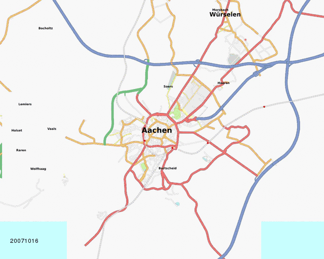 | 640 × 512 (1.79 MB) | JRohrer (talk | contribs) | new version with progress up to 2008-02-01 | |
| 17:13, 2 January 2008 |  | 640 × 512 (1.81 MB) | JRohrer (talk | contribs) | Illustration of mapping progress around Aachen, Germany, starting in October 2007. This animation shows various states of the Osmarender rendering of [http://tah.openstreetmap.org/MapOf/?lat=50.7759&long=6.085&z=13&w=1280&h=1024&format=jpg Aa |
You cannot overwrite this file.
File usage
The following page uses this file: