File:Ausfüllhilfe zum Erhebungsbogen Radverkehr Stand20230202.pdf
Jump to navigation
Jump to search
 Size of this JPG preview of this PDF file: 424 × 600 pixels. Other resolutions: 170 × 240 pixels | 339 × 480 pixels | 543 × 768 pixels | 1,239 × 1,752 pixels. |
Original file (1,239 × 1,752 pixels, file size: 4.52 MB, MIME type: application/pdf, 4 pages)
Summary
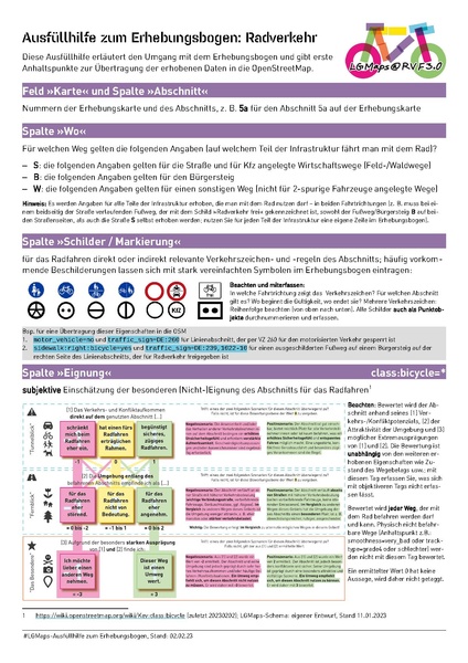
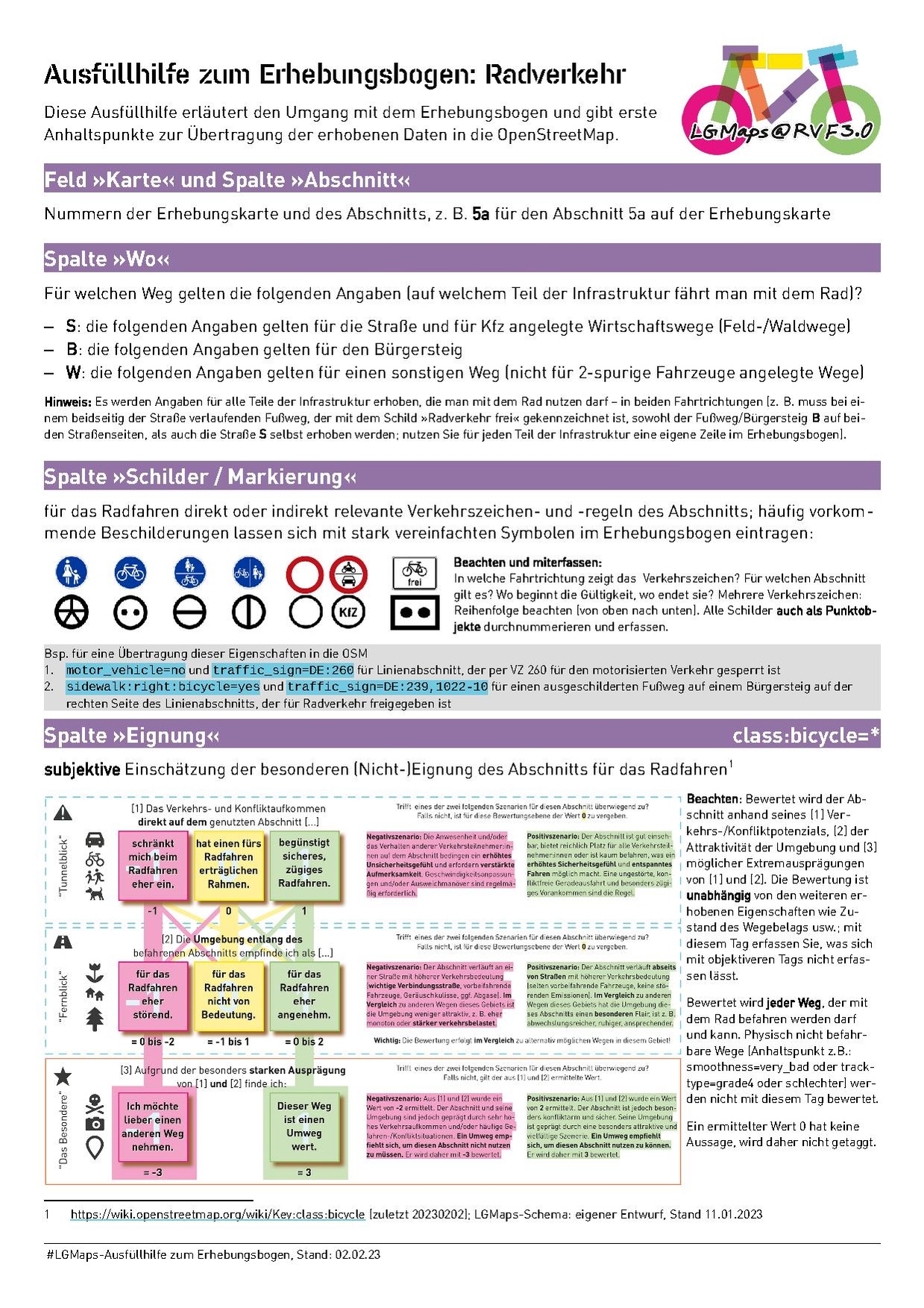
| Description | Ausfüllhilfe zum Erhebungsbogen des Projekts LGMaps |
|---|---|
| Author | Antje Seidel, LGMaps, University of Lueneburg |
| Source | Projekt Lüneburg Maps, Antje Seidel |
| Date | 2023-02-02 |
Licensing
![]()
![]()
![]()
This work is licensed under the Creative Commons Attribution-ShareAlike 4.0 License.
Attribution: Antje Seidel, LGMaps, University of Lueneburg
Attribution: Antje Seidel, LGMaps, University of Lueneburg
File history
Click on a date/time to view the file as it appeared at that time.
| Date/Time | Thumbnail | Dimensions | User | Comment | |
|---|---|---|---|---|---|
| current | 13:32, 8 February 2023 |  | 1,239 × 1,752, 4 pages (4.52 MB) | Aseidel (talk | contribs) | {{Information | description=Ausfüllhilfe zum Erhebungsbogen des Projekts LGMaps | source=Projekt Lüneburg Maps, Antje Seidel | date=2023-02-02 | author=Antje Seidel, LGMaps, University of Lueneburg | other_versions= }} |
You cannot overwrite this file.
File usage
The following page uses this file: