File:Br-classificacao-canoas-rs-plano-diretor.jpg
Jump to navigation
Jump to search

Size of this preview: 645 × 600 pixels. Other resolutions: 258 × 240 pixels | 516 × 480 pixels | 826 × 768 pixels | 1,024 × 952 pixels.
Original file (1,024 × 952 pixels, file size: 318 KB, MIME type: image/jpeg)
Summary
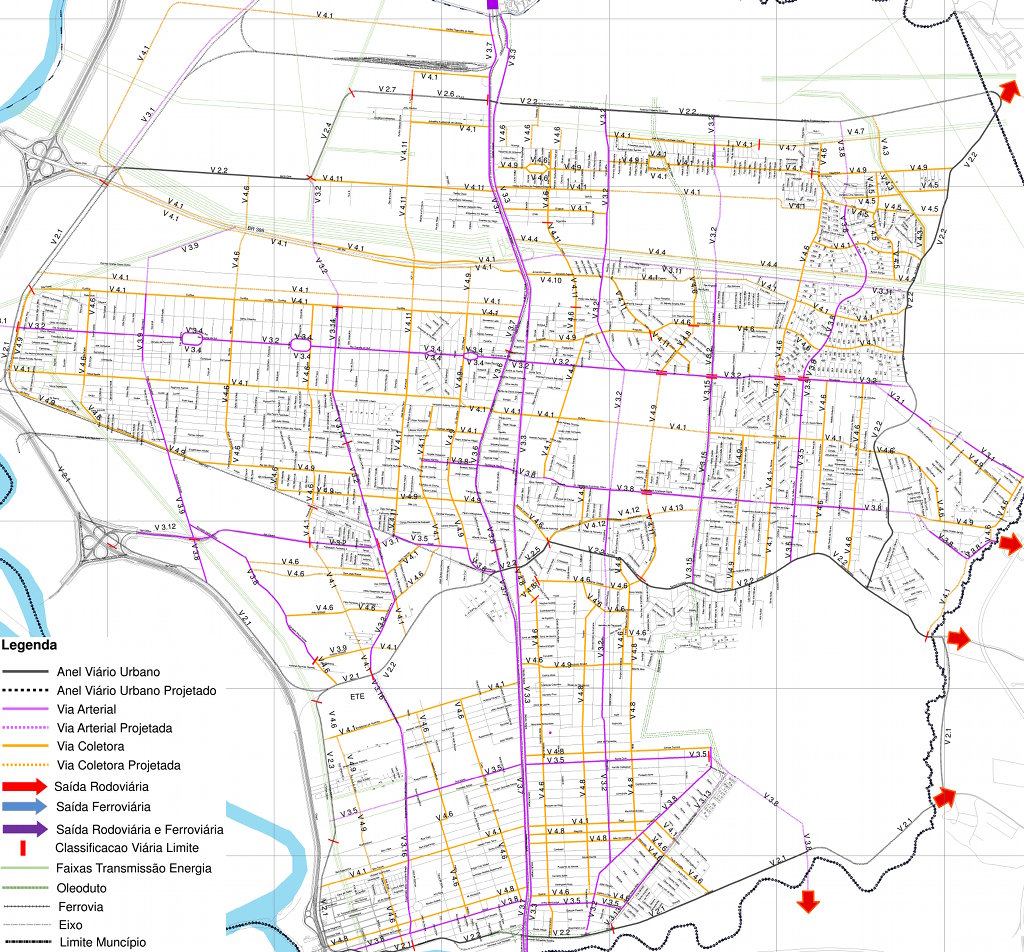
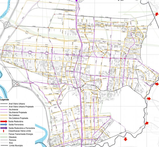
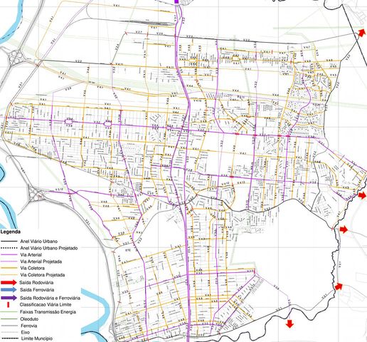
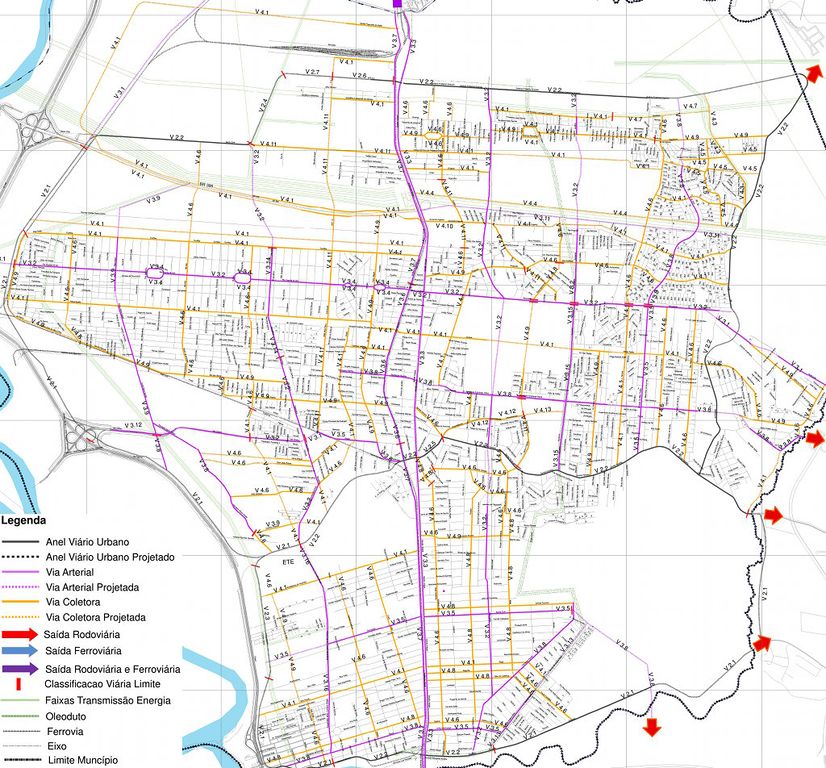
Classificação oficial segundo o plano diretor (PDDI), publicada em 11 de dezembro de 2015.
Disponível oficialmente no site da Prefeitura em Utilidade Pública > Plano Diretor > LEI Nº 5.961 de 11/12/2015 > Arquivos para Download > LEI Nº 5.961 > Anexo 2: Mapa do Sistema Viário Hierarquizado (página 86). Para ter mais qualidade, a imagem (com informação idêntica à original) foi obtida desta fonte.
Licensing
![]()
This file has been released into the public domain by the copyright holder, its copyright has expired, or it is ineligible for copyright. This applies worldwide.
Please, please use more specific template such as {{PD-self}} / {{PD-creator}} / {{PD-shape}} / {{PD-USGov}} / {{PD-old}} / {{PD-RU-exempt}} ... This template is not making clear why this work is in the public domain.
Please, please use more specific template such as {{PD-self}} / {{PD-creator}} / {{PD-shape}} / {{PD-USGov}} / {{PD-old}} / {{PD-RU-exempt}} ... This template is not making clear why this work is in the public domain.
File history
Click on a date/time to view the file as it appeared at that time.
| Date/Time | Thumbnail | Dimensions | User | Comment | |
|---|---|---|---|---|---|
| current | 00:27, 26 September 2017 | | 1,024 × 952 (318 KB) | Ftrebien (talk | contribs) | Classificação oficial segundo o plano diretor (PDDI), publicada em 11 de dezembro de 2015. Disponível oficialmente no site da [http://www.canoas.rs.gov.br/ Prefeitura] em Utilidade Pública > [http://www.canoas.rs.gov.br/site/home/pddi Plano Direto... |
You cannot overwrite this file.
File usage
The following page uses this file: