File:Br-classificacao-tramandai-rs-plano-diretor.jpg
(Redirected from File:Br-classificacao-tramandai-plano-diretor.jpg)
Jump to navigation
Jump to search
Size of this preview: 800 × 476 pixels. Other resolutions: 320 × 190 pixels | 640 × 381 pixels | 888 × 528 pixels.
Original file (888 × 528 pixels, file size: 119 KB, MIME type: image/jpeg)
Summary
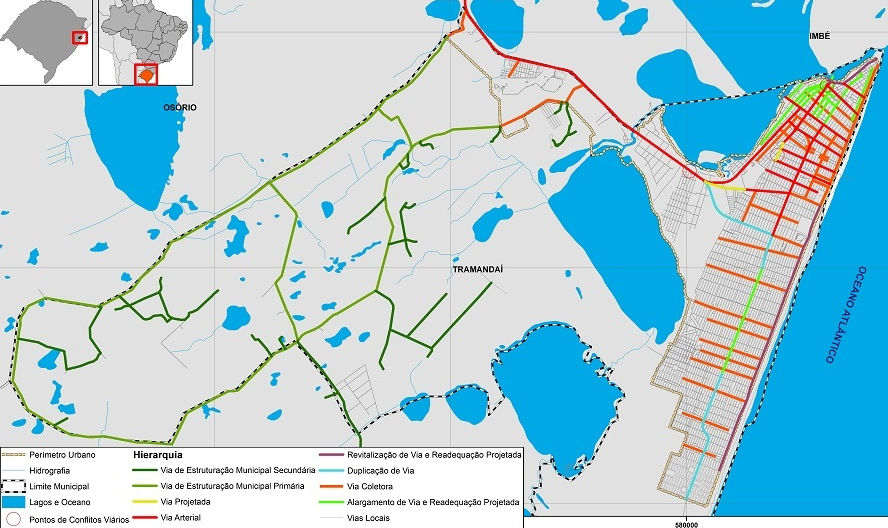
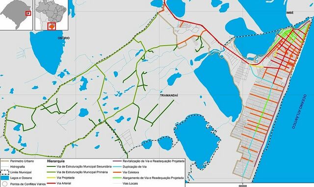
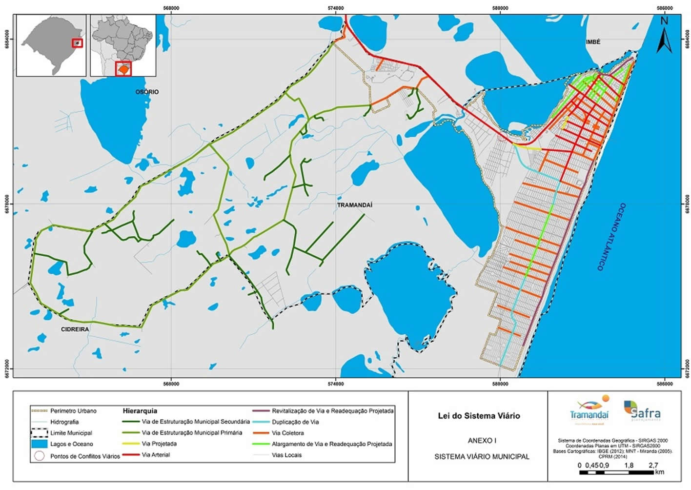
Classificação oficial segundo o plano diretor, publicada em 28 de junho de 2017.
Disponível oficialmente no site da Prefeitura em Consulta de leis municipais > Leis complementares > 2017 > Lei complementar nº 025, de 28/06/2017 > Anexo I - Sistema viário municipal e urbano. Uma cópia em maior definição está disponível neste link direto.
Licensing
![]()
This file has been released into the public domain by the copyright holder, its copyright has expired, or it is ineligible for copyright. This applies worldwide.
Please, please use more specific template such as {{PD-self}} / {{PD-creator}} / {{PD-shape}} / {{PD-USGov}} / {{PD-old}} / {{PD-RU-exempt}} ... This template is not making clear why this work is in the public domain.
Please, please use more specific template such as {{PD-self}} / {{PD-creator}} / {{PD-shape}} / {{PD-USGov}} / {{PD-old}} / {{PD-RU-exempt}} ... This template is not making clear why this work is in the public domain.
File history
Click on a date/time to view the file as it appeared at that time.
| Date/Time | Thumbnail | Dimensions | User | Comment | |
|---|---|---|---|---|---|
| current | 14:32, 29 January 2021 | | 888 × 528 (119 KB) | Ftrebien (talk | contribs) | Classificação oficial segundo o plano diretor, publicada em 28 de junho de 2017. Disponível oficialmente no site da [http://www.tramandai.rs.gov.br/ Prefeitura] em [https://tramandai.cespro.com.br/ Consulta de leis municipais] > [https://tramandai.cespro.com.br/visualizarLeisPorAno.php?cdMunicipio=8007&cdTipoDiploma=5100 Leis complementares] > [https://tramandai.cespro.com.br/pesquisaLegislacao.php?cdMunicipio=8007&byAno=2017&cdTipo=5100 2017] > [https://tramandai.cespro.com.br/visualizarDip... |
You cannot overwrite this file.
File usage
The following 2 pages use this file: