File:Building footprint and task boundary.png
Jump to navigation
Jump to search

No higher resolution available.
Building_footprint_and_task_boundary.png (626 × 563 pixels, file size: 444 KB, MIME type: image/png)
Summary
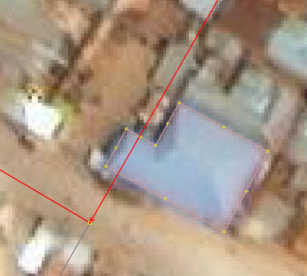
| Description | Map a building if it touches the boundary of your task |
|---|---|
| Author | unknown |
| Source | unknown |
| Date | unknown |
Licensing
![]()
This file has been released into the public domain by the copyright holder, its copyright has expired, or it is ineligible for copyright. This applies worldwide.
Please, please use more specific template such as {{PD-self}} / {{PD-creator}} / {{PD-shape}} / {{PD-USGov}} / {{PD-old}} / {{PD-RU-exempt}} ... This template is not making clear why this work is in the public domain.
Please, please use more specific template such as {{PD-self}} / {{PD-creator}} / {{PD-shape}} / {{PD-USGov}} / {{PD-old}} / {{PD-RU-exempt}} ... This template is not making clear why this work is in the public domain.
![]()
This file is a screenshot of the software JOSM, with imagery in background. It may include OpenStreetMap data, in such case ODbL license also applies.
Imagery in background: LICENSE OF IMAGERY
![]()
"JOSM" (Java OpenStreetMap Editor – josm.openstreetmap.de) is free software released under the terms of the GNU General Public License as published by the Free Software Foundation; either version 2 of the license, or any later version.
![]()
This media file does not have sufficient information on its copyright status. If you have created this file yourself, or the file is available under some open licence allowing its use on OSM Wiki or the file is in the public domain, you can edit the file description page to license it under one of the allowed licences. If you did not create it and it is not in the public domain, you must ask the copyright holder for permission to release it under one of the allowed licenses. Wiki:Media file license chart may be helpful to find a suitable licence.
Files without licences marked with this template are listed in Category:Media without a license or one of its subcategories. If the file is without a known open licence: ask its uploader to clarify situation or find a replacement and mark this file with {{Superseded by Commons}} and replace its uses.
Files without licences marked with this template are listed in Category:Media without a license or one of its subcategories. If the file is without a known open licence: ask its uploader to clarify situation or find a replacement and mark this file with {{Superseded by Commons}} and replace its uses.
If uploader was notified this month: use {{No licence|subcategory=uploader notified 2024, April}} - to put media into Category:Media without a license - uploader notified 2024, April and mark image as one where uploader was notified.
| Contains map data © OpenStreetMap contributors, made available under the terms of the Open Database License (ODbL).
The ODbL does not require any particular license for maps produced from ODbL data, produced maps may be subject also to other licences. |
File history
Click on a date/time to view the file as it appeared at that time.
| Date/Time | Thumbnail | Dimensions | User | Comment | |
|---|---|---|---|---|---|
| current | 10:40, 7 May 2021 | | 626 × 563 (444 KB) | Michael Montani (talk | contribs) | Map a building if it touches the boundary of your task |
You cannot overwrite this file.
File usage
There are no pages that use this file.