File:CAPT emprise-micro-carto LaCiotat-Athelia.JPG
Jump to navigation
Jump to search

Size of this preview: 694 × 599 pixels. Other resolutions: 278 × 240 pixels | 556 × 480 pixels | 946 × 817 pixels.
Original file (946 × 817 pixels, file size: 139 KB, MIME type: image/jpeg)
Summary
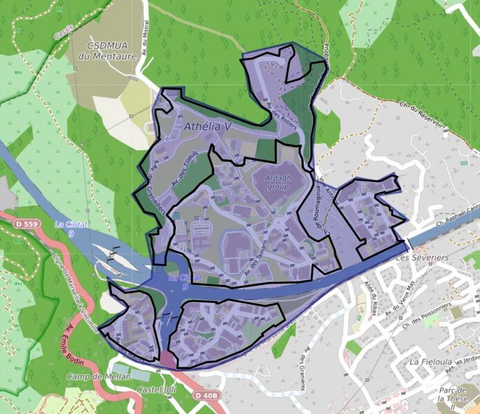
Emprise des sites Athelia avec leurs géométries du CR Sud.
Licensing
![]()
![]()
This work is licensed under the Creative Commons Attribution 4.0 License.
| Contains map data © OpenStreetMap contributors, made available under the terms of the Open Database License (ODbL).
The ODbL does not require any particular license for maps produced from ODbL data, produced maps may be subject also to other licences. |
File history
Click on a date/time to view the file as it appeared at that time.
| Date/Time | Thumbnail | Dimensions | User | Comment | |
|---|---|---|---|---|---|
| current | 18:15, 7 September 2021 | | 946 × 817 (139 KB) | J-Louis ZIMMERMANN (talk | contribs) | Emprise des sites Athelia avec leurs géométries du CR Sud. |
| 17:02, 7 September 2021 | 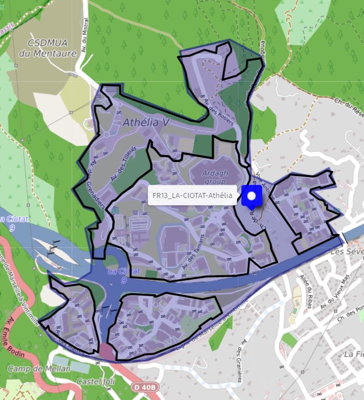 | 731 × 802 (112 KB) | J-Louis ZIMMERMANN (talk | contribs) | Emprise des sites Athelia avec leurs géométries du CR Sud. |
You cannot overwrite this file.
File usage
The following page uses this file: