File:Catatom2osm-fixmegeos.png
Jump to navigation
Jump to search

Size of this preview: 796 × 599 pixels. Other resolutions: 319 × 240 pixels | 638 × 480 pixels | 1,004 × 756 pixels.
Original file (1,004 × 756 pixels, file size: 242 KB, MIME type: image/png)
Summary
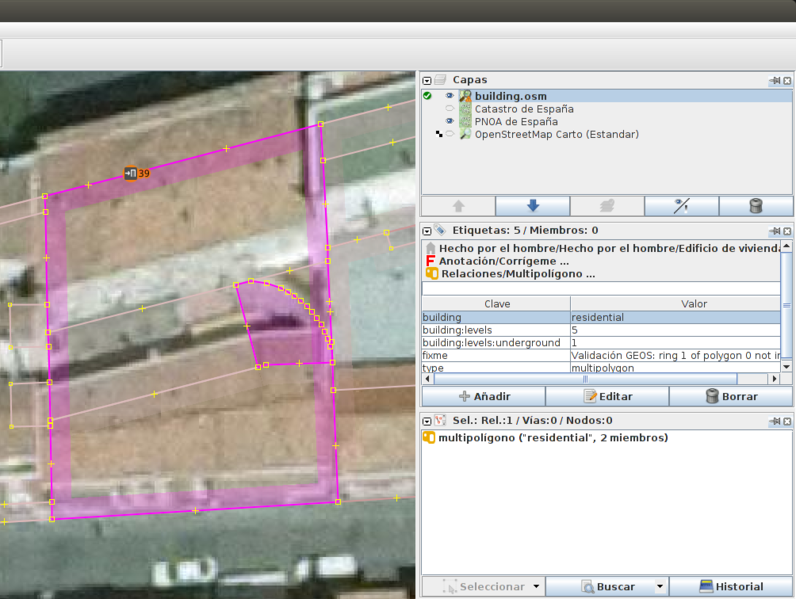
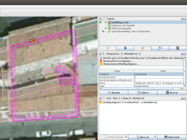
Importación de edificios de Catastro. Ejemplo de fixme 'Validación GEOS'.
Licensing
![]()
This file is a screenshot of the software JOSM, with imagery in background. It may include OpenStreetMap data, in such case ODbL license also applies.
![]()
"JOSM" (Java OpenStreetMap Editor – josm.openstreetmap.de) is free software released under the terms of the GNU General Public License as published by the Free Software Foundation; either version 2 of the license, or any later version.
License of imagery not specified! [→ template]
Data displayed: minimalFile history
Click on a date/time to view the file as it appeared at that time.
| Date/Time | Thumbnail | Dimensions | User | Comment | |
|---|---|---|---|---|---|
| current | 14:17, 9 January 2018 | | 1,004 × 756 (242 KB) | Javiersanp (talk | contribs) | |
| 14:10, 9 January 2018 | 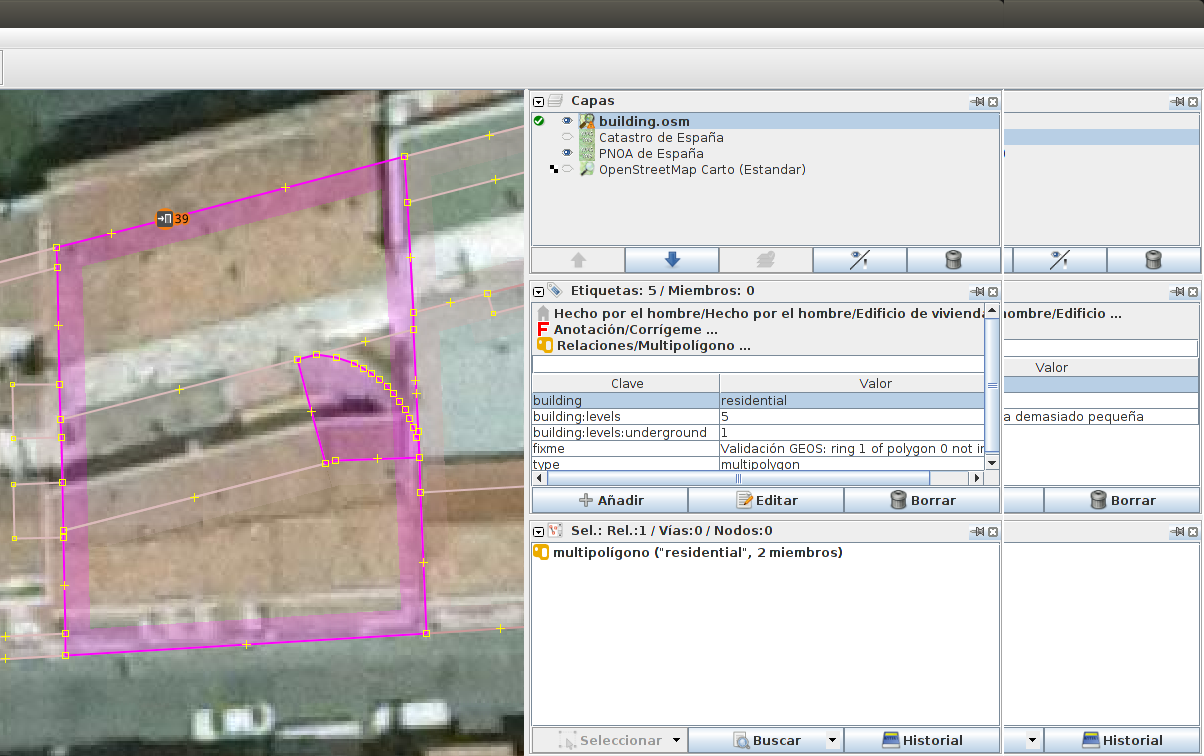 | 1,204 × 756 (248 KB) | Javiersanp (talk | contribs) | Importación de edificios de Catastro. Ejemplo de fixme 'Validación GEOS'. |
You cannot overwrite this file.
File usage
The following page uses this file: