File:ConnectivityExample1.png
Jump to navigation
Jump to search

Size of this preview: 398 × 599 pixels. Other resolutions: 159 × 240 pixels | 577 × 869 pixels.
Original file (577 × 869 pixels, file size: 1.05 MB, MIME type: image/png)
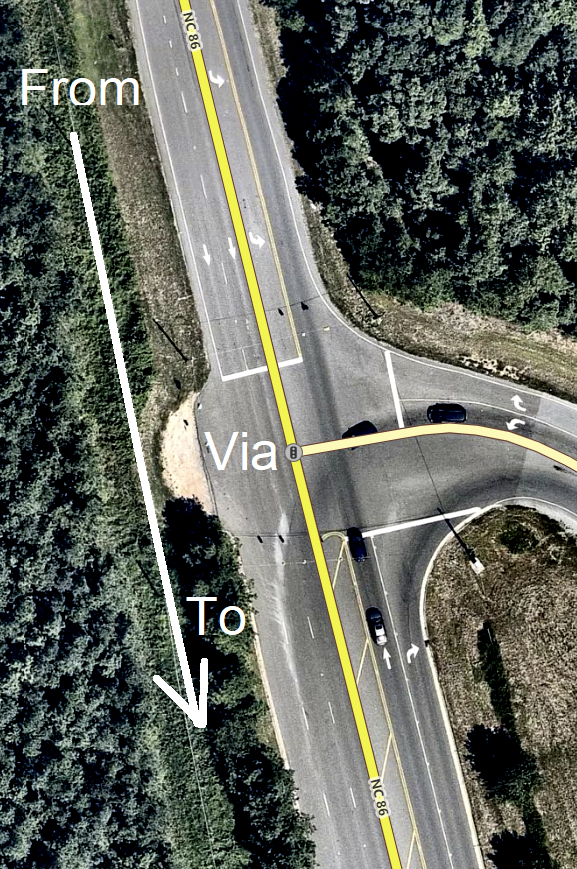
A view of iD showing a road layout where a connectivity relation would be very useful for tracking lane layout.
![]()
This image is composed partially or entirely of imagery from Mapbox.
The Mapbox imagery is not open licensed, but is made available to the OpenStreetMap project for deriving open licensed map data (see Mapbox page for details). This image is used for illustrative purposes on the OpenStreetMap wiki, to help document ways of using and interpreting the imagery in the OpenStreetMap mapping process and is used here with Mapbox's express permission for that purpose.
The Mapbox imagery is not open licensed, but is made available to the OpenStreetMap project for deriving open licensed map data (see Mapbox page for details). This image is used for illustrative purposes on the OpenStreetMap wiki, to help document ways of using and interpreting the imagery in the OpenStreetMap mapping process and is used here with Mapbox's express permission for that purpose.
File history
Click on a date/time to view the file as it appeared at that time.
| Date/Time | Thumbnail | Dimensions | User | Comment | |
|---|---|---|---|---|---|
| current | 18:26, 23 May 2019 | | 577 × 869 (1.05 MB) | LeifRasmussen (talk | contribs) | I made north be up instead of down. |
| 03:08, 18 April 2019 | 255 × 654 (209 KB) | LeifRasmussen (talk | contribs) |
You cannot overwrite this file.
File usage
The following 3 pages use this file: