File:DCS NSW Floods CIR 2021 Data license.pdf
Jump to navigation
Jump to search
 Size of this JPG preview of this PDF file: 423 × 599 pixels. Other resolutions: 169 × 240 pixels | 339 × 480 pixels | 542 × 768 pixels | 1,237 × 1,752 pixels. |
Original file (1,237 × 1,752 pixels, file size: 287 KB, MIME type: application/pdf, 2 pages)
Summary
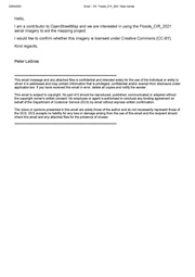
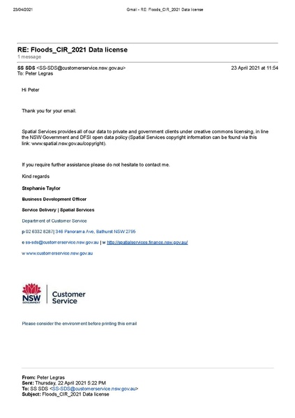
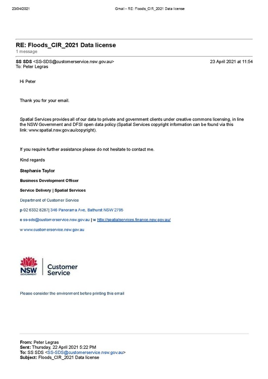
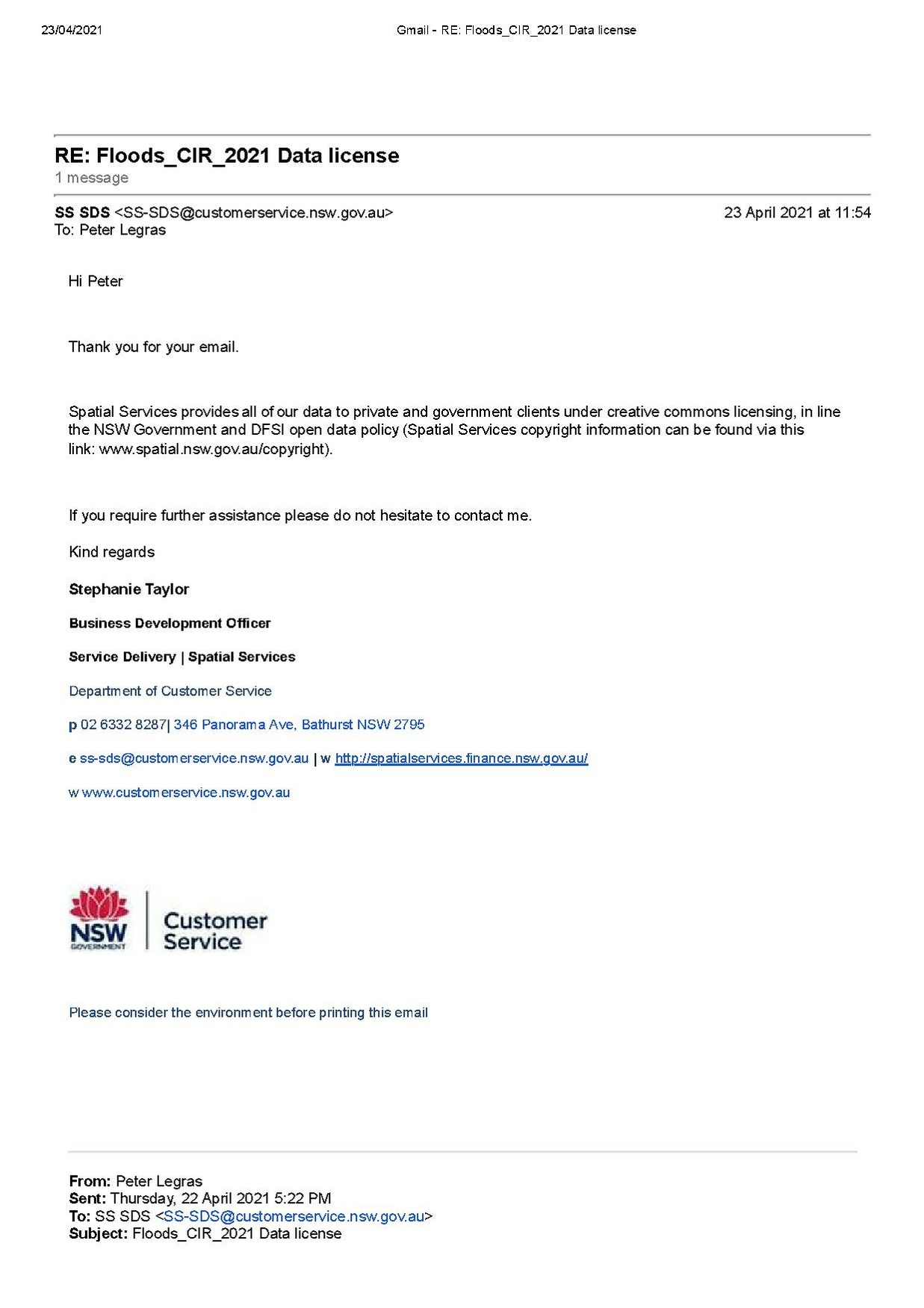
An email from DCS Spatial Services confirming that the Floods_CIR_2021 imagery is licensed under CC-BY-4.0 consistent with https://www.spatial.nsw.gov.au/copyright Data source: https://portal.spatial.nsw.gov.au/server/rest/services/Floods_CIR_2021/MapServer Copyright: © State of New South Wales (Spatial Services, a business unit of the Department of Customer Service NSW). For current information go to spatial.nsw.gov.au. https://creativecommons.org/licenses/by/4.0/legalcode
Licensing
![]()
![]()
This work is licensed under the Creative Commons Attribution 4.0 License.
File history
Click on a date/time to view the file as it appeared at that time.
| Date/Time | Thumbnail | Dimensions | User | Comment | |
|---|---|---|---|---|---|
| current | 03:01, 23 April 2021 |  | 1,237 × 1,752, 2 pages (287 KB) | 2hu4u (talk | contribs) | An email from DCS Spatial Services confirming that the Floods_CIR_2021 imagery is licensed under CC-BY-4.0 consistent with https://www.spatial.nsw.gov.au/copyright Data source: https://portal.spatial.nsw.gov.au/server/rest/services/Floods_CIR_2021/MapServer Copyright: © State of New South Wales (Spatial Services, a business unit of the Department of Customer Service NSW). For current information go to spatial.nsw.gov.au. https://creativecommons.org/licenses/by/4.0/legalcode |
You cannot overwrite this file.
File usage
There are no pages that use this file.