File:Dashoguz-etrap-map.jpg
Jump to navigation
Jump to search


Size of this preview: 800 × 567 pixels. Other resolutions: 320 × 227 pixels | 640 × 454 pixels | 1,024 × 726 pixels.
Original file (1,024 × 726 pixels, file size: 226 KB, MIME type: image/jpeg)
Summary
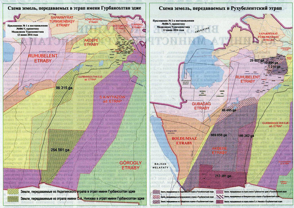
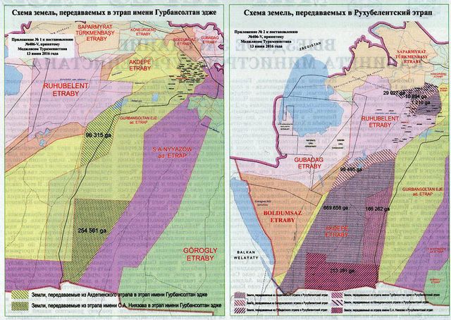
| Description | Map of districts of Dashoguz Province of Turkmenistan as of 2017. |
|---|---|
| Author | ?? |
| Source | ?? |
| Date | 2017 |
Licensing
This document is in the public domain.
Under Turkmenistan's copyright law,
Article 7. Works that are not objects of copyright
Not subject to copyright:
- official documents (laws, court decisions, other texts of a legislative, administrative and judicial nature), as well as their official translations;
- state symbols and signs (flag, coat of arms, anthem, awards, banknotes and other state symbols and signs);
- folk art (expressions of folklore); - messages about events and facts of an informational nature.''
File history
Click on a date/time to view the file as it appeared at that time.
| Date/Time | Thumbnail | Dimensions | User | Comment | |
|---|---|---|---|---|---|
| current | 11:24, 7 July 2018 | | 1,024 × 726 (226 KB) | Apm-wa (talk | contribs) | Map of districts of Dashoguz Province of Turkmenistan as of 2017. |
You cannot overwrite this file.
File usage
The following page uses this file: