File:French administrative boundaries completion.png
Jump to navigation
Jump to search

Size of this preview: 787 × 599 pixels. Other resolutions: 315 × 240 pixels | 630 × 480 pixels | 982 × 748 pixels.
Original file (982 × 748 pixels, file size: 367 KB, MIME type: image/png)
Summary
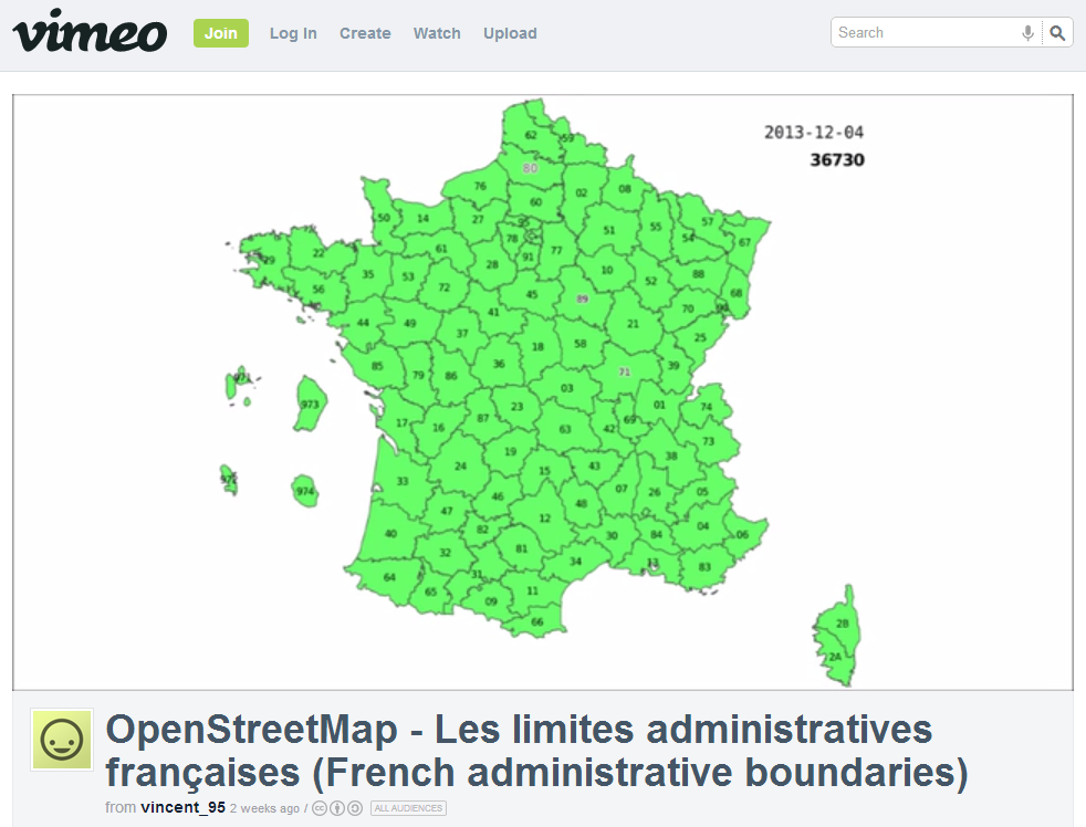
Screenshot of Chronological view of the 36000 french administrative boundaries (at commune level) during the 5 years of their integration in OpenStreetMap, mostly thanks to the French Cadastre.
Video can be found at http://vimeo.com/80974060
Licensing
![]()
![]()
![]()
This work is licensed under the Creative Commons Attribution-ShareAlike 2.0 License.
Attribution not specified as a parameter! THIS LICENSE ALWAYS REQUIRES ATTRIBUTION! Use {{CC-BY-SA-2.0|Attribution, typically name of author}} See Template:CC-BY-SA-2.0 for full description how this template should be used.
Note, there is
There is also
Attribution not specified as a parameter! THIS LICENSE ALWAYS REQUIRES ATTRIBUTION! Use {{CC-BY-SA-2.0|Attribution, typically name of author}} See Template:CC-BY-SA-2.0 for full description how this template should be used.
Note, there is
{{CC-BY-SA-2.0 OpenStreetMap}} for files based on old OSM map data, before the license change made on 2012-09-12.There is also
{{OSM Carto screenshot||old_license}} for files based on old OSM map data, before the license change made on 2012-09-12, created using OSM Carto map style.
File history
Click on a date/time to view the file as it appeared at that time.
| Date/Time | Thumbnail | Dimensions | User | Comment | |
|---|---|---|---|---|---|
| current | 01:26, 19 December 2013 | | 982 × 748 (367 KB) | Don-vip (talk | contribs) | Screenshot of Chronological view of the 36000 french administrative boundaries (at commune level) during the 5 years of their integration in OpenStreetMap, mostly thanks to the French Cadastre. Video can be found at http://vimeo.com/80974060 |
You cannot overwrite this file.
File usage
There are no pages that use this file.