File:J-40-081-Ashgabat-excerpt.jpg
Jump to navigation
Jump to search

Size of this preview: 800 × 436 pixels. Other resolutions: 320 × 175 pixels | 640 × 349 pixels | 1,024 × 559 pixels | 1,280 × 698 pixels | 3,731 × 2,035 pixels.
Original file (3,731 × 2,035 pixels, file size: 11.63 MB, MIME type: image/jpeg)
Summary
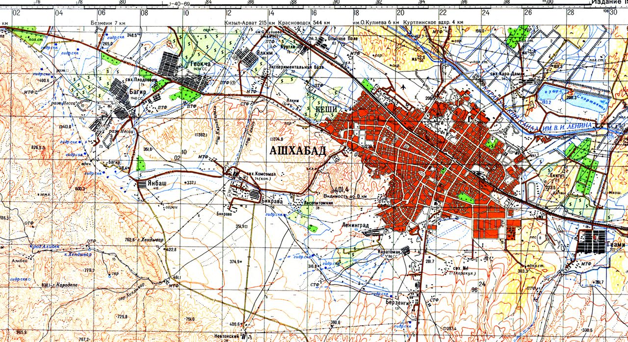
| Description | excerpt from Soviet General Staff (military) map J-40-081 of 1974, showing boundaries of Ashgabat and populated areas around Ashgabat at that time. |
|---|---|
| Author | ?? |
| Source | ?? |
| Date | 1974 |
Licensing
![]()
This file has been released into the public domain by the copyright holder, its copyright has expired, or it is ineligible for copyright. This applies worldwide.
Please, please use more specific template such as {{PD-self}} / {{PD-creator}} / {{PD-shape}} / {{PD-USGov}} / {{PD-old}} / {{PD-RU-exempt}} ... This template is not making clear why this work is in the public domain.
Please, please use more specific template such as {{PD-self}} / {{PD-creator}} / {{PD-shape}} / {{PD-USGov}} / {{PD-old}} / {{PD-RU-exempt}} ... This template is not making clear why this work is in the public domain.
File history
Click on a date/time to view the file as it appeared at that time.
| Date/Time | Thumbnail | Dimensions | User | Comment | |
|---|---|---|---|---|---|
| current | 00:44, 17 May 2020 | | 3,731 × 2,035 (11.63 MB) | Apm-wa (talk | contribs) | excerpt from Soviet General Staff (military) map J-40-081 of 1974, showing boundaries of Ashgabat and populated areas around Ashgabat at that time. |
You cannot overwrite this file.
File usage
The following page uses this file: