File:Line arrangement underground pipes.png
Jump to navigation
Jump to search


Size of this preview: 800 × 300 pixels. Other resolutions: 320 × 120 pixels | 640 × 240 pixels | 1,024 × 383 pixels | 1,280 × 479 pixels | 2,868 × 1,074 pixels.
Original file (2,868 × 1,074 pixels, file size: 194 KB, MIME type: image/png)
Summary
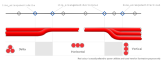
| Description | How to map lines arrangement underground, with a picture |
|---|---|
| Author | François Lacombe |
| Source | Own work |
| Date | 2023-05-31 |
Licensing
- This media file was uploaded by author of the work and its copyright holder.
![]()
![]()
![]()
This work is licensed under the Creative Commons Attribution-ShareAlike 4.0 License.
Attribution: François Lacombe
Attribution: François Lacombe
File history
Click on a date/time to view the file as it appeared at that time.
| Date/Time | Thumbnail | Dimensions | User | Comment | |
|---|---|---|---|---|---|
| current | 17:12, 2 June 2023 | 2,868 × 1,074 (194 KB) | Fanfouer (talk | contribs) | Color and disclaim add | |
| 22:22, 30 May 2023 | 2,868 × 1,074 (169 KB) | Fanfouer (talk | contribs) | {{Information | description=How to map lines arrangement underground, with a picture | source=Own work | date=2023-05-31 | author=François Lacombe | other_versions= }} |
You cannot overwrite this file.
File usage
The following 5 pages use this file: