File:Mediterranean wf 2021 hot.png
Jump to navigation
Jump to search

Size of this preview: 800 × 565 pixels. Other resolutions: 320 × 226 pixels | 640 × 452 pixels | 1,024 × 724 pixels | 1,404 × 992 pixels.
Original file (1,404 × 992 pixels, file size: 201 KB, MIME type: image/png)
Summary
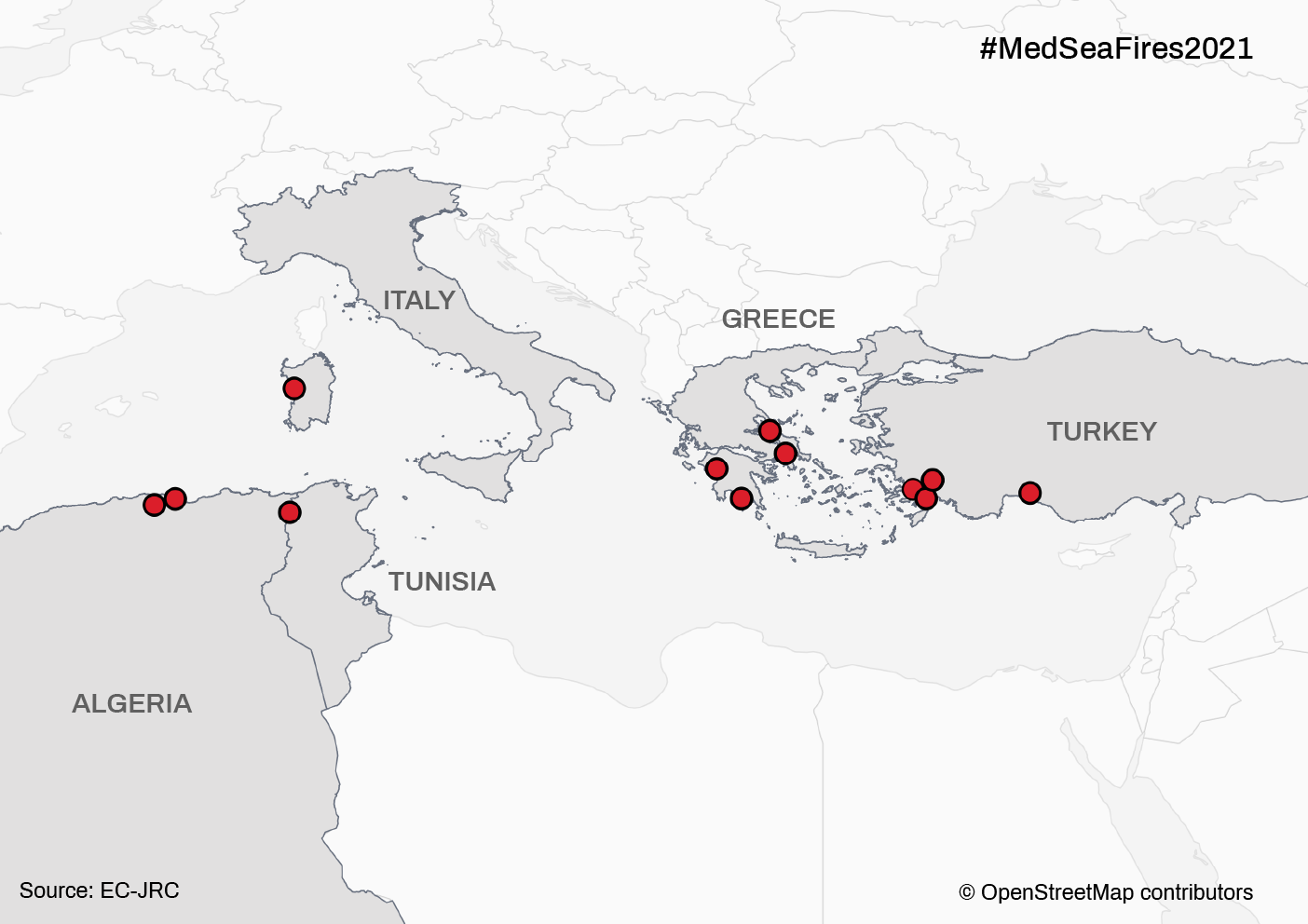
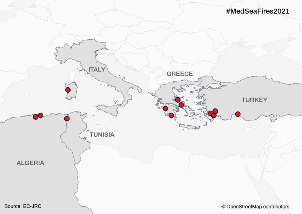
Location of the affected areas related to the Mediterranean Wildfires 2021 campaign, an activation supported by HOT's Disaster Services. As of August 17, 2021.
Licensing
![]()
This file has been released into the public domain by the copyright holder, its copyright has expired, or it is ineligible for copyright. This applies worldwide.
Please, please use more specific template such as {{PD-self}} / {{PD-creator}} / {{PD-shape}} / {{PD-USGov}} / {{PD-old}} / {{PD-RU-exempt}} ... This template is not making clear why this work is in the public domain.
Please, please use more specific template such as {{PD-self}} / {{PD-creator}} / {{PD-shape}} / {{PD-USGov}} / {{PD-old}} / {{PD-RU-exempt}} ... This template is not making clear why this work is in the public domain.
| Contains map data © OpenStreetMap contributors, made available under the terms of the Open Database License (ODbL).
The ODbL does not require any particular license for maps produced from ODbL data, produced maps may be subject also to other licences. |
File history
Click on a date/time to view the file as it appeared at that time.
| Date/Time | Thumbnail | Dimensions | User | Comment | |
|---|---|---|---|---|---|
| current | 19:25, 17 August 2021 | | 1,404 × 992 (201 KB) | Claurt07 (talk | contribs) | Location of the affected areas related to the Mediterranean Wildfires 2021 campaign, an activation supported by HOT's Disaster Services. As of August 17, 2021. |
You cannot overwrite this file.
File usage
The following page uses this file: