File:Natural=peninsula vs natural=cape.png
Jump to navigation
Jump to search


Size of this preview: 624 × 599 pixels. Other resolutions: 250 × 240 pixels | 500 × 480 pixels | 703 × 675 pixels.
Original file (703 × 675 pixels, file size: 106 KB, MIME type: image/png)
Summary
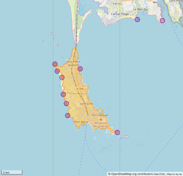
A natural=peninsula (orange) and several natural=cape (purple)
Image is from here: https://www.openstreetmap.org/#map=12/47.5090/-3.1420
Licensing
| Contains map data © OpenStreetMap contributors, made available under the terms of the Open Database License (ODbL).
The ODbL does not require any particular license for maps produced from ODbL data, produced maps may be subject also to other licences. |
File history
Click on a date/time to view the file as it appeared at that time.
| Date/Time | Thumbnail | Dimensions | User | Comment | |
|---|---|---|---|---|---|
| current | 15:53, 27 January 2019 | | 703 × 675 (106 KB) | SelfishSeahorse (talk | contribs) | New image from another peninsula |
| 21:03, 22 January 2019 | 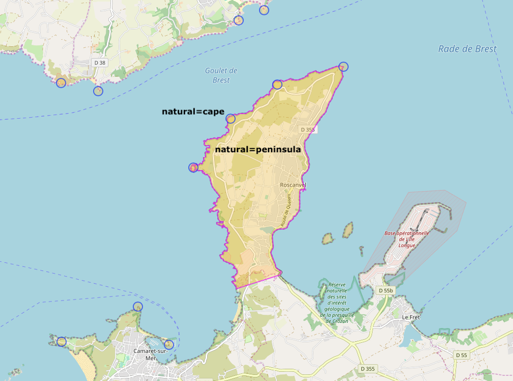 | 1,008 × 748 (367 KB) | SelfishSeahorse (talk | contribs) | Corrected font size | |
| 20:46, 22 January 2019 | 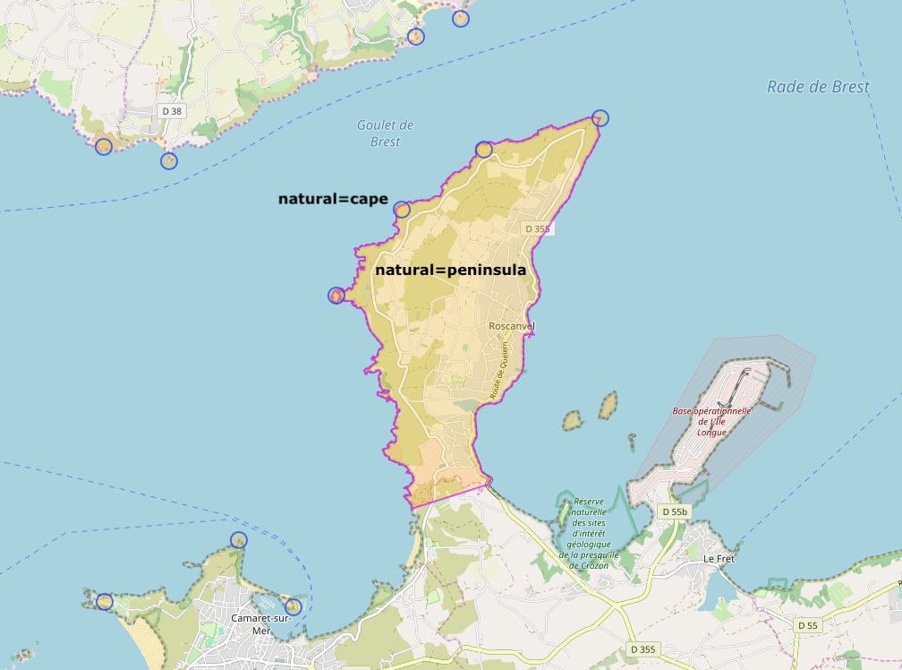 | 1,008 × 748 (367 KB) | SelfishSeahorse (talk | contribs) | New image with more natural=cape | |
| 21:34, 20 January 2019 | 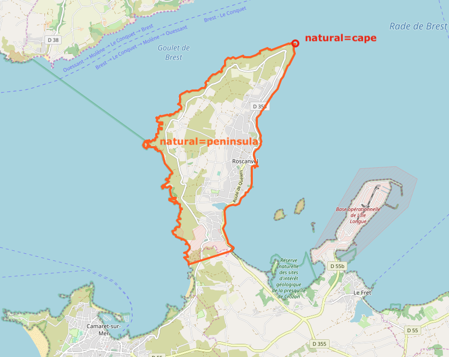 | 888 × 706 (335 KB) | SelfishSeahorse (talk | contribs) | Correction: natural=island --> natural=peninsula | |
| 19:13, 20 January 2019 | 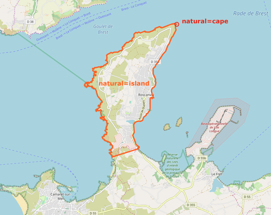 | 888 × 705 (335 KB) | SelfishSeahorse (talk | contribs) | {{tag|natural|peninsula}} vs {{tag|natural|cape}} |
You cannot overwrite this file.
File usage
The following 4 pages use this file: