File:Nepal fields manang mapbox.jpg
Jump to navigation
Jump to search

Size of this preview: 799 × 599 pixels. Other resolutions: 320 × 240 pixels | 640 × 480 pixels | 845 × 634 pixels.
Original file (845 × 634 pixels, file size: 321 KB, MIME type: image/jpeg)
Summary
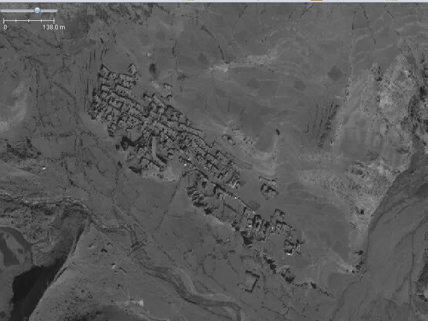
Farmland surrounding the tourist village of Manang. This shows fairly typical terracing of fields, and field paths can be picked out. At the time of this imagery no 4-wheeled vehicles could reach Manang, so all paths correspond to path or footway.
Source:Mapbox, used with permission.
Licensing
![]()
This image is composed partially or entirely of imagery from Mapbox.
The Mapbox imagery is not open licensed, but is made available to the OpenStreetMap project for deriving open licensed map data (see Mapbox page for details). This image is used for illustrative purposes on the OpenStreetMap wiki, to help document ways of using and interpreting the imagery in the OpenStreetMap mapping process and is used here with Mapbox's express permission for that purpose.
The Mapbox imagery is not open licensed, but is made available to the OpenStreetMap project for deriving open licensed map data (see Mapbox page for details). This image is used for illustrative purposes on the OpenStreetMap wiki, to help document ways of using and interpreting the imagery in the OpenStreetMap mapping process and is used here with Mapbox's express permission for that purpose.
File history
Click on a date/time to view the file as it appeared at that time.
| Date/Time | Thumbnail | Dimensions | User | Comment | |
|---|---|---|---|---|---|
| current | 08:31, 30 April 2015 | | 845 × 634 (321 KB) | SK53 (talk | contribs) | Farmland surrounding the tourist village of Manang. This shows fairly typical terracing of fields, and field paths can be picked out. At the time of this imagery no 4-wheeled vehicles could reach Manang, so all paths correspond to path or footway. Sou... |
You cannot overwrite this file.
File usage
The following page uses this file: