File:OSM2go-0.9-N900-map-Göttingen.png
Jump to navigation
Jump to search

No higher resolution available.
OSM2go-0.9-N900-map-Göttingen.png (800 × 480 pixels, file size: 127 KB, MIME type: image/png)
Summary
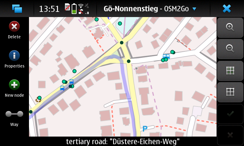
OSM2go version 0.9.x showing the intersection of Nikolausberger Weg, Nonnenstieg, and Düstere-Eichen-Weg in Göttingen in the main view, screenshot taken on N900.
Licensing
![]()
![]()
![]()
This work is licensed under the Creative Commons Attribution-ShareAlike 4.0 License.
Attribution not specified as a parameter! THIS LICENSE ALWAYS REQUIRES ATTRIBUTION! Use {{CC-BY-SA-4.0|Attribution, typically name of author}} See Template:CC-BY-SA-4.0 for full description this template should be used.
Attribution not specified as a parameter! THIS LICENSE ALWAYS REQUIRES ATTRIBUTION! Use {{CC-BY-SA-4.0|Attribution, typically name of author}} See Template:CC-BY-SA-4.0 for full description this template should be used.
| Contains map data © OpenStreetMap contributors, made available under the terms of the Open Database License (ODbL).
The ODbL does not require any particular license for maps produced from ODbL data, produced maps may be subject also to other licences. |
File history
Click on a date/time to view the file as it appeared at that time.
| Date/Time | Thumbnail | Dimensions | User | Comment | |
|---|---|---|---|---|---|
| current | 19:59, 8 September 2018 | | 800 × 480 (127 KB) | Dakon (talk | contribs) | OSM2go version 0.9.x showing the intersection of Nikolausberger Weg, Nonnenstieg, and Düstere-Eichen-Weg in Göttingen in the main view, screenshot taken on N900. |
You cannot overwrite this file.
File usage
The following page uses this file: