File:Osmand Erweiterungen zum Bahnmapping.jpg
Jump to navigation
Jump to search
Size of this preview: 291 × 598 pixels. Other resolutions: 116 × 240 pixels | 233 × 480 pixels | 373 × 768 pixels | 1,080 × 2,220 pixels.
Original file (1,080 × 2,220 pixels, file size: 422 KB, MIME type: image/jpeg)
Summary
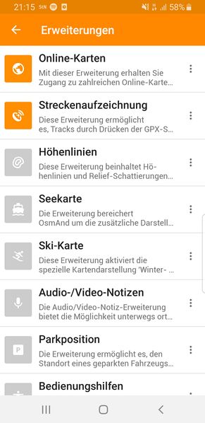
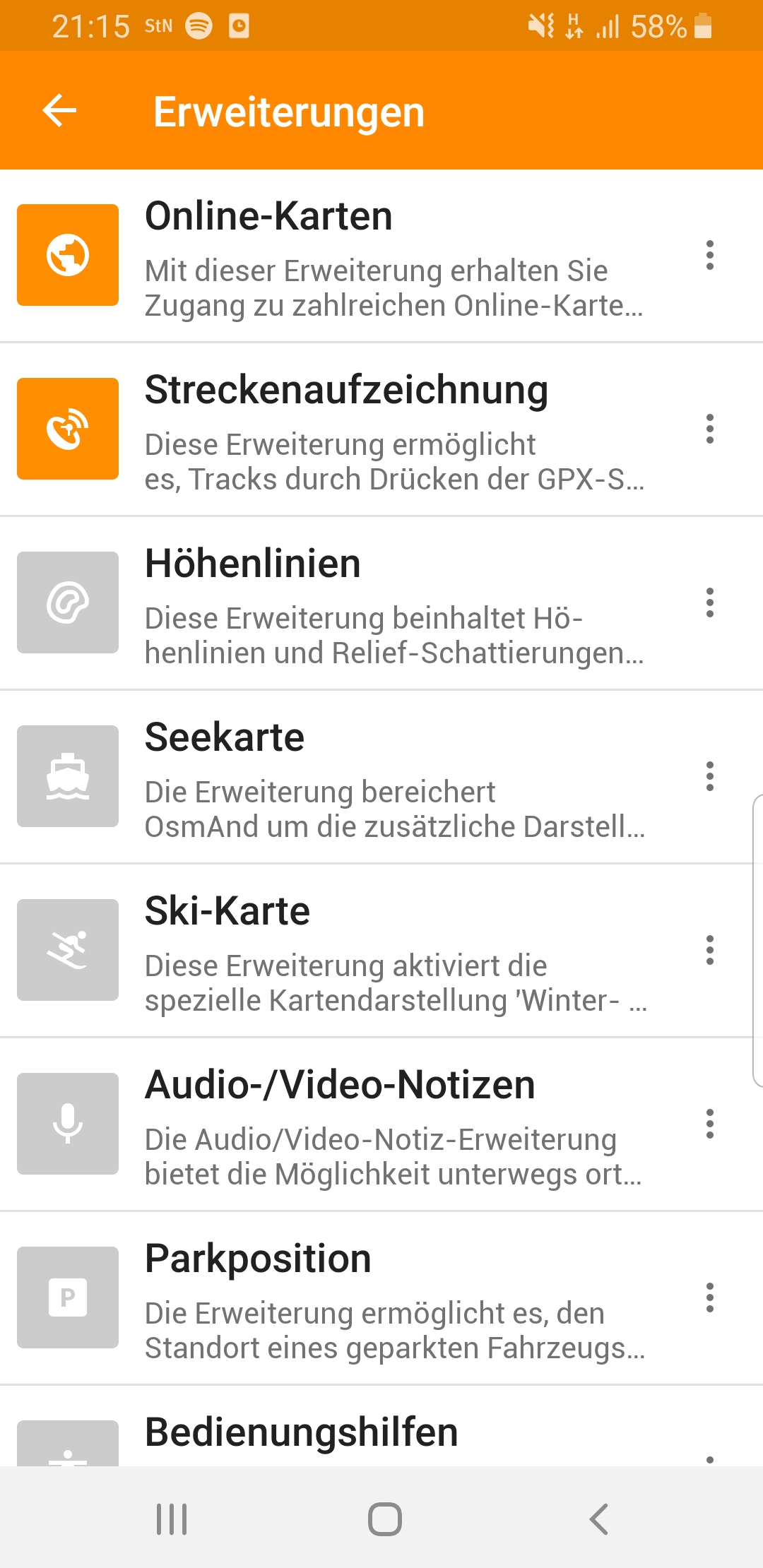
Screenshot aus dem Osmand-Menü Erweiterungen mit den beiden für das Mapping von Bahnanlagen empfehlenswerten Modulen Online-Karten (um OpenRailwayMap-Overlays einblenden zu können) und Streckenaufzeichnung (um GPX-Spuren und -Punkte anzulegen).
Licensing
![]()
![]()
![]()
This work is licensed under the Creative Commons Attribution-ShareAlike 2.0 License.
Attribution not specified as a parameter! THIS LICENSE ALWAYS REQUIRES ATTRIBUTION! Use {{CC-BY-SA-2.0|Attribution, typically name of author}} See Template:CC-BY-SA-2.0 for full description how this template should be used.
Note, there is
There is also
Attribution not specified as a parameter! THIS LICENSE ALWAYS REQUIRES ATTRIBUTION! Use {{CC-BY-SA-2.0|Attribution, typically name of author}} See Template:CC-BY-SA-2.0 for full description how this template should be used.
Note, there is
{{CC-BY-SA-2.0 OpenStreetMap}} for files based on old OSM map data, before the license change made on 2012-09-12.There is also
{{OSM Carto screenshot||old_license}} for files based on old OSM map data, before the license change made on 2012-09-12, created using OSM Carto map style.
File history
Click on a date/time to view the file as it appeared at that time.
| Date/Time | Thumbnail | Dimensions | User | Comment | |
|---|---|---|---|---|---|
| current | 21:39, 12 September 2019 | | 1,080 × 2,220 (422 KB) | Bigbug21 (talk | contribs) | Screenshot aus dem Osmand-Menü ''Erweiterungen'' mit den beiden für das Mapping von Bahnanlagen empfehlenswerten Modulen ''Online-Karten'' (um OpenRailwayMap-Overlays einblenden zu können) und ''Streckenaufzeichnung'' (um GPX-Spuren und -Punkte anzulegen). |
You cannot overwrite this file.
File usage
The following page uses this file: