File:Rendering of OSM data and terrain using Mapbox Unity SDK.gif
Jump to navigation
Jump to search

No higher resolution available.
Rendering_of_OSM_data_and_terrain_using_Mapbox_Unity_SDK.gif (732 × 367 pixels, file size: 1.78 MB, MIME type: image/gif, looped, 22 frames, 3.4 s)
Summary
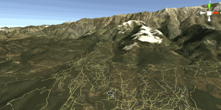
A sample scene in Unity3D that renders OpenStreetMap data, Mapbox Satellite and elevation data using the Mapbox Unity SDK for the Himalayan town of Dharmsala, India.
Licensing
| Contains map data © OpenStreetMap contributors, made available under the terms of the Open Database License (ODbL).
The ODbL does not require any particular license for maps produced from ODbL data, produced maps may be subject also to other licences. |
File history
Click on a date/time to view the file as it appeared at that time.
| Date/Time | Thumbnail | Dimensions | User | Comment | |
|---|---|---|---|---|---|
| current | 05:55, 10 May 2017 | | 732 × 367 (1.78 MB) | Planemad (talk | contribs) | A sample scene in Unity3D that renders OpenStreetMap data, Mapbox Satellite and elevation data using the [https://www.mapbox.com/unity/ Mapbox Unity SDK] for the Himalayan town of Dharmsala, India. |
You cannot overwrite this file.
File usage
There are no pages that use this file.