File:Shoho estimated mapping done.png
Original file (1,300 × 1,239 pixels, file size: 854 KB, MIME type: image/png)
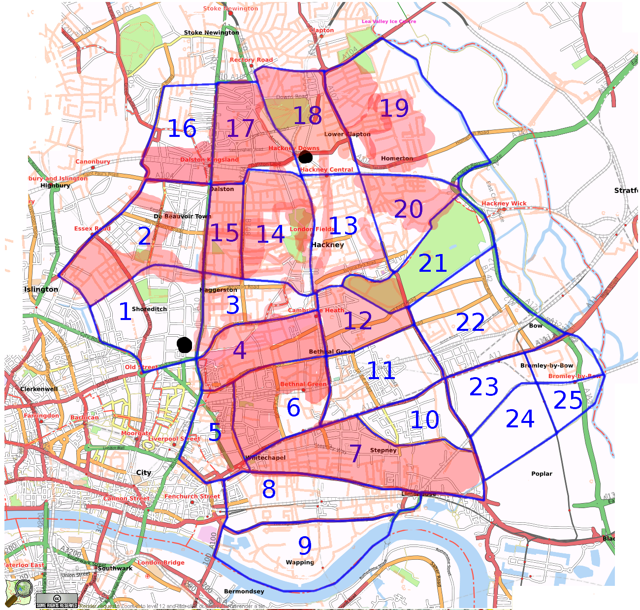
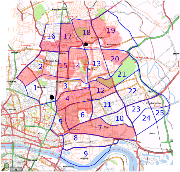
Guestimate of the areas mapped by the ShoHo Mapping Party (red blobs)
This is the same image as Image:Shoho Cake inc segments.png but with more layers. User:Harry Wood has this as Paint.NET file, with seperate layers for the red blobs of different people's mapped areas.
There may well be some additional mapping which we managed with slice number 13 (maybe User:Morwen covered the east of that a bit more) and slice number 19 (newbies went off and did this, possibly helped by User:Steve8)
...but the proof will be in the the rendering after we've entered the data (next week or so).
File history
Click on a date/time to view the file as it appeared at that time.
| Date/Time | Thumbnail | Dimensions | User | Comment | |
|---|---|---|---|---|---|
| current | 01:34, 14 September 2007 | | 1,300 × 1,239 (854 KB) | Harry Wood (talk | contribs) | more red blobs. TomH and Stevec did more. Also the girls did 19. |
| 20:28, 9 September 2007 | 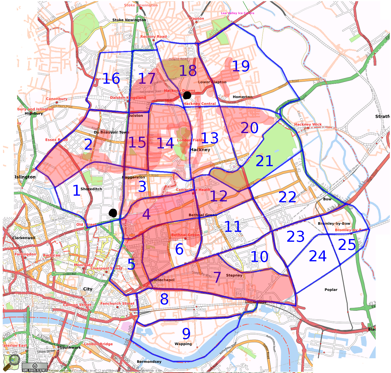 | 1,300 × 1,239 (847 KB) | Harry Wood (talk | contribs) | blobs where we mapped |
You cannot overwrite this file.
File usage
The following page uses this file: