File:Taghistory-reservoir-relations.svg
Jump to navigation
Jump to search

Size of this PNG preview of this SVG file: 800 × 474 pixels. Other resolutions: 320 × 190 pixels | 640 × 379 pixels | 1,024 × 607 pixels | 1,280 × 759 pixels | 1,080 × 640 pixels.
Original file (SVG file, nominally 1,080 × 640 pixels, file size: 217 KB)
Summary
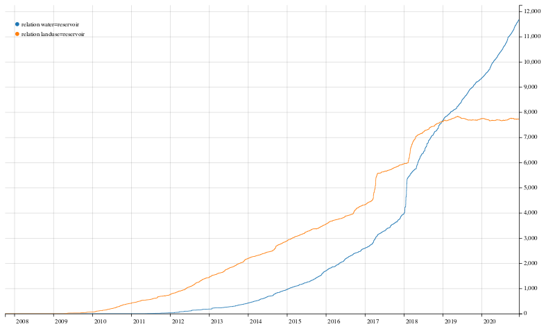
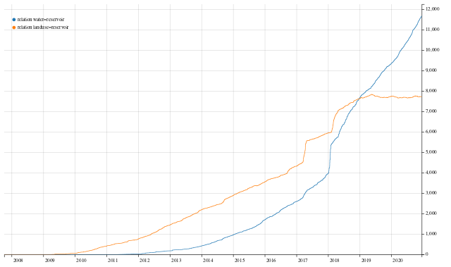
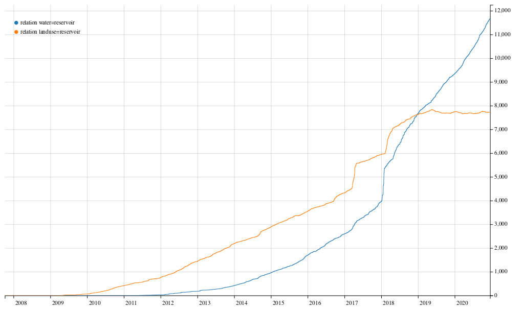
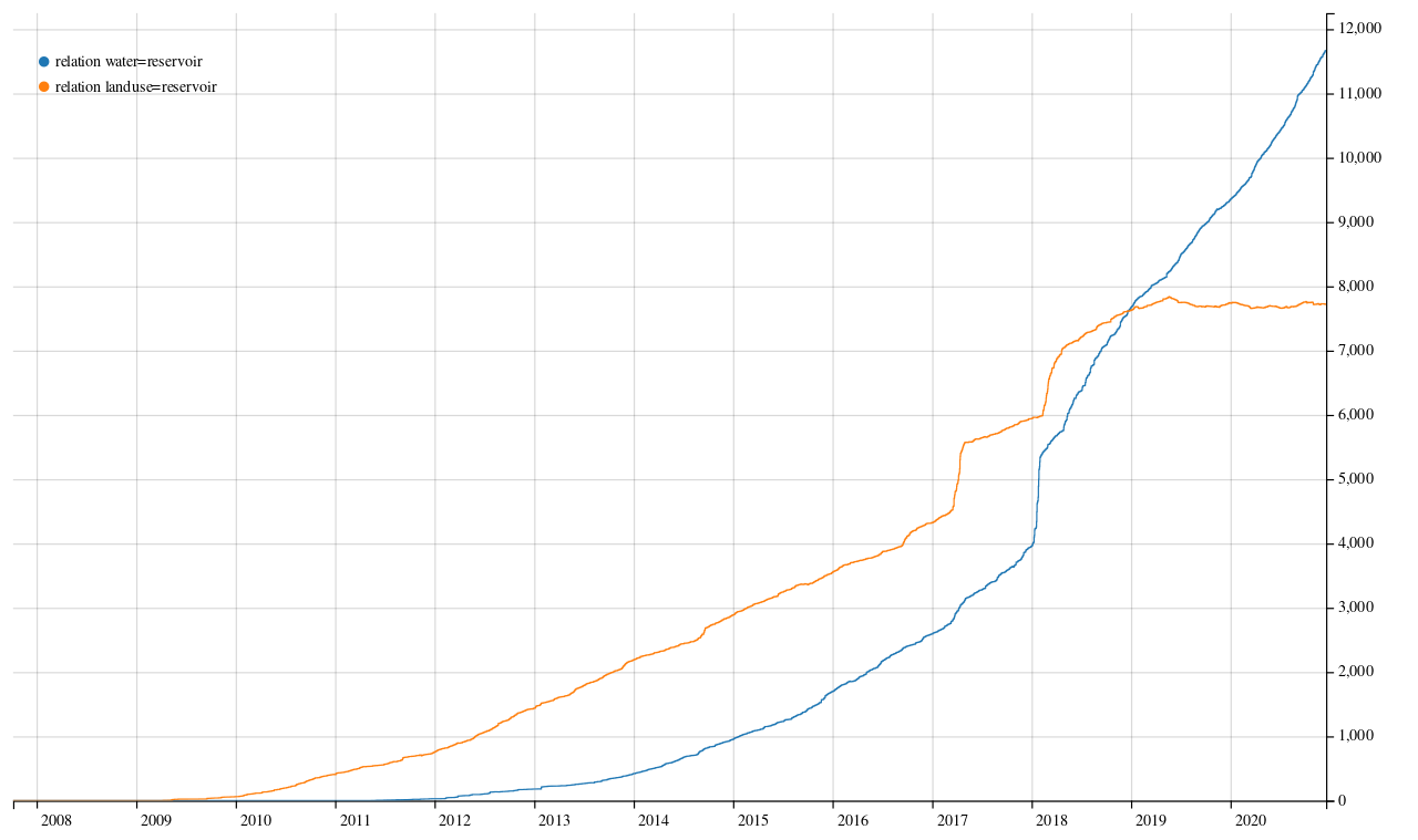
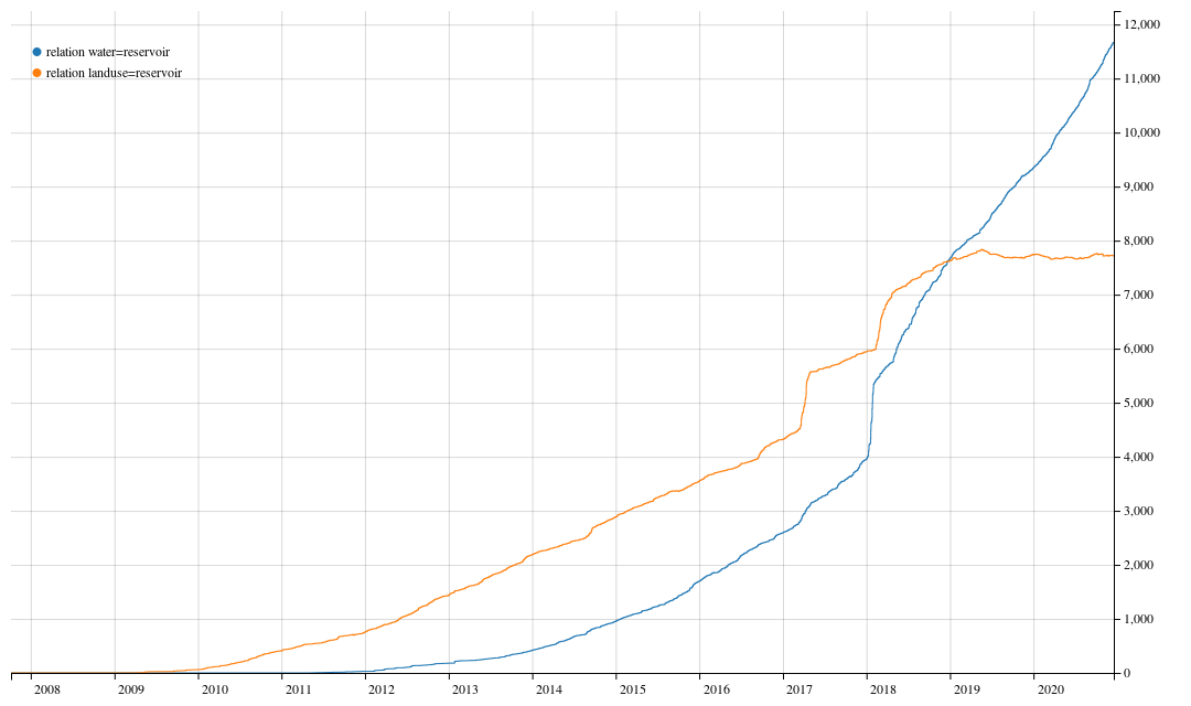
Reservoir relations analysis
This graph was made with the OSM Tag History tool.
Click here for the interactive graph: https://taghistory.raifer.tech/#relation/water/reservoir&relation/landuse/reservoir
Licensing
| Contains map data © OpenStreetMap contributors, made available under the terms of the Open Database License (ODbL).
The ODbL does not require any particular license for maps produced from ODbL data, produced maps may be subject also to other licences. |
File history
Click on a date/time to view the file as it appeared at that time.
| Date/Time | Thumbnail | Dimensions | User | Comment | |
|---|---|---|---|---|---|
| current | 02:42, 17 December 2020 | | 1,080 × 640 (217 KB) | ZeLonewolf (talk | contribs) | Reservoir relations analysis |
You cannot overwrite this file.
File usage
There are no pages that use this file.