File:TawiTawiPH mappingexpedition.jpg
Jump to navigation
Jump to search

Size of this preview: 800 × 600 pixels. Other resolutions: 320 × 240 pixels | 640 × 480 pixels | 1,024 × 768 pixels | 1,280 × 960 pixels | 2,592 × 1,944 pixels.
Original file (2,592 × 1,944 pixels, file size: 1.83 MB, MIME type: image/jpeg)
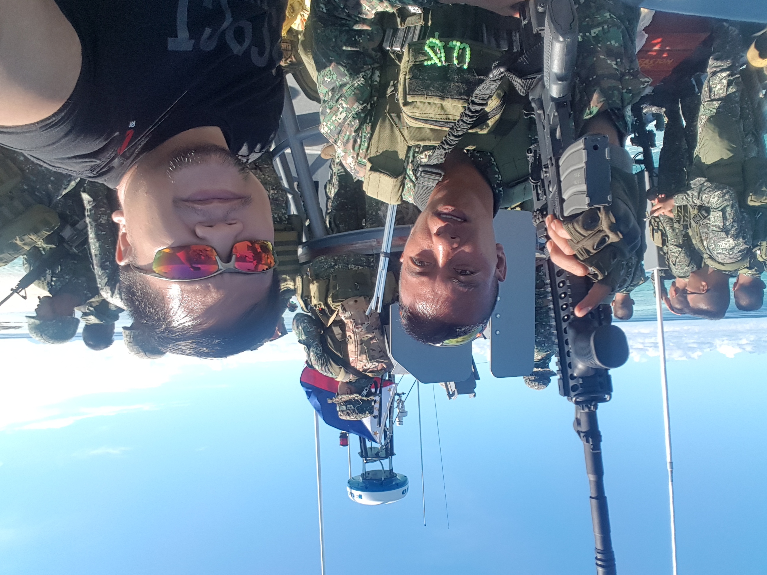
| Description | Upon the occupation of Marawi City in the Philippines, the Philippine President has declared martial law in the southern islands of Mindanao. User:Schadow1 together with a group of drone operators mapped the southernmost province of Tawi-Tawi for logistics, tourism and military operations purposes. The mapping expedition is supported by various divisions of the Armed Forces of the Philippines. Most of the data obtained from the mapping expedition has been uploaded to OpenStreetMap and documented on Schadow1 Expeditions |
|---|---|
| Author | schadow1 |
| Source | Own photo |
| Date | 2017-05-27 |
| Permission | Attribution |
Licensing

The copyright holder of this file allows anyone to use it for any purpose, provided that the copyright holder is properly attributed. Redistribution, derivative work, commercial use, and all other use is permitted.
If you are the uploader, please provide proper attribution including source and name of author.
If you are the uploader, please provide proper attribution including source and name of author.
File history
Click on a date/time to view the file as it appeared at that time.
| Date/Time | Thumbnail | Dimensions | User | Comment | |
|---|---|---|---|---|---|
| current | 07:00, 6 June 2017 | | 2,592 × 1,944 (1.83 MB) | Schadow1 (talk | contribs) | Upon the occupation of Marawi City in the Philippines, the Philippine President has declared martial law in the southern islands of Mindanao. User:Schadow1 together with a group of drone operators mapped the southernmost province of Tawi-Tawi for l... |
You cannot overwrite this file.
File usage
The following file is a duplicate of this file (more details):
- File:TawiTawiPH mappingexpedition.jpg from Wikimedia Commons
The following page uses this file: