Category:Philippines
Jump to navigation
Jump to search
Subcategories
This category has the following 11 subcategories, out of 11 total.
Pages in category "Philippines"
The following 116 pages are in this category, out of 116 total.
F
G
H
M
O
P
- Template:WikiProject Philippines
- Philippines/Taskings
- Philippines/2020 Typhoon Activation
- Philippines/2021 Drone Imagery Collection Grant by Datum & OSMph
- Philippines/Building Resilient Communities in Bohol Through the Use of OpenStreetMap
- Philippines/Chains
- Philippines/ChasingWaterways
- Philippines/CWTSS++ Project
- Philippines/Data sources/pafid data
- Philippines/Disaster Response in the Philippines
- Philippines/Events
- Philippines/Events/Open Data Day 2013
- Philippines/Events/Pista Ng Mapa
- Philippines/FAQs for PH data
- Philippines/header
- Philippines/Local Community Channels
- Philippines/Map
- Philippines/Map/Baguio
- Philippines/Map/Batangas City
- Philippines/Map/Bontoc
- Philippines/Map/CALABARZON
- Philippines/Map/Calamba City
- Philippines/Map/Central Luzon
- Philippines/Map/Los Baños
- Philippines/Map/Naga City
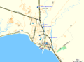
- Philippines/Map/Philippines
- Philippines/Map/Sagada
- Philippines/Map/San Pablo City
- Philippines/Map/Tagaytay
- Philippines/Map/UPLB
- Philippines/MapaTime!
- Philippines/MapaTime!/2019-OpenDataDay
- Philippines/Mappers
- Philippines/Mapping conventions/Local government
- Philippines/Mapping conventions/Roads
- Philippines/Mapping conventions/Roads/Classification
- Philippines/Mapping conventions/Schools
- Philippines/Mapping Party
- Philippines/Node density maps
- Philippines/OSMaPaaralan
- Philippines/OSMPH
- Philippines/PRCVCAD Project
- Philippines/Project SUCCESS
- Philippines/Projects
- Philippines/Public transportation
- Philippines/Public transportation/PUJ Baguio
- Philippines/Tabang-AI
- Philippines/Template for Project Pages
- Philippines/Timeline
- Philippines/Typhoon Ompong
- Philippines/Planning
- Power networks/Philippines
- Power networks/Philippines/Abbreviation of substations and power plants
- Power networks/Philippines/Components of power lines
- Power networks/Philippines/List of power lines
- Power networks/Philippines/List of relocated or reused and retired structures
- Power networks/Philippines/Mapped transmission and subtransmission lines constructed by each companies
- Power networks/Philippines/Mapped transmission and subtransmission lines constructed by each companies/Exceptions
- Power networks/Philippines/Number of retired structures
- Power networks/Philippines/Number of towers that were painted with aluminum or zinc paint
- Power networks/Philippines/Operators
- Power networks/Philippines/Power line references
- Power networks/Philippines/Power line structures references
- Power networks/Philippines/Power stations/substations mapped
- Davao City/Public transportation
- Public transportation in Metro Cebu
R
Media in category "Philippines"
The following 148 files are in this category, out of 148 total.
-
 1 year of edits in Cavite, Laguna, Batangas 2011-02-05.png 1,280 × 960; 874 KB
-
 1 year of edits in Metro Manila 2010-01-24.png 1,280 × 960; 879 KB
-
 1 year of edits in Metro Manila 2010-01-31.png 1,280 × 960; 916 KB
-
 1 year of edits in Metro Manila 2011-02-05.png 1,280 × 960; 980 KB
-
 1 year of edits in Metro Manila 2012-01-01.png 1,280 × 960; 1.13 MB
-
 2008 A Year of Edits - Philippines frame.jpg 1,280 × 720; 90 KB
-
 4636578697 6e85855407.jpg 1,024 × 768; 329 KB
-
 59082 463627032596 345455082596 7100402 5319097 n.jpg 720 × 540; 99 KB
-
 Arivac bohol POI lr.jpg 230 × 168; 10 KB
-
 ASoG - iBop Asia - New Mobility - NMT Mapping Workshop.jpg 2,048 × 1,536; 186 KB
-
 Balayan OSMPH Garmin 2011-12.png 878 × 646; 6 KB
-
 Balayan RoadGuide Garmin 2011-12.png 878 × 646; 24 KB
-
 Bangui Windmills.png 1,044 × 438; 45 KB
-
 Barangay boundaries in OpenStreetMap.png 577 × 524; 129 KB
-
 Bing misalignment in Daang Hari - Bacoor.jpg 500 × 300; 51 KB
-
 Bing not yet aligned in GMA, Cavite.jpg 400 × 400; 31 KB
-
 Bing now aligned and traced in GMA, Cavite.jpg 400 × 400; 32 KB
-
 Bing now aligned in GMA, Cavite.jpg 400 × 400; 29 KB
-
 Bohol 20100309 lr.png 230 × 162; 23 KB
-
 Buenavista OSMPH Garmin 2011-12.png 878 × 646; 29 KB
-
 Buenavista RoadGuide Garmin 2011-12.png 878 × 646; 6 KB
-
 Bulabog Beach, Boracay OSMPH Garmin 2011-12.png 878 × 646; 28 KB
-
 Bulabog Beach, Boracay RoadGuide Garmin 2011-12.png 878 × 646; 14 KB
-
 Bulacan spot5 20100121.png 320 × 344; 83 KB
-
 Catbalogan OSMPH Garmin 2012-12.png 878 × 646; 48 KB
-
 Catbalogan RoadGuide Garmin 2012-12.png 878 × 646; 31 KB
-
 Cavite Road Network Mapping Party animation frame.png 800 × 608; 83 KB
-
 Cavite Road Network Mapping Party annotated traces.gif 510 × 510; 28 KB
-
 Cavite Road Network Mapping Party cake slices.png 807 × 633; 101 KB
-
 Cebu Jeepney Route 06H.png 868 × 601; 270 KB
-
 ClickTheCity using OSM.png 960 × 616; 98 KB
-
 CloudMade routing at C-5 - Kalayaan.png 660 × 860; 80 KB
-
 Corregidor OSMPH Garmin 2012-12.png 878 × 646; 57 KB
-
 Corregidor RoadGuide Garmin 2012-12.png 878 × 646; 27 KB
-
 Cubao Mapping Party Before and After.png 705 × 950; 137 KB
-
 Dasmarinas OSMPH Garmin 2011-12.png 878 × 646; 39 KB
-
 Dasmarinas RoadGuide Garmin 2011-12.png 878 × 646; 27 KB
-
 Davao yahoo 20100118.jpg 549 × 612; 61 KB
-
 Diniwid Beach, Boracay OSMPH Garmin 2011-12.png 878 × 646; 21 KB
-
 Diniwid Beach, Boracay RoadGuide Garmin 2011-12.png 878 × 646; 10 KB
-
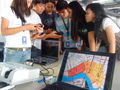
 Drone panguan mapping.jpg 824 × 589; 108 KB
-
 Enchanted Kingdom via Bing.png 494 × 490; 71 KB
-
 GADM vs OSM - Central Quezon City.png 767 × 592; 35 KB
-
 GADM vs OSM - Northern Caloocan.png 767 × 592; 24 KB
-
 Garmin IMG file sizes.png 1,335 × 540; 67 KB
-
 Gingoog OSMPH Garmin 2012-12.png 878 × 646; 49 KB
-
 Gingoog RoadGuide Garmin 2012-12.png 878 × 646; 23 KB
-
 GK-Telus Mapping Party Rally.jpg 720 × 480; 63 KB
-
 HOT style map of Southern Tacloban.png 950 × 625; 578 KB
-
 HOT Task 338.png 533 × 915; 239 KB
-
 IMG 3488.JPG 446 × 594; 83 KB
-
 Intramuros and Rizal Park in Stamen's Watercolor tileset.jpg 960 × 960; 284 KB
-
 Intramuros Mapping Party - before and after.png 2,010 × 1,000; 1.13 MB
-
 Intramuros Mapping Party morning meetup.jpg 720 × 540; 73 KB
-
 Intramuros Mapping Party planned slices.png 1,000 × 866; 666 KB
-
 Intramuros Mapping Party written Walking Paper for slice 4.jpg 654 × 900; 80 KB
-
 Intramuros OSMPH Garmin 2011-12.png 878 × 646; 76 KB
-
 Intramuros RoadGuide Garmin 2011-12.png 878 × 646; 46 KB
-
 Kidapawan OSMPH Garmin 2011-12.png 878 × 646; 27 KB
-
 Kidapawan OSMPH Garmin 2012-12.png 878 × 646; 93 KB
-
 Kidapawan RoadGuide Garmin 2011-12.png 878 × 646; 16 KB
-
 Kidapawan RoadGuide Garmin 2012-12.png 878 × 646; 53 KB
-
 Lubao ESSC OSM training group photo.jpg 960 × 720; 97 KB
-
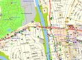
 Lucena and Western Pangasinan from new Bing imagery.png 640 × 970; 295 KB
-
 Malapascua Island 2010-01-29.png 924 × 1,209; 50 KB
-
 Malapascua OSMPH Garmin 2011-12.png 878 × 646; 19 KB
-
 Malapascua RoadGuide Garmin 2011-12.png 878 × 646; 5 KB
-
 MapAction using OSM after Ondoy.png 825 × 1,161; 126 KB
-
 MapaTime 20190325 133852.jpg 4,048 × 3,036; 3.33 MB
-
 MapaTime 20190325 200945 077.jpg 1,280 × 960; 198 KB
-
 MapaTime IMG 20190325 132542.jpg 4,048 × 3,036; 3.97 MB
-
 MapaTime! IMG 20190325 094003-COLLAGE.jpg 2,047 × 2,047; 582 KB
-
 MapBox GPS traces layer Elliptical Road.png 926 × 662; 187 KB
-
 MapBox Streets style for Makati CBD.png 800 × 600; 219 KB
-
 MapCraft pie for Marikina.png 800 × 800; 938 KB
-
 MapQuest's OSM cartography - Metro Manila.png 1,002 × 1,002; 385 KB
-
 Marikina Cake.jpg 720 × 540; 97 KB
-
 Marikina cycleways.png 547 × 553; 558 KB
-
 Marikina mapping priorities.png 1,448 × 932; 1.12 MB
-
 Marikina OSMPH Garmin 2011-12.png 878 × 646; 78 KB
-
 Marikina RoadGuide Garmin 2011-12.png 878 × 646; 45 KB
-
 Metromanila yahoo 20100118.jpg 449 × 550; 57 KB
-
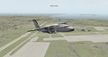 MNL in X-Plane.png 1,024 × 543; 759 KB
-
 Mount Samat Shrine in F4 Map.jpg 542 × 549; 62 KB
-
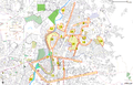
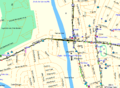
 Naga osm.png 1,020 × 1,189; 598 KB
-
 Naic OSMPH Garmin 2011-12.png 878 × 646; 34 KB
-
 Naic RoadGuide Garmin 2011-12.png 878 × 646; 26 KB
-
 New Mobility Mapping Workshop 2012-02-01.jpg 1,600 × 1,063; 1.06 MB
-
 OpenOrienteeringMap of Ayala Center, Makati 2010-01-29.png 986 × 782; 112 KB
-
 OpenStreetMap Philippines Inc. SEC Certificate of Incorporation.jpg 2,988 × 5,312; 4.43 MB
-
 OpenStreetMap.org.ph screenshot.png 1,024 × 617; 63 KB
-
 Ormoc OSMPH Garmin 2011-12.png 878 × 646; 43 KB
-
 Ormoc RoadGuide Garmin 2011-12.png 878 × 646; 26 KB
-
 Ortigas-Mandaluyong Mapping Party group shot.jpg 720 × 540; 90 KB
-
 Ortigas-Mandaluyong Mapping Party Slices.PNG 667 × 589; 127 KB
-
 OSM ADDU Workshop 2011-01-29.jpg 720 × 540; 68 KB
-
 OSM South Cotabato LGUs Workshop.jpg 960 × 712; 118 KB
-
 OSM Workshop at FEATI University 1.jpg 2,048 × 1,536; 854 KB
-
 OSM Workshop at Software Freedom Day Philippines 2012.jpg 2,048 × 1,536; 251 KB
-
 OSM-PH sawtooth coastlines example.png 854 × 1,106; 30 KB
-
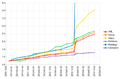 OSMPH data growth graph.png 697 × 456; 43 KB
-
 Osmph-structures-noah.jpg 884 × 407; 139 KB
-
 Paete OSMPH Garmin 2011-12.png 878 × 646; 28 KB
-
 Paete RoadGuide Garmin 2011-12.png 878 × 646; 16 KB
-
 Pampanga yahoo 20100118.jpg 458 × 561; 49 KB
-
 Pangasinan qb 20100118.jpg 414 × 462; 41 KB
-
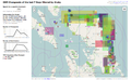
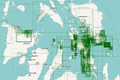
 Pangasinan Typhoon Pepeng imagery extent (DigitalGlobe Quickbird).png 520 × 518; 136 KB
-
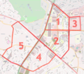
 Pasay boundaries.png 1,364 × 1,466; 326 KB
-
 Passi OSMPH Garmin 2011-12.png 878 × 646; 34 KB
-
 Passi RoadGuide Garmin 2011-12.png 878 × 646; 12 KB
-
 Pateros Mapping Party activity via ITO.png 1,280 × 960; 538 KB
-
 Philippines mapping project banner.png 600 × 130; 43 KB
-
 Puerto Princesa OSMPH Garmin 2011-12.png 878 × 646; 38 KB
-
 Puerto Princesa RoadGuide Garmin 2011-12.png 878 × 646; 32 KB
-
 Quiapo in 3D.png 1,100 × 650; 335 KB
-
 Rally's typ file.png 968 × 626; 139 KB
-
 Rizal Park OSMPH Garmin 2011-12.png 878 × 646; 78 KB
-
 Rizal Park RoadGuide Garmin 2011-12.png 878 × 646; 52 KB
-
 San Pablo City 2010-01-30.png 780 × 780; 79 KB
-
 San Pablo OSM-PH Garmin 2011-12-23.png 878 × 646; 209 KB
-
 San Pablo OSMPH Garmin 2011-12.png 878 × 646; 86 KB
-
 San Pablo RoadGuide Garmin 2011-12.png 878 × 646; 51 KB
-
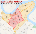 Santa Ana, Manila Mapping Party cake.png 1,300 × 1,250; 1.62 MB
-
 Sendong humanitarian maps.png 924 × 1,309; 556 KB
-
 Silang OSMPH Garmin 2011-12.png 878 × 646; 29 KB
-
 Silang RoadGuide Garmin 2011-12.png 878 × 646; 22 KB
-
 SM City Cebu 2010-11-29.png 1,052 × 812; 226 KB
-
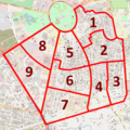
 Southwestern Makati Mapping Party planned slices.png 1,017 × 1,544; 1.76 MB
-
 Sta Cruz OSMPH Garmin 2011-12.png 878 × 646; 52 KB
-
 Sta Cruz RoadGuide Garmin 2011-12.png 878 × 646; 30 KB
-
 State of the Countries 2010 posters PH FR.jpg 1,000 × 664; 117 KB
-
 Taal Lemery OSMPH Garmin 2011-12.png 878 × 646; 28 KB
-
 Taal Lemery RoadGuide Garmin 2011-12.png 878 × 646; 19 KB
-
 Tagging examples on a street view photo.jpg 1,024 × 386; 329 KB
-
 TawiTawiPH mappingexpedition.jpg 2,592 × 1,944; 1.83 MB
-
 Three large poster maps of Tacloban, Guiuan and Ormoc.jpg 640 × 918; 198 KB
-
 Typhoon Hagupit changesets till 2014-12-08.png 1,196 × 741; 369 KB
-
 Typhoon Haiyan - OSM data growth line graph.png 1,837 × 1,361; 41 KB
-
 Typhoon Haiyan changesets vis.png 785 × 526; 243 KB
-
 Typhoon Haiyan mapping changeset bounding boxes viz by Pascal Neis.png 2,236 × 1,608; 1.59 MB
-
 UP Los Baños Campus 2010-10-31.png 1,692 × 1,375; 608 KB
-
 UP Village+ Mapping Party planned slices.png 1,280 × 1,280; 1.82 MB
-
 UPLB OSMPH Garmin 2011-12.png 878 × 646; 76 KB
-
 UPLB RoadGuide Garmin 2011-12.png 878 × 646; 33 KB
-
 White Beach, Puerto Galera OSMPH Garmin 2011-12.png 878 × 646; 23 KB
-
 White Beach, Puerto Galera RoadGuide Garmin 2011-12.png 878 × 646; 12 KB
-
 WikiProject Philippines banner.png 600 × 130; 31 KB
-
 WikiProject Philippines mini banner.png 122 × 76; 11 KB


.png)


