Philippines/Typhoon Ompong
Typhoon Ompong , (aka Mangkhut ) is a category 5 super typhoon that made landfall in Cagayan province of the Philippines on 15th September 2018. It is considered as the strongest typhoon to hit Luzon since Typhoon Juan (aka Megi) in October 2010, and the strongest to hit the Philippines since Typhoon Haiyan in November 2013.
This is a community-led mapping effort to to augment available open geodata for affected areas for use during disaster response, damage assessment, and future spatial analysis.

Micro-tasking Manager Jobs
The first task job was published and shared to the mapping community in 13th September. The following tasks cover the areas to be mapped affected by Ompong.
| Job | Coverage | Priority features | Status |
|---|---|---|---|
| 5236 | Cagayan and Batanes Province | Buildings | Complete |
| 5242 | Parts of Cordillera Region | Buildings | Complete |
| 5234 | Isabela Province | Buildings | Complete |
Parts of Ilocos Region were also hit but already has base data, created from a pilot project led by UP Resilience Institute, (then an ad-hoc group under DOST, and previously known as Project NOAH) to map select provinces in the Philippines.
Imagery and Other data sources
Currently utilizing suitable pre-disaster open imagery from DigitalGlobe and Bing.
There are some discussions about utilizing ML-generated priority areas, to assist mappers in identifying places to map, but no specific action has been made.
Mapping effort needed
The tasks are open to beginners and volunteers new to mapping in OpenStreetMap, who are instructed to prioritize the mapping of building structures. All other features are considered secondary, but tagging settlements and digitizing the roads that connect them to the rest of the highway network are strongly encouraged.
Mapping Coordination and Support
This effort is led by several advocates from several technical communities, and the co-ordination process was largely made through a local community Telegram channel: OSMph LoCo. Mapping efforts are made remotely, and a few mapathons.
Activity timeline

Timeline of activities.
| Date | Activity | Organizer | Host | Supporters | Status | Notes |
|---|---|---|---|---|---|---|
| 12-29 | MapaTime! | Community | Community | Completed | ||
| 10-14 | Mapathon | Philippines/PRCVCAD Project | Red Cross @ co.lab | Planned | ||
| 10-11 | Mapathon | CWTS++ Project | PUP San Juan | Completed | ||
| 10-04 | Mapathon | CWTS++ Project | PUP San Juan | Completed | ||
| 09-23 | Mapathon | Community | Red Cross @ co.lab | Kaart | Completed | |
| 09-20 | Mapathon | CWTS++ Project | PUP San Juan | Completed | ||
| 09-16 | Mapathon | Community | Red Cross @ co.lab | Red Cross | Completed | |
| 09-14 | Imagery release | DigiGlobe | Completed. | CC-BY-NC 4.0 license, with OSM exception. | ||
| 09-13 | Activation | Community | Online | On-going |
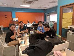
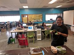
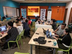
Some photos taken during the various mapping marathons help for #ompongPH mapping efforts.
- Various photos from several mapathons


Raw statistics
 Quick road and building stats from Missing Maps Leaderboard. Changed buildings numbers extracted using an Overpass Turbo query.
Activity column indicates activities other than remote mapping.
| Run date | Road length (km.) | Total Buildings (n) | Contributors | Objects query | Activity |
|---|---|---|---|---|---|
| 12-29 | 4,417 | 515,738 | 28 | 24 | |
| 12-28 | 4,416 | 515,576 | 42 | 1,922 | |
| 12-27 | 48 | 2,092 | |||
| 12-26 | 33 | 1,264 | |||
| 12-25 | 4,408 | 512,028 | 26 | 1,224 | |
| 12-24 | 27 | 1,513 | |||
| 12-23 | 24 | 1,188 | |||
| 12-22 | 32 | 962 | |||
| 12-21 | 4,312 | 507,900 | 34 | 1,482 | |
| 12-20 | 37 | 750 | |||
| 12-19 | 4,279 | 506,416 | 32 | 1,273 | |
| 12-18 | 33 | 1,611 | |||
| 12-17 | 4,264 | 504,229 | 38 | 1,157 | |
| 12-16 | 32 | 935 | |||
| 12-15 | 24 | 304 | |||
| 12-14 | 33 | 884 | |||
| 12-13 | 4,204 | 502,358 | 49 | 606 | |
| 12-12 | 4,179 | 501,636 | 43 | 606 | |
| 12-11 | 48 | 729 | |||
| 12-10 | 4,127 | 498,941 | 53 | 602 | |
| 12-9 | 22 | 151 | |||
| 12-8 | 25 | 828 | |||
| 12-7 | 4,127 | 498,941 | 50 | 991 | |
| 12-6 | 41 | 781 | |||
| 12-5 | 47 | 997 | |||
| 12-4 | 3,973 | 494,290 | 59 | 2,158 | |
| 12-3 | 3,970 | 494,232 | 101 | 2,113 | |
| 12-2 | 37 | 1,001 | |||
| 12-1 | 30 | 495 | |||
| 11-30 | 3,887 | 492,296 | 43 | 1,352 | |
| 11-29 | 51 | 1,152 | |||
| 11-28 | 103 | 690 | |||
| 11-27 | 41 | 688 | |||
| 11-26 | 3,8344 | 489,006 | 54 | 1,192 | |
| 11-25 | 25 | 323 | |||
| 11-24 | 3,799 | 488,226 | 30 | 865 | |
| 11-23 | 3,765 | 487,464 | 70 | 648 | |
| 11-22 | 98 | 933 | |||
| 11-21 | 52 | 1,856 | |||
| 11-20 | 68 | 2,057 | |||
| 11-19 | 3,533 | 482,603 | 67 | 1,181 | |
| 11-18 | 42 | 1,273 | |||
| 11-17 | 62 | 1,097 | |||
| 11-16 | 122 | 2,108 | |||
| 11-15 | 3,363 | 478,704 | 101 | 2,624 | |
| 11-14 | 253 | 1,749 | |||
| 11-13 | 167 | 1,028 | |||
| 11-12 | 3,249 | 474,951 | 88 | 482 | |
| 11-11 | 3,248 | 474,298 | 44 | 0 | |
| 11-10 | 86 | 5 | |||
| 11-09 | 142 | 716 | |||
| 11-08 | 3,216 | 462,041 | 154 | 131 | |
| 11-07 | 3,184 | 454,588 | 94 | 2,568 | DSWD #VAWfreePH mapathon |
| 11-06 | 96 | 666 | |||
| 11-05 | 3,138 | 445,569 | 51 | 2,553 | |
| 11-04 | 3,106 | 443,265 | 51 | 700 | |
| 11-03 | 3,081 | 435,629 | 37 | 212 | |
| 11-02 | 39 | 864 | |||
| 11-01 | 49 | ||||
| 10-31 | 72 | ||||
| 10-30 | 2,800 | 392,734 | 61 | ||
| 10-29 | 57 | 789 | |||
| 10-28 | 40 | 748 | |||
| 10-27 | 43 | 0 | |||
| 10-26 | 63 | 1 | |||
| 10-25 | 97 | 701 | |||
| 10-24 | 104 | 134 | MapaTime! #VAWfreePH mapathon | ||
| 10-23 | 2,800 | 392,734 | 54 | 312 | |
| 10-22 | 2,791 | 391,618 | 698 | ||
| 10-21 | 2,756 | 388,248 | 50 | 427 | |
| 10-20 | 2,740 | 386,244 | 50 | 341 | |
| 10-19 | 2,703 | 380,970 | 88 | 578 | |
| 10-18 | 2,653 | 377,345 | 82 | 692 | |
| 10-17 | 2,619 | 369,447 | 61 | 893 | |
| 10-16 | 2,556 | 362,963 | 86 | 976 | |
| 10-15 | 2,525 | 358,111 | 63 | 271 | |
| 10-14 | 2,463 | 346,831 | 70 | 1,780 | mapathon @ co.lab |
| 10-13 | 2,445 | 342,490 | 48 | 566 | |
| 10-12 | 2,439 | 337,726 | 74 | 683 | |
| 10-11 | 2,407 | 326,939 | 101 | 2,159 | mapathon @ Philippines/CWTSS++ Project |
| 10-10 | 2,394 | 321,085 | 77 | 751 | |
| 10-09 | 80 | 1,864 | |||
| 10-08 | 2,343 | 305,020 | 76 | 1,290 | |
| 10-07 | 2,289 | 299,534 | 68 | 1,239 | |
| 10-06 | 2,252 | 294,058 | 65 | 1,169 | |
| 10-05 | 2,191 | 286,987 | 113 | 2,111 | |
| 10-04 | 2,111 | 280,038 | 128 | 2,020 | mapathon @ Philippines/CWTSS++ Project |
| 10-03 | 2,093 | 274,605 | 100 | 987 | |
| 10-02 | 2,029 | 266,943 | 125 | 777 | |
| 10-01 | 1,962 | 260,146 | 170 | 1,085 | |
| 09-30 | 1,829 | 253,431 | 83 | 1,074 | |
| 09-29 | 1,764 | 243,792 | - | 1,277 | |
| 09-28 | 1,633 | 238,486 | 91 | 2,160 | |
| 09-27 | 1,585 | 227,122 | 137 | 3,531 | mapathon @ Philippines/CWTSS++ Project |
| 09-26 | 1,520 | 207,157 | 110 | 1,796 | |
| 09-25 | 1,412 | 194,533 | 117 | 3,762 | |
| 09-24 | 1,362 | 185,351 | 87 | 5,141 | |
| 09-23 | 1,264 | 169,045 | 93 | 3,855 | mapathon @ co.lab |
| 09-22 | 1,107 | 156,319 | 54 | 1,556 | |
| 09-21 | 1,009 | 140,343 | 116 | 6,215 | |
| 09-20 | 841 | 114,226 | 168 | 9,286 | mapathon @ Philippines/CWTSS++ Project |
| 09-19 | 779 | 99,478 | 119 | 4,800 | |
| 09-18 | 674 | 85,021 | 153 | 4,855 | |
| 09-17 | 528 | 66,428 | 117 | 2,107 | |
| 09-16 | 100 | 3,094 | mapathon @ co.lab | ||
| 09-15 | 100 | 6,652 | |||
| 09-14 | 125 | 12,055 | |||
| 09-13 | 83 | 1,556 | Activation | ||
| 09-12 | 38 | 23 | Pre-activation |