Geocaching
- See Geocaching on Wikipedia
Geocaching is an outdoor recreational activity, in which the participants use a Global Positioning System (GPS) receiver or mobile device and other navigational techniques to hide and seek containers, called "geocaches" or "caches", anywhere in the world. The most popular web service is Groundspeak (geocaching.com) and the open alternative is the Opencaching Network.
Not including geocaches into OSM
A German community discussion from 2014 recommends keeping geocaches out of the database due to several reasons:
- Importing geocaches from other sources is almost impossible due to license issues.
- The Opencaching Network already serves geocaching information under a CC-BY-NC-ND license.
- Geocaching has its own databases. Duplicating information creates a maintenance issue, e.g. when caches are temporarliy disabled or archived.
- Geocaches do not connect to other OSM objects, are hard to verify and do not support to guide the way.
- There is no public interest to render this data except for geocachers.
- Some caches are only for an event or a short time period.
- The most types of geocaches require a geocaching community or more detailed information which cannot be served by the OSM.
For the last reason there is almost no type of geocache which can be included into the OSM except traditional caches for example. Hence OSM is not a good place to provide information about caches itself.
Apps
This section lists geocaching applications using OSM.
Websites
Almost every Geocaching platform provides OSM tiles. Here are some: XCTrails, Opencaching Network (opencaching.org.uk, opencaching.de etc), opencaching.com and Geocaching.com
Mobile apps
| Name | Screenshot | Platform | License | Offline Maps supported | OSM tiles | OSM vector map | Dedicated to geocaching | Login to Geocaching Network | Supported Networks | Remark |
|---|---|---|---|---|---|---|---|---|---|---|
| c:geo | - | android | Apache License 2.0 | yes | yes | yes | yes | yes | geocaching.com, Opencaching Network, opencaching.com, Extremcaching.com, gcvote.com | |
| Locus | 
|
android | proprietary (gratis, paid) | yes | yes | yes | ? | ? | ? | |
| OsmAnd | 
|
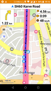
android | GPL v3 | yes | yes | yes | no | no | - | shows up an option to filter for "Geocache" |
| Looking4Cache | 
|
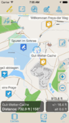
ios | proprietary (gratis, paid) | yes | yes | yes | yes | ? | geocaching.com | |
| Trésors de Haute Bretagne | iOS, Android | proprietary (gratis) | yes | yes | yes | yes | yes | tresorsdehautebretagne.fr | Developped by Comité du Tourisme de Haute Bretagne with tourism offices in Ille-et-Vilaine (Bretagne, France). The mobile application uses OSM-based maps while playing. The website uses Google Maps only to list the caches. |
Garmin
Geocaching is supported by many Garmin devices. Here are some pages on the Wiki which deal with information about Garmin.
Events for OSM and Geocaching
There are several Events and Conferences dealing with OSM and about the geocaching community. The following lists might include some in your region.