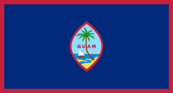
Guam
Jump to navigation
Jump to search
| V・T・E |
| latitude: 13.4464, longitude: 144.7929 |
| Browse map of Guam 13°26′47.04″ N, 144°47′34.44″ E |
| Edit map |

|
|
External links:
|
| Use this template for your locality |
Guam is an unincorporated and organized territory in the United States at latitude 13°26′47.04″ North, longitude 144°47′34.44″ East.
Guam's admin_level=* tagging
As a US territory, Guam itself (including its territorial waters) is tagged admin_level=4. The US exercises a federal-level Exclusive Economic Zone further out to sea around Guam, delineated with admin_level=2.
In US territories, administrative subdivisions are known as "municipalities," similar to "counties" in states. Guam has 19 municipalities, called "villages" (see ![]() Villages_of_Guam). Like other municipalities in US territories (and like counties in US states), Guam's villages are tagged
Villages_of_Guam). Like other municipalities in US territories (and like counties in US states), Guam's villages are tagged admin_level=6.

