JOSM/Plugins/GeoHash
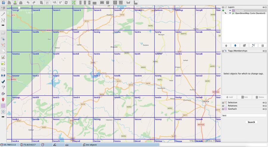
Geohash is a public domain geocoding system that encodes a geographic location (lat/long) into a short string of letters and digits. The JOSM's GeoHash plugin displays a layer on top of the JOSM map that contains the corresponding geohashes, up to a depth of 10. This means that the geohash can have a code length of maximum 10 characters.
How to use the Geohash plug-in
The geohashes are automatically generated based on the user map view and zoom level. Increased zoom means increased depth level for geohashes. The maximum geohash code length is 10 characters.
To search for a geohash, use the Geohash plug-in dialog. Type or paste the geohash code in the text field and press the Search button. If the code is invalid, a message will be shown. Otherwise, the map view will be moved and zoomed over the selected geohash.
The layer menu has 2 options that activate during certain zoom level: display smaller geohashes and display larger geohashes.
