Tag:flood_prone=yes
| Description |
|---|
| Indicates that the feature is likely to flood after very heavy rain. |
| Group: hazards |
| Used on these elements |
| Useful combination |
|
| See also |
| Status: in use |
| Tools for this tag |
|
An area or way, that is prone to flooding. This is mostly applicable to roads that go under water after heavy rains.
A ![]() floodplain is an area around a waterway where it could break its banks and flood the surrounding area. A
floodplain is an area around a waterway where it could break its banks and flood the surrounding area. A ![]() floodway is a crossing along a waterway or floodplain.
floodway is a crossing along a waterway or floodplain.
Other than floodways, this tag is typically used only on short stretches of major highways, such as in low-lying tunnels, low-lying passages under bridges, and low-lying roads near bodies of water that overflow easily. Depending on the situation, it is rare and generally undesirable to apply it to large sets of adjacent local urban streets.
The default value of the key is flood_prone=no and should not be used.
Mapping flood prone highways
If the area is surrounded by flood plains or is otherwise at risk of flooding. You should apply a flood_prone=yes to the exact part of the way that is likely to go underwater. However, if you don't this information precisely, you can also tag flood_prone=yes on a single node.
Mapping flood prone bridges
For a flood prone bridge, you should ensure a bridge=* tag is on the relevant highway and add flood_prone=yes. Nothing really needs to be done to the waterway since the bridge is a structure above the waterway.
Mapping waterway crossings
To map a simple floodway crossing that does not have a bridge-like structure. Apply a tunnel=culvert tag to the waterway, and put flood_prone=yes on the intersecting highway.
General situation

|

|
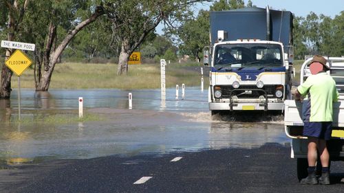
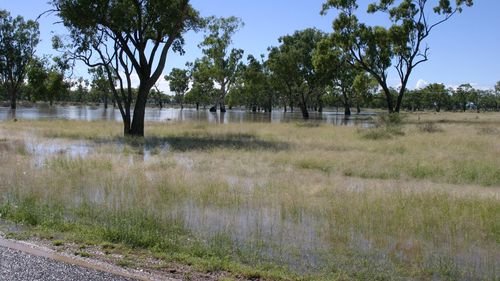
The above photos were taken on River Road, West Toodyay.

|

|
The above photos are of the Gwydir highway east of Moree.
Rendering and possible usages
Flood prone areas don't have water across them 99.9% of the time, so there isn't any perceived benefit in rendering these areas most of the time.
However, the information can help routing software to avoid potentially hazardous crossings after heavy rain.
Furthermore, some Emergency services may find it useful to have their own flood mapping that highlights these and similar tags.
Sources and verifiability
Without an official data source, it is difficult to determine the exact outline of a flood-prone area and the exact set of ways to tag as flood-prone. Sometimes, a partial assessment can be made from sources such as OpenAerialMap and Sentinel-2. Ideally, one should consider multiple flood events due to heavy rainfall occurring in different years.
Similar tag ideas
- It might be useful to tag the markers that indicate depth of water when flooded, although similar markers can be found along river banks and tidal water areas
- It might be useful to tag how often flooding gets or covers a certain area, eg once in 100 years.
See also
- hazard=washout – A section of road which presents a risk to motorists due to washouts.
- ford=* – Unlike flood prone areas, fords may be safe to cross if there is water across the roadway.
- Proposal:floodplain
- OpenHazardMap – risk mapping project, including flooding
- “Landsat TM image analysis for identifying areas prone to flooding” (in Spanish). 2011.


