Key:ref:IE:nm
 |
| Description |
|---|
| Reference number for National Monuments in Ireland. |
| Group: references |
| Used on these elements |
| Requires |
|
| Implies |
|
| Useful combination |
|
| Status: imported |
| Tools for this tag |
ref:IE:nm may be used for National Monuments in the Republic of Ireland for a reference number issued by the National Monuments Service.
Unfortunately, the National Monuments Service seems to only publish a list[1] of those under state care[2][3], but some National Monuments have a black information board or the silver Fógra sign which can enable the mapper to identify them as such. See below in gallery.
How to map
Add ref:IE:nm=* to the site or building which represents the National Monument. Use the number provided on the list below or, if you cannot ascertain the number, use ref:IE:nm=unknown.
If the date of the protection order is known, you can add ref:IE:nm:po=* in the pattern NO/YEAR to verify the status as National Monument, especially for the ones not on the official list.
Examples
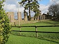
The types of monuments range from Bronze Age barrows (archaeological_site=tumulus) over Iron Age hillforts (fortification_type=hillfort), ogham (historic=ogham_stone) and standing stones (megalith_type=menhir) and medieval castles and ecclesiastical sites to early modern houses and Georgian buildings.
-
 Seefin Passage Tomb,
ref:IE:nm=317 -
 Kiltera ogham stones,
ref:IE:nm=330 -
 Clonmacnoise Ecclesiastic Site,
ref:IE:nm=81 -
 Shee Almshouse, Kilkenny, built 1582,
ref:IE:nm=unknown -
 Jigginstown House, Naas,
ref:IE:nm=528 -
 Kilmainham Goal, Dublin,
ref:IE:nm=675


Gallery

,_Tory_Island_-_geograph.org.uk_-_2492988.jpg)
See also
References
- ↑ List by county with downloadable pdfs
- ↑ Email sent January 2023, reply pending.
- ↑ Personal conversation with Head of Archaeology, Michael MacDonagh, 2023-02-07.