Key:thatcher_name
Jump to navigation
Jump to search
| Description |
|---|
| Name(s) of the thatcher(s) involved in thatching a building. |
| Group: names |
| Used on these elements |
| Implies |
| Useful combination |
|
| Status: in use |
| Tools for this tag |
The thatcher_name key can be used to the name of a thatcher or a succession of thatchers to a building, where the roof is thatched (roof:material=thatch). The source for this information can be the residents/ owners, the thatchers themselves or a survey.
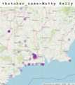
The tag can for example be used to show the "catchment area" of a thatcher, similar to the key artist_name=*.
Examples
-
Distribution of thatcher_name=Matty Kelly
Links
- Buildings of Ireland provides a list of thatchers and thatch material providers for Ireland under the heading "Thatch in Ireland". https://www.buildingsofireland.ie/resources/


