Mappa Mercia/Inner Ringroad
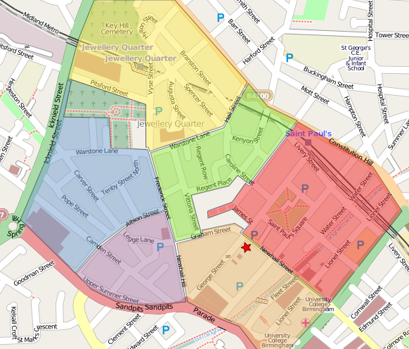
The Midlands User Group (Mappa Mercia) meets on the first Thursday of the month somewhere in the centre of Birmingham. At the April meeting we decided to combine the social with some mapping during the summer months. The idea is to meet every month in a different pub somewhere in the city centre and start the evening with mapping addresses, turn restrictions and other POIs in the area around the pub for an hour. By the end of the summer will then hopefully have collected complete address information and turn restrictions for the area within the inner ringroad.
Of course, there is no need to restrict the mapping to addresses and turn restrictions. Walking through the city centre provides a good opportunity to check the current map for mistakes and details that were missed before!
Next Meeting: June 4th 2009, 7pm (mapping) and 8pm (pub) at the Queens Arms
May Cake

We will meet outside the Queens Arms, Newhall St, Birmingham at 7pm to split the cake. If you cannot make it by 7 then just enter your name in the table below to claim your part of the cake in advance.
| Slice | Taken by |
|---|---|
| Orange | |
| Red | |
| Purple | |
| Green | |
| Blue | |
| Yellow |