Nepal remote mapping guide Experiment
This Nepal remote mapping guide describes mapping Nepal remotely with OpenStreetMap, including details about typical structures which can be found in Nepal and which will help you to map the region more accurately.
Introduction
Hello mapping volunteers!
This document contains hints, tips and methods to map regions in Nepal with OpenStreetMap (OSM). The training material is based on practices developed by people who are both familiar with Nepal and experienced with OSM.
Mapping with JOSM
JOSM is a Java-based application for editing OSM which you can run on your desktop.
It has many more features than other editors but takes longer to learn. If you are using JOSM for the first time to contribute to OpenStreetMap, then have a look at one of the various tutorials:
- JOSM Guide (LearnOSM)
- Very brief but nice guide to learn OSM mapping with JOSM
- JOSM Guide wiki
- JOSM Keyboard Shortcuts
Common Features in Nepal: Section 1-4 show characteristics of buildings of this region with specific mapping hints
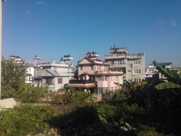
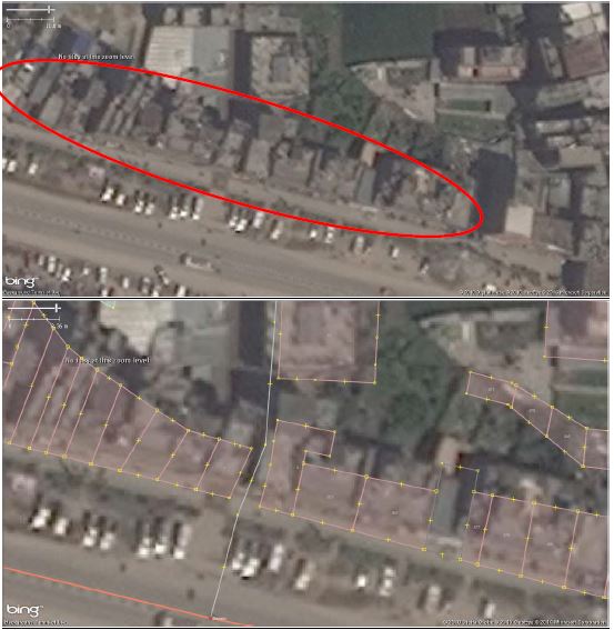
1. Buildings that are irregular in elevation might appear as a set of houses
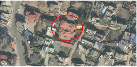
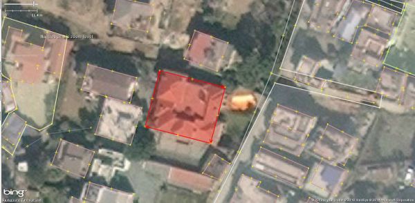
In Nepal, there is often a mix of large buildings, such as temples or apartments, and small buildings. From the air, it looks like as if they all have the same height. But as you can see from the pictures below, it can be quite different.
Sometimes looking at shadows can help you to differentiate one building from another.
Try to find the boundaries of each building. The more you map, the better you will get at recognizing the edges of each building. If it is not possible, just outline the building complex as one "big building".
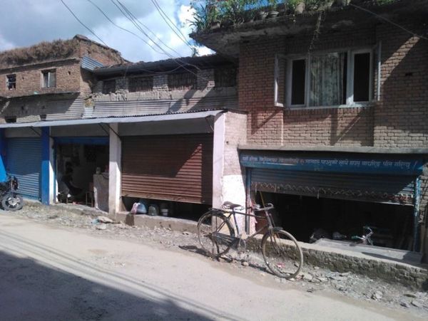
2. A row of houses may look like one big house
Try to find the boundaries of each building. In cases when you are not sure, outline the row of buildings as one big building.
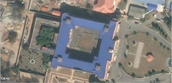
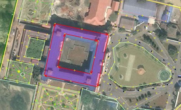
3. Complex building structures
To trace a building which has an open space in the middle (which may look like a roof) you need to create a "Multi-Polygon":
“Create multipolygon”: Initially make 2 polygons (outer and inner) then select both polygons, go to “Tools” and select “Create multipolygon”
You can also create more complicated buildings by using the merge option. Create your building outline, select all of the polygons (press ⇧ Shift to highlight them all) and then hit ⇧ Shift+J to
merge the objects.
4. What is the actual layout of a building?
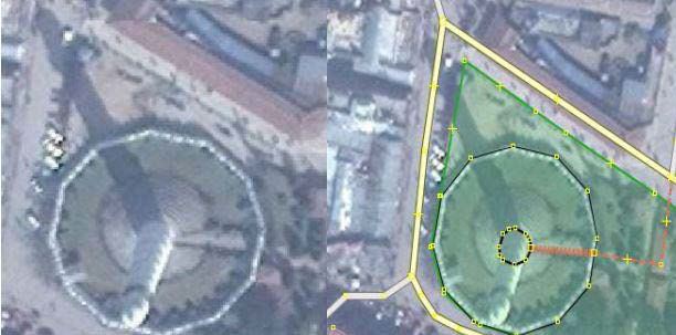
Sometimes, buildings are very high or the image was taken from an angle. In such cases it is important to have an idea about the actual layout of the building:
Below it is clear that the shape of the shadow identifies the shape of the building. Displacements due to high rise buildings must also be taken into consideration.
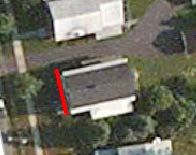
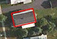
Using JOSM you may find a situation where a tall building appears to be leaning to one side because of the angle of the satellite photo. In this case it is important to trace the base of the building, not the top (roof), and to make it rectangular. JOSM has a Building plug-in to help with this:
This plug-in is by far one of the most useful tools for editing (digitizing). This tool allows you to create shapes with 90 degree corners with just three clicks.
To install the plug-in: Preferences in MenuBar → Plug-ins → search for building plug-in on the list.
First, you trace the edge of your building and then you drag out the line to make it a polygon.
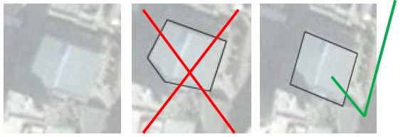
Below we see that a part of the building is covered by the shadow of another building. In this case you have to reference the other edges of the building and digitize accordingly.
The picture on the far right is correct.
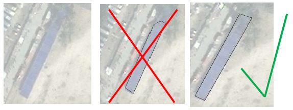
Below we see that a part of the building is covered by trees. Again, use your intuition to digitize as best as you can. The picture on the far right is correct.
