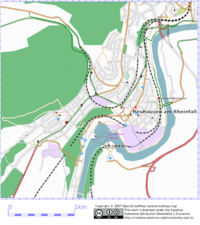
Neuhausen am Rheinfall
Jump to navigation
Jump to search
| V・T・E |
| latitude: 47.681, longitude: 8.6197 |
| Browse map of Neuhausen am Rheinfall 47°40′51.60″ N, 8°37′10.92″ E |
| Edit map |

|
|
External links:
|
| Use this template for your locality |
Neuhausen am Rheinfall is a town in Switzerland at latitude 47°40′51.60″ North, longitude 8°37′10.92″ East.
Galgenbuck Tunnel
A new tunnel is in progress that goes right under the Galenbuck peak to connect the auto road A4 to the Klettgau. One entry is from Bahntal and the other is from Enge/Klettgauerstrasse.
I managed to follow the sounding drill truck for a few holes. This allows to get the GPS position for points in the tunnel. Here is the list of coordinates I collected so far:
| latitude | longitude | where |
|---|---|---|
| 47.688764 | 8.617560 | Rosenbergstrasse, between Charlottenweg/Hofluhstrasse and Randenstrasse/Quellenstrasse |
| 47.689112 | 8.618303 | Connection Nelkenstrasse/Charlottenweg |
Detailed plans see here: http://www.sh.ch/Galgenbucktunnel.1157.0.html
What needs to be done
- There are still a few amenities and public places missing
- Many wood ways are still missing
- We need Relations for bike routes, etc.