Nottingham/Mapping Meetup/New Year 2019
2019 New Year Meeting : Date: Saturday 5th January 2019
Meet at The Cow, Lees, Derbyshire at 10:30 (mapping) or between 12:30 and 13:00 (social & lunch) also at The Cow.
Event Details
The New Year mapping meeting will be in the same format of the initial meeting, and again will be focussed on mapping footpaths and other rights of way. A lunch time pub stop also gives other interested people a chance to join the group. This time we will be again in Derbyshire, W of the city of Derby, and S of, the former roman road, Long Lane. This area of rolling countryside has an extensive network of paths, but is poorly mapped with the exceptions of a couple of long-distance trails. It seems to have a fair amount of pasture (fewer muddy ploughed fields perhaps), and is surprisingly rural given it's proximity to Derby.
The settlements of the area (Lees, Long Lane etc) have more of a feel of hamlets than villages, so there is less opportunity to tackle a village than last year. Most footpaths, with the exceptions of one long-distance path are missing or lack detail.
- Morning Meeting Point: Cow pub, Lees
- Lunch & Afternoon Meeting Point: Cow pub (1953484552
 1953484552)
The format is as follows, with 3 discrete activities which allows people to participate in 1 or 2 if they wish:
- 10:30: Meet for morning footpath session (either together or splitting up to maximise area covered)
- 12:30-13:00: Pub lunch (pub lunch, some walkers may arrive a bit after 12:30). The Cow is a fairly upmarket pub, but has stone floors in at least part of the front bar. It has gluten free & vegetarian options.
- 14:00-14:30: Further footpath or other mapping sessions.
Mapping Objectives
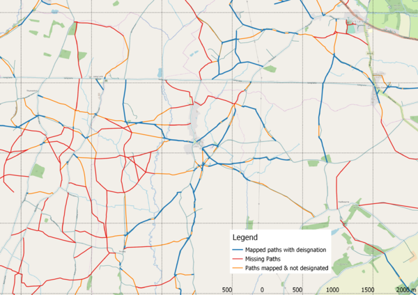
- Public Rights of Way. See map below:
The principle area of work is to the W of Lees. However there are a couple of other areas to consider:
- NE of Lees there are two paths which meet about 1 km to NW, neither path has actually been surveyed. They have been mapped as viewed from the village and close to the Severn Trent pumping station to the S. In particular how the network of paths meet in this area is unknown. There is also a connecting path from the junction with Long Lane.
- Kirk Langley. Dudley will look at the small network of missing paths here.
- N of the Long Lane junction is a missing path. A cursory inspection failed to identify a signpost.
There's plenty elsewhere in the direction of Longford. Some known paths have been mapped as stubs from the road.
I suggest we largely concentrate on the area W of Lees in the morning & then individually knock off some of the other targets in the afternoon.
- Settlements. Some detail missing, but in the main they are quite small, so not as rewarding to survey as some areas..
- Better Photos, Mapillary sequences to assist interpretation of aerial imagery, maps for remote mapping of the area.
- Countryside detail, hedges , watercourses, woodland etc. Feel free to add detail before the event as it will be cross-checked on the ground.
Useful sources of Info
- Wikipedia account of civil parish: Dalbury Lees
![[W]](https://upload.wikimedia.org/wikipedia/commons/thumb/0/00/Tango_style_Wikipedia_Icon_no_shadow.svg/20px-Tango_style_Wikipedia_Icon_no_shadow.svg.png) Dalbury Lees
Dalbury Lees
What happened on the day
Attendees

5 people attended, SK53, User:will_p and SomeoneElse met at The Cow at 10:30.
User:dudone mapped around Kirk Langley, and trigpoint around Sutton-on-the-Hill before joining the others in The Cow.
What got surveyed
At least 8 different mapping activities took place:
- will_p and SK53 resolves a short missing path before the meeting time
- will_p mapped the two villages of Lees and Long Lane Village and 3 footpaths en route (morning)
- SomeoneElse mapped around Trusely village (morning)
- SK53 drove to Osleston (about 2 km W of Lees) and walked the paths in that area (morning)
- trigpoint was in Sutton-on-the-Hill in the morning
- dudone mapped a few missing paths in the vicinity of Kirk Langley
- All except dudone set-off together in the afternoon and mapped two separate paths to Grange Fields Farm
- trigpoint and SomeoneElse mapped to the W of Grange Fields Farm (around Osleston medieval village ?)
- will_p and SK53 mapped to the S (past Truselywood to Broad Close) and then missing paths towards Lees
In addition SK53 took a number of panoramas of the area with a view to completing hedgerows & other details beyond the immediate area surveyed.
What got mapped
A few tentative statistics (so far):
- 3 Villages (Kirk Langley, Lees and Long Lane Village) and one hamlet (Osleston), with details added for POIs in Sutton-on-the-Hill.


- Over 650 buildings [1]
- 78
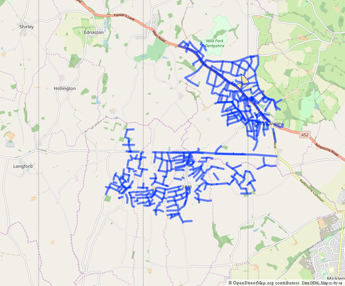
barrier=stile[2] - Over 120 kms of linear farmland barriers (hedges, fences, electric fences but excluding gates mapped as ways) [3]
- Just short of 25 km of new or altered rights of way with designations [4]. To put this in perspective Derbyshire has perhaps 5000 km of paths, so maybe 0.5%!
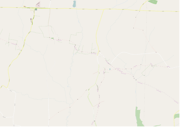
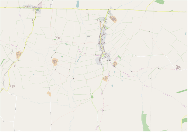
Comparison before & after maps using SomeoneElse's AJT version of Carto-CSS (scale 1:20k at 254 dpi):


