OpenGastroMap
|
OpenGastroMap (Discontinued) | |
|---|---|

| |
| Slippy map: | opengastromap |
| OpenGastroMap has been discontinued since February 2017 |
OpenGastroMap was a special map that showed all mapped restaurants, pubs and hotels. There used to be a traffic signal indicator for permitted or forbidden smoking. Green = no smoking, Yellow = separated rooms, red = smoking allowed.
Existing Maps
You can reach OpenGastroMap (Mozilla Firefox only)
- OpenGastroMap.de (neutral view, with cuisine info)
and via MapJumper
Note: There are some problems using this map with Google Chrome and Internet Explorer 7.
History
OpenGastroMap was created for the non-smoking initiative, as a result of which the citizens of Bavaria could vote in a referendum whether or not smoking should be allowed in bars and restaurants. The initiative, which comprised members of all parties, planned to create a map showing non-smoking bars and restaurants. It was planned to create this map with Google.
Some active OpenStreetMap members offered to implement this using the free OpenStreetMap.
Since requests for such maps are frequent, and in order to make implementation easier for non-programmers, the "political maps" project was created together with Wikimedia and Wikipedia. The aim was to create a tool for easy implementation of such applications. OpenGastroMap is intended as a prototype, which has much more to offer than to show where smoking is allowed and where it is not. Possible future uses include: showing contact information for each place in a popup, searching for a particular type of establishment (restaurant, bar, hotel, café etc.), searching by cuisine (Italien, Greek etc.), finding establishments with free Wi-Fi access, routing, adding new places etc. Some of these are already underway.
Hence the broader name "OpenGastroMap".
Map Images
OpenGastroMap.org is a worldwide map with edit functionality (screenshots from June, 30th 2010):
-
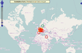 World
World -
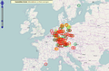 Europe
 -
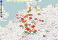 Austria, Germany, Switzerland
 -
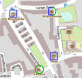
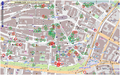 Altstadt Nürnberg (center of Nuremberg, Germany)


OpenGastroMap.de covers the area of Germany, Austria and Switzerland and displays a cuisine icon for each restaurant:
-
 smoking/non-smoking
 -
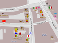 cuisine as icon
 -
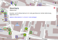 popup with restaurant infos


Legend
Marker
OpenGastroMap.orgMarker
OpenGastroMap.deMeaning Tags (political view "Smoking ban") (neutral view)  red
red
 blue square
smoking allowed everywhere or in a dedicated area without an effective separation smoking=separated,smoking_hours=*,smoking=yes,smoking=dedicated yellow
 square/circle
smoking allowed in an effectively separated room smoking=isolated green
green
 green circle
no smoking smoking=no blue
blue
 small circle
this restaurant is not mapped with the smoking tag no smoking=*
Editor

Blue circles indicate unmapped amenities.
These can be tagged by the user easily:
- center on blue circle
- go to maximum zoom level
now a pink pencil appears - click the pencil
now an editing window pops up - Use the dropdown list and choose the correct option (German)
- accept the license and you have added the information.
After a few days the change will be visible in the map.
Hilfe zum Bearbeiten der Karte (mit Bildern)
In the Mass Media
- 30.06.2010 - Nürnberger Zeitung: Übersicht zu Raucherlokalen
- 01.07.2010 - Heise: Raucher- und Nichtraucherlokale in OpenStreetMap
- 02.07.2010 - Nürnberger Nachrichten: Raucher-Landkarte im Internet - Lokale mit und ohne blauen Dunst im Ampelsystem
Create your own Map
In case you want to create your own GastroMap or use it as a template for a new specialized map, please have a look at the OpenGastroMap.de installation page.