Proposal:DisputedTerritories
| DisputedTerritories | |
|---|---|
| Proposal status: | Abandoned (inactive) |
| Proposed by: | Dkiselev |
| Tagging: | boundary_disputed=level
|
| Statistics: |
|
| Rendered as: | see rendering part |
| Draft started: | |
| Proposed on: | 2015-03-30 |
See also
Proposed features/Mapping disputed boundaries
Rationale
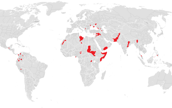
According to wikipedia, we have 17 states with limited recognition https://en.wikipedia.org/wiki/List_of_states_with_limited_recognition Also there are lots of territorial disputes among UN recognizeable states.
We don't have a way to map territorial disputes, we don't have any guidelines to solve territorial disputes among mappers neither. This situation cause a tons of pain in mailing-lists and forum, provoke wars of edits and lots of fuss and recriminations.
Some of these territories have special entry rules, so it would be nice to see a special status of territory. So every traveller could, at least, get an alert that territory have a special visiting rules. Also it gives us ability to build routes, which avoids such territories, as long as destination point is outside of such territory. Also ability to map controversies will channelize mappers' hatred into mapping instead of battling each other in comments.
Mapping
boundary_disputed=*for ways and relations. Where * is a level of territory if dispute will be solved.- Use roles disputed_exclude/disputed_include for existed state boundaries relations.
For example, if territory claims independant country status, tag it as boundary_disputed=2 and if territory claimed as a province of other country, tag it as boundary_disputed=4 or use any other appropriate boundary level which will be assigned to territory if it became a part of other state.
After polygon of area have been formed include them into state boundary administrative relation with roles from list below to specify how this territory should be included/excluded from curent version of state borders.
| Role | Description |
|---|---|
| disputed_exclude | If dispute is solved, referenced territory will be excluded from current state boundary relation. |
| disputed_include | If dispute is solved, referenced territory will be included to current state boundary relation. |
Mapping of Current State and de-facto control among territories
As I think, there are too many types of control types over territories, puppet-government, military control, UN-controll, occupation, rebels support and so on. I don't think it could be encoded via tags. Use description and description:CC to specify details.
If, you feel cappabale to invent a tag system for such purposes, edit this page.
Guidelines
Additional tags
| Tag | Value | Description |
|---|---|---|
| visit_mode:CC | exclusive | Some territories may be accesed only thrue territory of other country (e.g. North Cyprus may be accesed only through Turkey). Use this combination for such cases. |
| visit_mode:CC | strict_in_out | Another common visit mode is then you should enter and leave territory thrue one country. Use this combination for such cases. |
| visit_mode:CC | regular | For case, when there are no special visiting rules are applied. You could anter and leave with regular border crossing procedures. |
| visit_mode:CC | restricted | Some special rules are applied, check gov. regulations |
| visit_mode:CC | prohibited | You couldn't coross border between this territory and specified country. |
| visit_mode:CC | free | There is no border control between specified country and this territory. |
| Tag | Value | Description |
|---|---|---|
| recognition:CC | yes | Use yes to specify that CC country have recognized this territory. |
| recognition:CC | no | Use no if country doesn't accept existence of such territory. |
| recognition:CC | partial | Use partial if country accepted existance of such territory but states illegitimacy of territory. |
(Where CC is ISO 3166-1 alpha 2 country code).
Examples
Northern Cyprus
Map Northen Cyprus boundary relation as
And add them under disputed_exclude role to Republic of Cyprus boundary relation.
Visiting regulations
Recognition
recognition:tr=yesrecognition:cy=no- Default value is no so it's unnecessary to add all other countries unleast they doesn't states specific notes about recognition of this territory
Donetsk/Lughansk Peoples Republic claims to become independant country
Relations for these territories should be mapepd as relation with
type=disputed_boundarydisputed_boundary=2(use lvl 2 because these territories claims to become a new state)
Add them under disputed_exclude role to Ukraine state boundary relation.
Since Russia supports this terriotories, Russia doesn't claim this territories to become a part of Russia, so they shouldn't be included into Russia state boundary relation.
Add recognition:ru=partial
If there is new boundaries ways will be created, map them as disputed_boundary=2
For now, border is under military forces control, so add border_control=military for border way.
Add the following tags to spicify visiting rules:
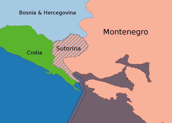
Bosnia&Hercegovina dispute for Montenegrins owned Sutorina territory
Soutirna relation should be mapped using relation type=disputed_boundary, disputed_boundary=6 and included into Montenegro boundary relation in role disputed_exclude and into Bosnia&Hercegovina with role disputed_include.
Newly creted boundary line should be mapped as disputed_boundary=6
Threre is no any restrictions for visitors, so there is no visit_mode tags needed but you can add visit_mode=free if you want.
Rendering
For political maps, it may looks like hatching in colors of countries who claims rights on this territory.

