Proposal:Park boundary/Case studies
(Redirected from Proposed features/Park boundary/Warwick case study)
Warwick, Rhode Island, USA Case Study
This case study examines two very similar parks in the city of Warwick, Rhode Island, USA![]() Warwick, Rhode Island, USA. It is intended to demonstrate the existence of this class of park as well as show that there is often no distinction between state and city parks:
Warwick, Rhode Island, USA. It is intended to demonstrate the existence of this class of park as well as show that there is often no distinction between state and city parks:
- Warwick City Park
 Warwick City Park, a local, partially-wooded mixed-use park.
 - Goddard State Park Goddard State Park, a partially-wooded mixed-use state park
Map Comparison
| Warwick City Park: 11739119 |
Tagging notes |
|---|---|
 |
|
| Goddard State Park: 11582427 |
Tagging notes |
|---|---|
 |
|
Warwick City Park Photo Gallery
These photos of Warwick City Park demonstrate the mixed-use character of this park. Note that the photos are geotagged, and contain the exact location in the park where the photos were taken.
-
 Entrance sign
 -
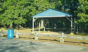
 Gazebo and historical Marker
 -
 Parking aign
 -
 Manicured area
 -
 Wooded track road
 -
 Wild, natural wooded areas
 -
 Foot path
 -
 Open field
 -
 WDog park within the park
 -
 Soccer fields
 -
 Picnic area
 -
 Interpretive sign
 -
 Nature trail entrance
 -
 Playground at the beach


Oakland, California, USA Case Study
| Lakeside Park: 224771927 |
Tagging notes |
|---|---|
 |
This tag combination is a standard convention method for tagging mixed-use parks, however:
|