RawEditor
Jump to navigation
Jump to search
| this project is abandoned, only the wiki page and the git still exist |
| RawEditor | ||||||||||||||||||||||||||||||||||||||||||||
|---|---|---|---|---|---|---|---|---|---|---|---|---|---|---|---|---|---|---|---|---|---|---|---|---|---|---|---|---|---|---|---|---|---|---|---|---|---|---|---|---|---|---|---|---|
| License: | GNU GPL | |||||||||||||||||||||||||||||||||||||||||||
| Platform: | Web | |||||||||||||||||||||||||||||||||||||||||||
| Status: | Broken | |||||||||||||||||||||||||||||||||||||||||||
| Language: | English
| |||||||||||||||||||||||||||||||||||||||||||
| Website: | ||||||||||||||||||||||||||||||||||||||||||||
| Source code: | https://github.com/osm-fr/rawedit | |||||||||||||||||||||||||||||||||||||||||||
| Programming language: | Python | |||||||||||||||||||||||||||||||||||||||||||
|
Webfrontend to edit OSM XML directly | ||||||||||||||||||||||||||||||||||||||||||||
| ||||||||||||||||||||||||||||||||||||||||||||
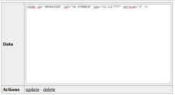
Raw edit is an Openstreetmap HTML based editor hosted on the french openstreetmap server: http://rawedit.openstreetmap.fr/.
You use it by creating/updating XML, all done in a HTML form, here are the URLs:
- http://rawedit.openstreetmap.fr/edit/node/####
- http://rawedit.openstreetmap.fr/edit/node/create
- http://rawedit.openstreetmap.fr/edit/way/####
- http://rawedit.openstreetmap.fr/edit/way/create
- http://rawedit.openstreetmap.fr/edit/relation/####
- http://rawedit.openstreetmap.fr/edit/relation/create
- http://rawedit.openstreetmap.fr/edit/changeset/####
It is written in Python, source code is on github.
There is also a simple HTML interface to RawEdit: http://osmz.ru/rawedit/
Warnings
- Before performing any query, you must first create a changeset using "http://rawedit.openstreetmap.fr/edit/changeset/create".
- It will first request an authentication with your OSM user id using the OAuth protocol (you need to create an OSM account on the OSM website if you still don't have one).
- The OAuth authentication is then kept by your web browser in resident cookies (associated to the "rawedit.openstreetmap.fr" domain name).
- The last changeset id created is also kept using session cookies, that must be transmitted along with the authentication cookie with your following queries.
- That changeset will remain open for you on the data OSM server for a limited time, as long as you continue using it and it will expire after typically one hour.
- If your session is expired or if you don't transmit the session cookies, the data submission queries will return errors and you'll need to recreate another changeset.
- In standard XML, some ASCII-only characters have a special meaning: this is not a bug. If you'd like to use them in your text, please enter them as XML entities, notably within attribute values, e.g.:
- & as &
- < as <
- > as >
- " as " (needed in attribute values surrounded by double quotes)
- ' as ' (needed in attribute values surrounded by single quotes)
- All other named character entities (such as entities defined by HTML) not predefined by the XML standard are not recognized.
- You may however use numerical character references for characters based on their Unicode code point value (in decimal or hexadecimal).
- But you should not reference C0 and C1 controls: tabulations may be used but should be avoided and replaced by single spaces; as well as C0 and C1 newline controls (CR and/or LF, VT, FF, PS) should be converted to ASCII spaces.
- Almost all other Unicode characters (in the BMP or not) may be used, with the exception of (low or high) surrogate code points and non-characters (such as U+FFFF); private-use characters (in the BMP or in the last two supplementary planes U+F000..U+10FFF) should also be avoided in OSM data as they are not interoperable.
- Only elements defined in the core XML schema for OpenStreetMap data are recognized:
node,wayandrelation(and their subelements for tags and members).- XML declaration headers and embedded DTD and are not supported and will cause parsing errors.
- The XML data must be entered using the UTF-8 charset. No transcoding from other charsets are supported. Entering raw data composed from other encodings (such as ISO 8859-1 or Windows 1252) will either cause errors or will pollute the database with invalid/unredable Unicode text.
Bugs
- http://rawedit.openstreetmap.fr/edit/changeset/create doesn't seem to work. It says that it is created but won't close the old changeset and use the new one instead
- You may be able to upload the same data multiple times. Please be patient after requesting an update. Updating large datasets may take some time.
