Routing/Travel Time Analysis/MatchGPX2OSM
About
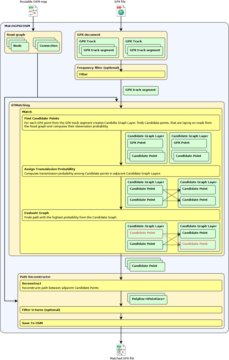
MatchGPX2OSM utility matches GPX track logs to the map. It is using STMatching algorithm.
Usage
 matchgpx2osm [OPTIONS]+
 Options:
       --osm=VALUE        path to the routable map file (required)
       --gpx=VALUE        path to the GPX file to process or to the directory to process (required)
   -o, --output=VALUE     path to the output directory
   -p, --period=VALUE     sampling period of the GPX file (in seconds)
   -f, --filter           enables output post processing
   -h, -?, --help
--gpx parameter can be either path to the single GPX file or path to the directory – in that case, all GPX files in the directory are processed.
--output parameter defines output path. Default value is ‘.’ which means the current working directory. An output file is created for every GPS track segment. Output of the application is the OSM file that represents a GPX track log "snaped" to the map. Naming conversion is gpxFilename_[trackName|trackIndex]_segmentIndex.osm
--period parameter sets minimal sampling period of the GPS track log. It can be used to reduce sampling period of the GPS track log. GPS track logs with higher sampling period are processed faster and sometimes even more precisely.
--filter parameter enables matched track post processing. Post processing removes short U-turns that can occur when processing logs with worse accuracy or in the places, where a GPS unit wasn’t moving (points from the log oscillates around center position and it makes result path going back and forth).
MatchGPX2OSM reguires .NET framework runtime or MONO runtime installed on the computer.
Samples
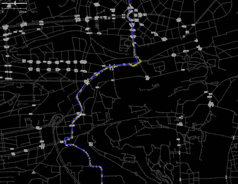
(blue line - GPS log, gray line with yellow squares - matched track)
Details
In depth description of the STMatching algorithm can be found in the article Map-Matching for Low-Sampling-Rate GPS Trajectories

