Uploads by LA2
Jump to navigation
Jump to search
This special page shows all uploaded files.
| Date | Name | Thumbnail | Size | Description | Versions |
|---|---|---|---|---|---|
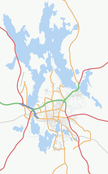
| 23:40, 10 March 2008 | Helgasjon.png (file) |  |
25 KB | Screenshot of Osmarender layer at zoom=11, showing city Växjö in Sweden and the lake Helgasjön, [http://informationfreeway.org/?lat=56.91318611658695&lon=14.80050307075305&zoom=11&layers=B000F000F link]. | 1 |
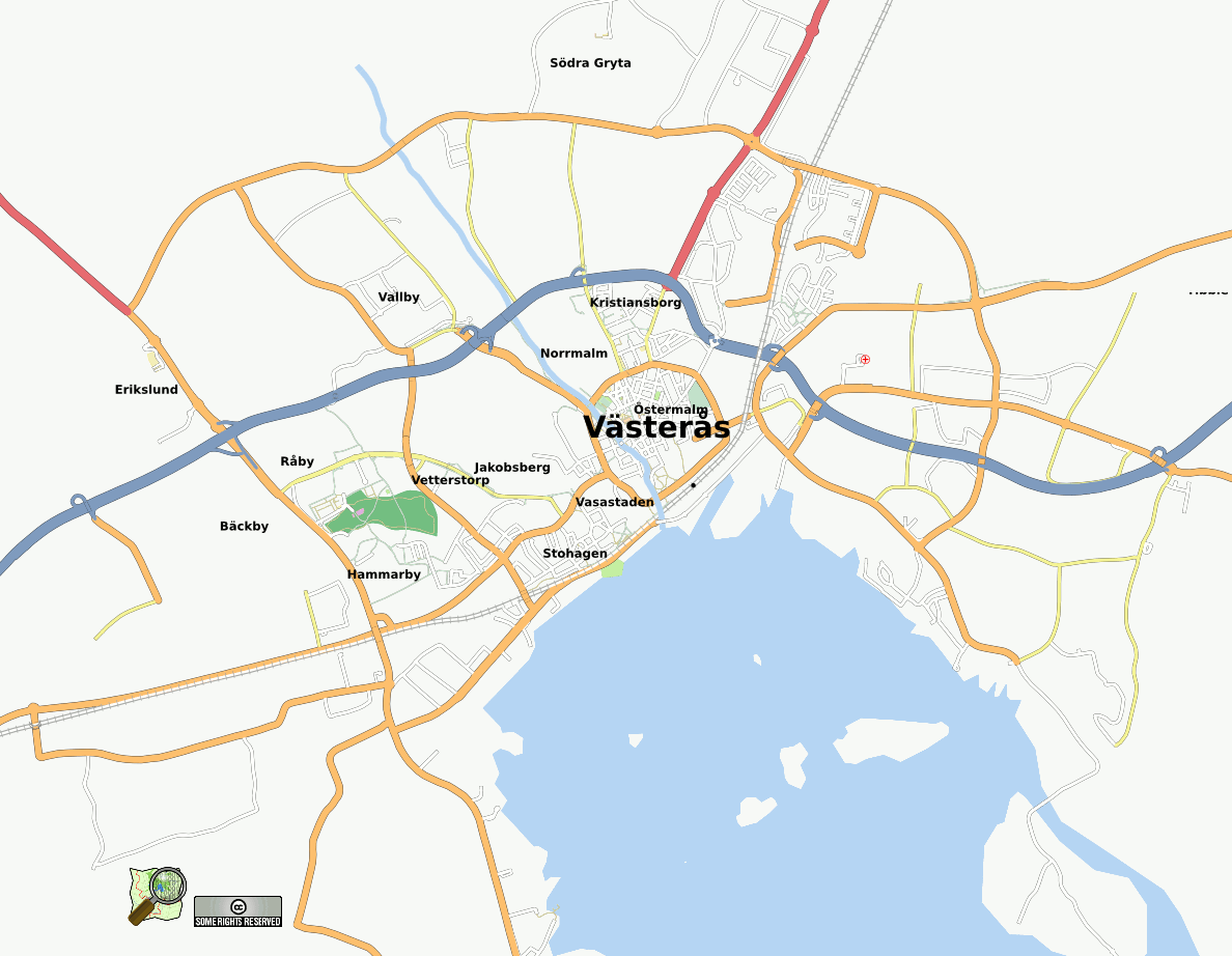
| 04:45, 17 October 2007 | LA2-20071017-Vasteras.png (file) |  |
97 KB | Screenshot on October 17, 2007, of www.informationfreeway.org (zoom 13) over Västerås in Sweden a few days after the mapping weekend. | 1 |
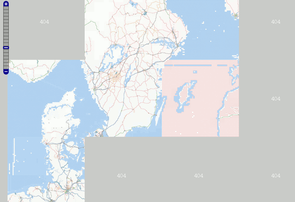
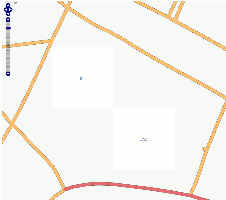
| 11:41, 21 May 2007 | LA2-tah-404.png (file) |  |
66 KB | Screenshot showing the Osmarender layer from tiles@home on May 21, 2007, including "blue dots" (404 at sea), "red dots" (Database unavailable) and large grey 404 tiles for areas that have not been rendered since the new disk (hdd1) was installed for t | 1 |
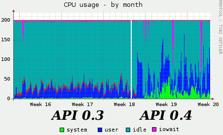
| 22:00, 17 May 2007 | LA2-API-0.4-cpu.png (file) |  |
7 KB | Two weeks after the "Rails port" (OSM API 0.4) was launched on Saturday May 5, CPU overload on www.openstreetmap.org has not yet come down to the earlier cool levels. [http://munin.openstreetmap.org/openstreetmap/www.openstreetmap-cpu.html Monthly CPU usa | 1 |
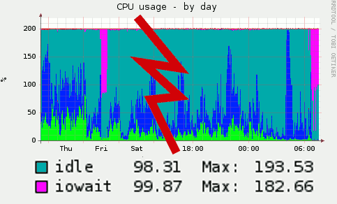
| 07:08, 16 May 2007 | LA2-iowait-20070516.png (file) |  |
10 KB | Screendump of Munin graph for the CPU usage on www.openstreetmap.org, indicating high levels of iowait on Friday May 11 and Wednesday May 16, 2007. This is a montage of the week and day graphs. | 1 |
| 13:17, 13 May 2007 | LA2-404-city.png (file) |  |
13 KB | Screenshot showing the new "404" tiles in tiles@home. Zoom down into any city block, and they show up. How nice is that? | 1 |
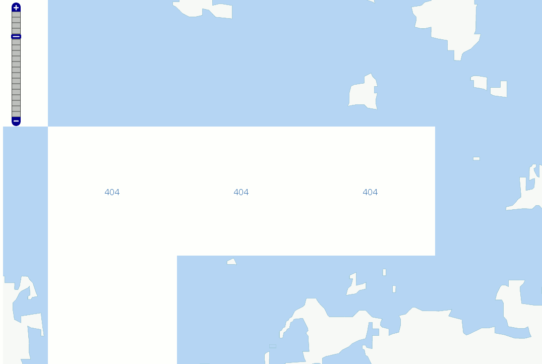
| 13:06, 13 May 2007 | LA2-404.png (file) |  |
7 KB | Screen dump showing the new "404" tiles of tiles@home | 1 |
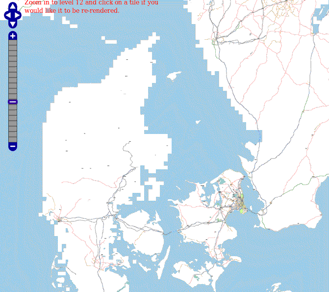
| 08:03, 9 May 2007 | LA2-pixelcoast.png (file) | 59 KB | Screenshot of the map of Denmark at zoom=6 showing the Osmarender layer, generated by tiles@home. This picture shows the state of importing and fixing up coastlines. Denmark's islands Funen (Fyn) and Sealand (Sjælland) an | 1 | |
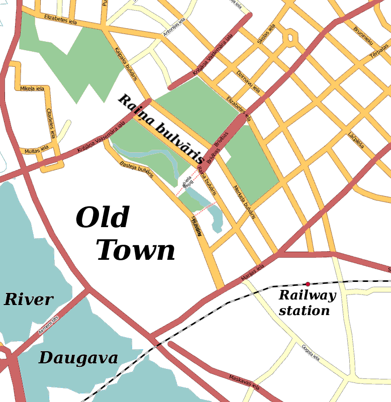
| 18:51, 4 May 2007 | Riga-linux-16.png (file) |  |
41 KB | Map of downtown Riga, Latvia, indicating the street Raiņa bulvāris where the Linux Center is located. Based on the Mapnik rendering of OpenStreetMap. | 1 |
| 13:44, 20 April 2007 | LA2-streets-of-gold.png (file) |  |
59 KB | "City with streets of gold". Screenshot of the Osmarender layer (tiles@home) of Saint Petersburg, Russia, on April 20, 2007, after all line segments had automatically been converted to highway=secondary (yellow) roads, and before these had been converted | 1 |
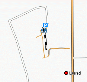
| 00:10, 18 April 2007 | LA2-taget.png (file) |  |
28 KB | Screenshot of the Osmarender layer (from tiles@home), showing a detail of Lund, Sweden. | 1 |
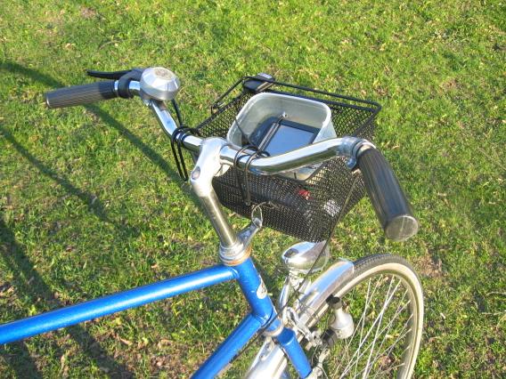
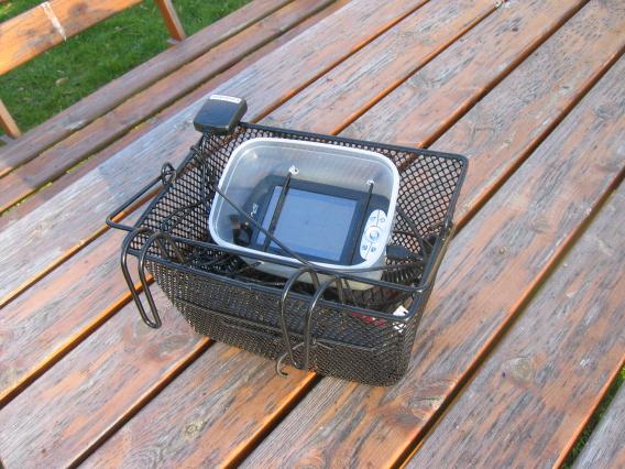
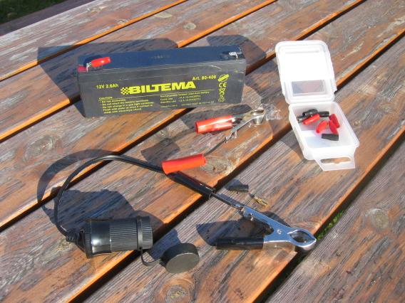
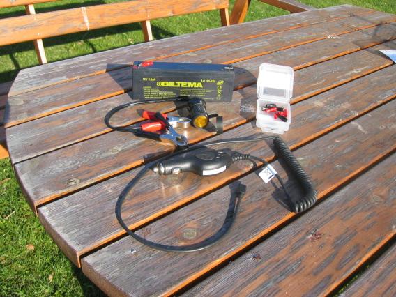
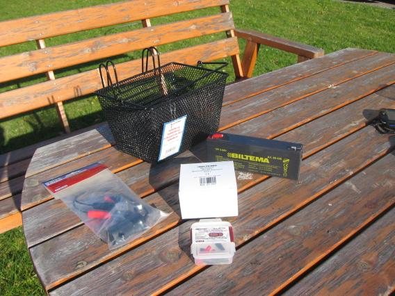
| 23:13, 16 April 2007 | LA2-bikebasket-9.jpg (file) |  |
80 KB | Bike-mounted PDA/GPS, picture 9 of 9, as described by user:LA2. This photo (C) by Lars Aronsson, April 16, 2007, may be used according to the Creative Commons Share-Alike license. {{cc-sa}} | 1 |
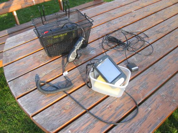
| 23:13, 16 April 2007 | LA2-bikebasket-8.jpg (file) |  |
55 KB | Bike-mounted PDA/GPS, picture 8 of 9, as described by user:LA2. This photo (C) by Lars Aronsson, April 16, 2007, may be used according to the Creative Commons Share-Alike license. {{cc-sa}} | 1 |
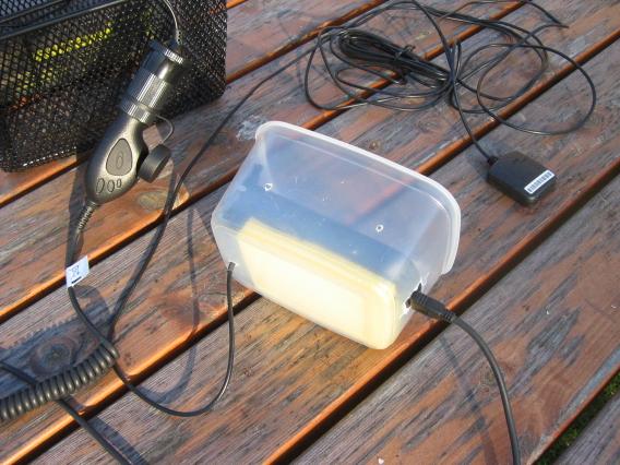
| 23:12, 16 April 2007 | LA2-bikebasket-7.jpg (file) |  |
58 KB | Bike-mounted PDA/GPS, picture 7 of 9, as described by user:LA2. This photo (C) by Lars Aronsson, April 16, 2007, may be used according to the Creative Commons Share-Alike license. {{cc-sa}} | 1 |
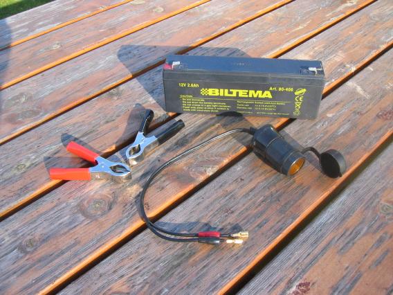
| 23:12, 16 April 2007 | LA2-bikebasket-6.jpg (file) |  |
51 KB | Bike-mounted PDA/GPS, picture 6 of 9, as described by user:LA2. This photo (C) by Lars Aronsson, April 16, 2007, may be used according to the Creative Commons Share-Alike license. {{cc-sa}} | 1 |
| 23:12, 16 April 2007 | LA2-bikebasket-5.jpg (file) |  |
62 KB | Bike-mounted PDA/GPS, picture 5 of 9, as described by user:LA2. This photo (C) by Lars Aronsson, April 16, 2007, may be used according to the Creative Commons Share-Alike license. {{cc-sa}} | 1 |
| 23:12, 16 April 2007 | LA2-bikebasket-4.jpg (file) |  |
53 KB | Bike-mounted PDA/GPS, picture 4 of 9, as described by user:LA2. This photo (C) by Lars Aronsson, April 16, 2007, may be used according to the Creative Commons Share-Alike license. {{cc-sa}} | 1 |
| 23:12, 16 April 2007 | LA2-bikebasket-3.jpg (file) |  |
53 KB | Bike-mounted PDA/GPS, picture 3 of 9, as described by user:LA2. This photo (C) by Lars Aronsson, April 16, 2007, may be used according to the Creative Commons Share-Alike license. {{cc-sa}} | 1 |
| 23:11, 16 April 2007 | LA2-bikebasket-2.jpg (file) |  |
56 KB | Bike-mounted PDA/GPS, picture 2 of 9, as described by user:LA2. This photo (C) by Lars Aronsson, April 16, 2007, may be used according to the Creative Commons Share-Alike license. {{cc-sa}} | 1 |
| 23:11, 16 April 2007 | LA2-bikebasket-1.jpg (file) |  |
53 KB | Bike-mounted PDA/GPS, picture 1 of 9, as described by user:LA2. This photo (C) by Lars Aronsson, April 16, 2007, may be used according to the Creative Commons Share-Alike license. {{cc-sa}} | 1 |
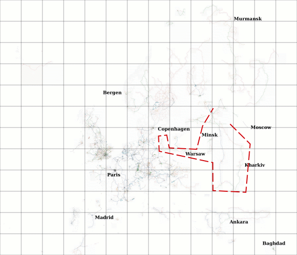
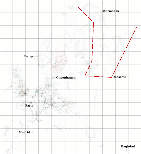
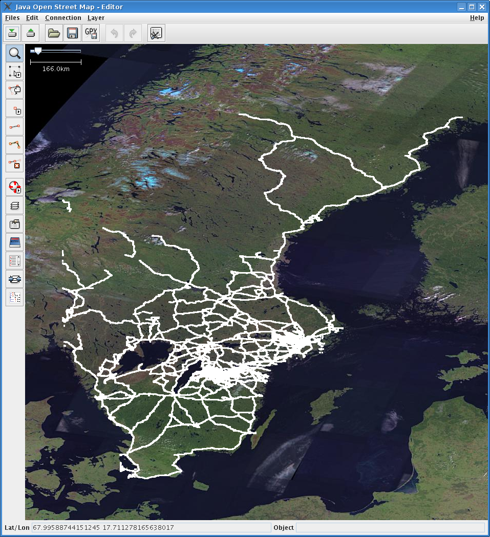
| 08:18, 11 April 2007 | LA2-Europe-20070411-Ukraine.png (file) |  |
72 KB | Open Street Map of Europe, based on zoom=6 Osmarender Tiles@home, as of April 11, 2007 (planet.osm), scaled down to 1/6 of original size. Grid shows zoom=6 tiles. Red zone marks the Ukraine, Belarus, parts of Poland and southern Russia drawn by [ | 1 |
| 05:59, 4 April 2007 | LA2-Europe-20070404-Russia.png (file) |  |
62 KB | Open Street Map of Europe, based on zoom=6 Osmarender Tiles@home, as of April 4, 2007 (planet.osm), scaled down to 1/6 of original size. Grid shows zoom=6 tiles. Red zone marks parts of Russia drawn by user:LA2 in last two weeks. | 1 |
| 02:54, 26 March 2007 | LA2-slippy-duplicate.png (file) |  |
50 KB | Screen shot of a bug in the display of the slippy map, either in JavaScript OpenLayers or in Firefox 2.0.0.2: At random places and times, the wrong tiles turn up. | 1 |
| 07:58, 31 October 2006 | Vaxjo-200610.png (file) |  |
283 KB | Screenshot of OpenStreetMap's "slippy map" showing Växjö in Sweden as of October 2006, after the mapping weekeind. | 1 |
| 04:19, 29 October 2006 | Savsjo-200610.png (file) |  |
157 KB | Screenshot of OpenStreetMap's "slippy map" showing Sävsjö in Sweden in October 2006. | 1 |
| 08:22, 20 October 2006 | JOSM-Svealand-20061020.png (file) |  |
1.32 MB | Screenshot (by user TeLLuS) of JOSM showing roads in south central Sweden as of October 20, 2006. | 1 |
| 08:19, 20 October 2006 | JOSM-Sweden-20061020.png (file) |  |
1.17 MB | Screenshot (by user TeLLuS) of JOSM showing roads in Sweden as of October 20, 2006. | 1 |
| 09:54, 18 October 2006 | Stockholm-20060916.png (file) |  |
296 KB | Jonas Svensson's Osmarendering of Stockholm of 16 Sept 2006, flattened and color-enhanced in Gimp by LA2. | 1 |
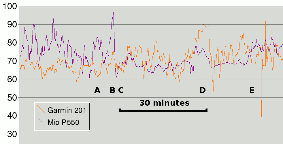
| 17:34, 28 September 2006 | 20060928-altitude.png (file) |  |
11 KB | Altitude calibration of two GPS receivers | 1 |
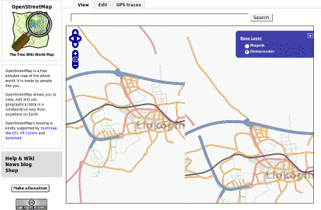
| 11:32, 27 September 2006 | 20060927-missingtile.png (file) |  |
294 KB | Screenshot of the "slippy map" showing Linköping with streets missing on one tile. | 1 |
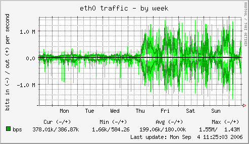
| 10:49, 4 September 2006 | 20060831-tile-eth0-week.png (file) |  |
10 KB | OSM server diagram from magic Thursday August 31, 2006. Network throughput on eht0 on the tile server. Week view. | 1 |
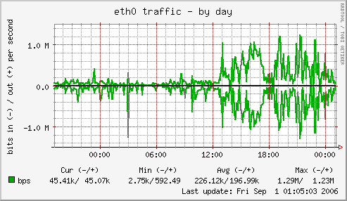
| 10:49, 4 September 2006 | 20060831-tile-eth0-day.png (file) |  |
8 KB | OSM server diagram from magic Thursday August 31, 2006. Network throughput on eht0 on the tile server. Day view. | 1 |
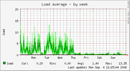
| 10:49, 4 September 2006 | 20060831-db-load-week.png (file) |  |
6 KB | OSM server diagram from magic Thursday August 31, 2006. Load average on the db server. Week view. | 1 |
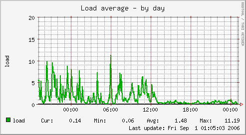
| 10:48, 4 September 2006 | 20060831-db-load-day.png (file) |  |
5 KB | OSM server diagram from magic Thursday August 31, 2006. Load average on the db server. | 1 |
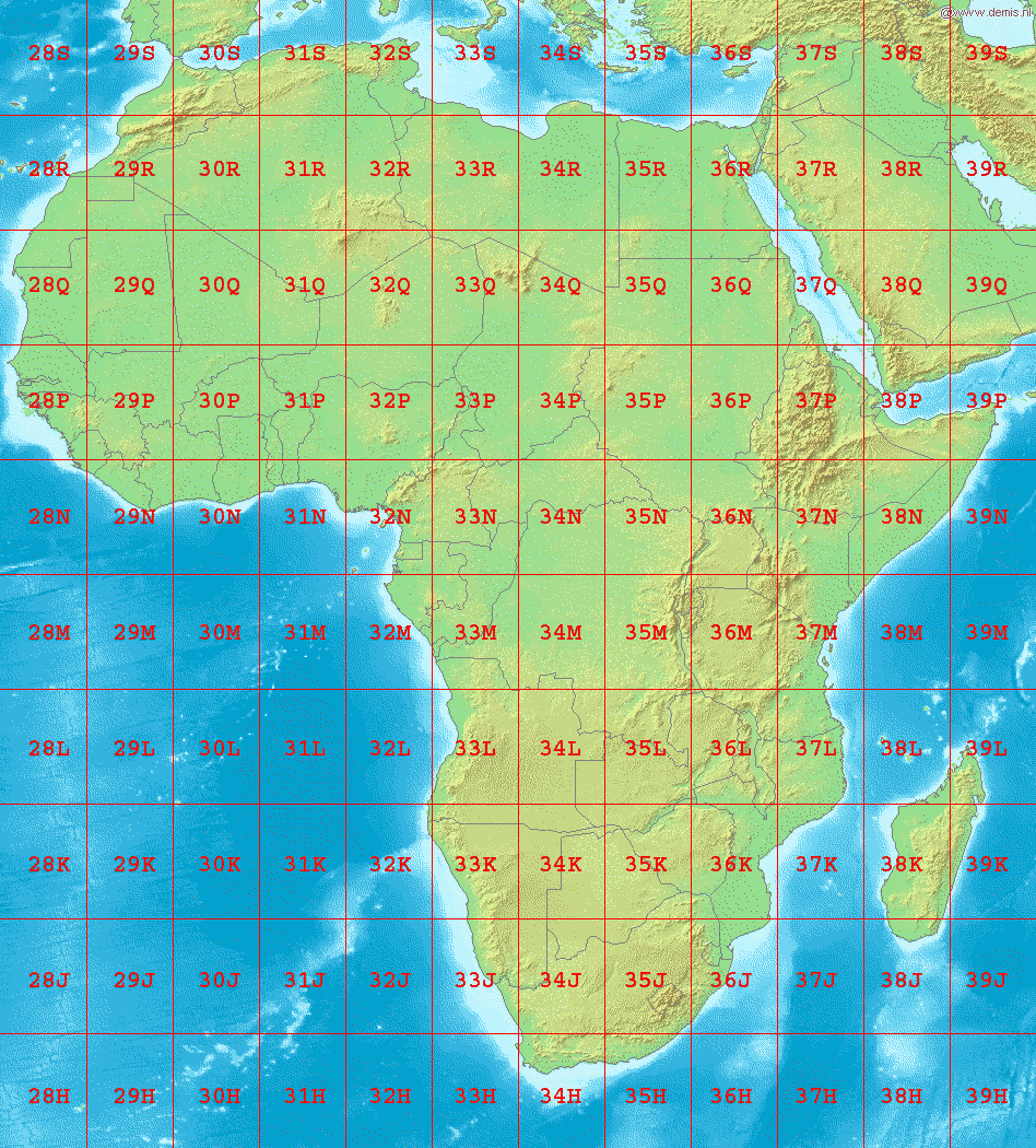
| 02:23, 3 September 2006 | LA2-Africa-UTM-zones.png (file) |  |
225 KB | Map of Africa, showing the latitude and longitude zones of the [http://en.wikipedia.org/wiki/Universal_Transverse_Mercator_coordinate_system Universal Transverse Mercator coordinate system], from 28H to 39S. Bounding box West -18°, South -40°, East 54� | 1 |
| 15:28, 27 August 2006 | Broken-Uddevalla.png (file) |  |
375 KB | Screenshot of the utterly broken "slippy map" on August 27, 2006, trying to show Uddevalla, Sweden, but streets are missing from many tiles in the town center and on two tiles to the left, the background satellite images are also missing. | 1 |
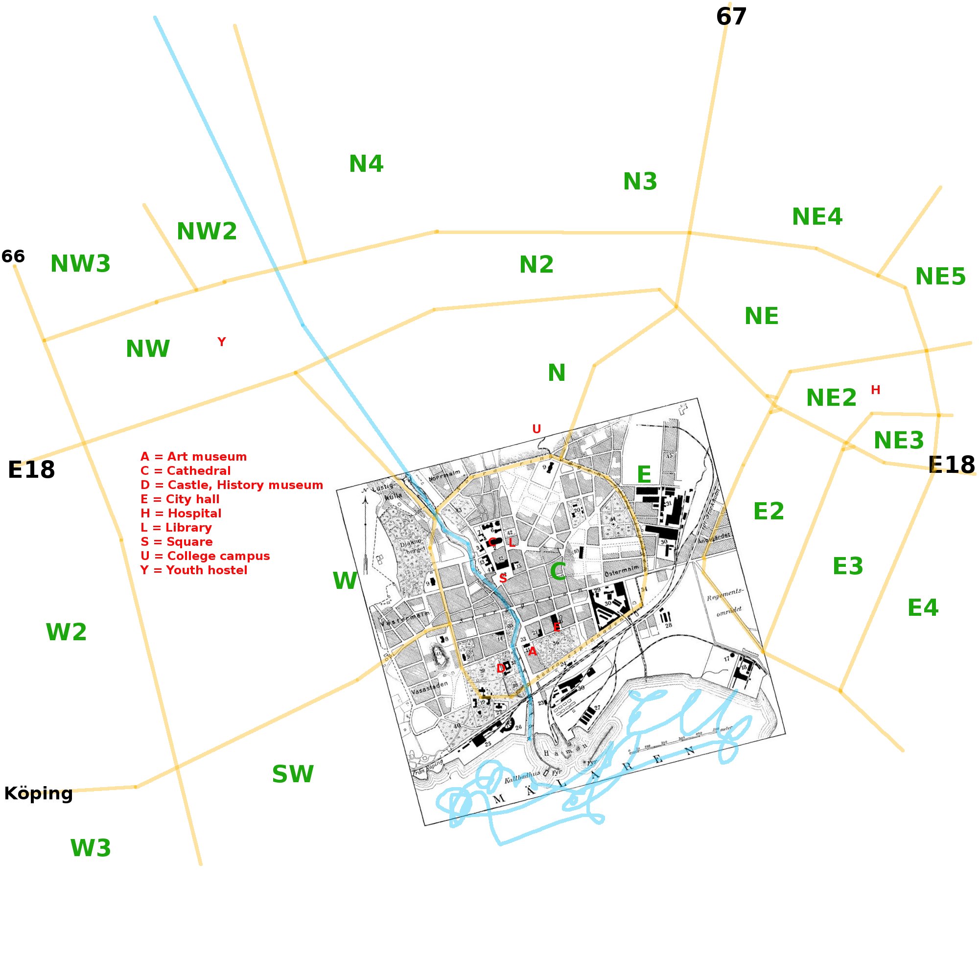
| 03:59, 26 August 2006 | Vasteras.jpg (file) |  |
379 KB | Rough planning map of Västerås, Sweden. Based in part on a city map from the out-of-copyright encyclopedia ''Nordisk familjebok'' (1922). Major streets are marked in yellow, dividing the city into sectors, marked with green letters. Some points of inter | 1 |
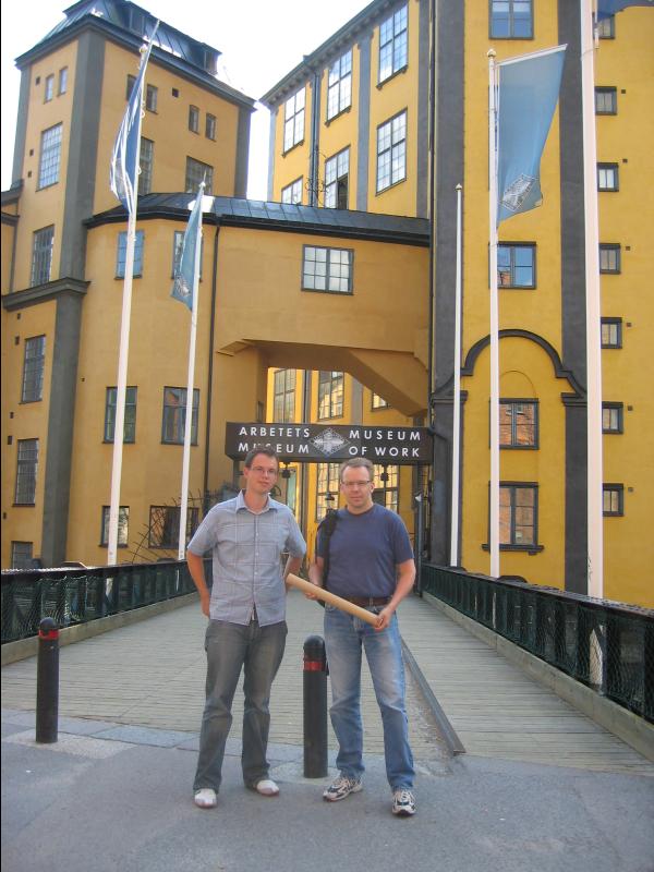
| 20:29, 11 August 2006 | Eriso-la2.jpg (file) |  |
76 KB | user:Eriso and user:LA2 at Museum of Labour in Norrköping, August 2006. | 1 |
| 22:21, 21 July 2006 | Osm-200607-rossia.png (file) |  |
14 KB | OpenStreetMap of Russia (Murmansk, Sankt Peterburg, Pskov, Novgorod) based on the planet.osm dump from July 2006. | 1 |
| 17:45, 11 July 2006 | Osm-200607-peterburg.png (file) |  |
310 KB | en:OpenStreetMap screenshot of map of en:Saint Petersburg, from http://www.openstreetmap.org/index.html?lat=59.949&lon=30.304&zoom=11 | 1 |
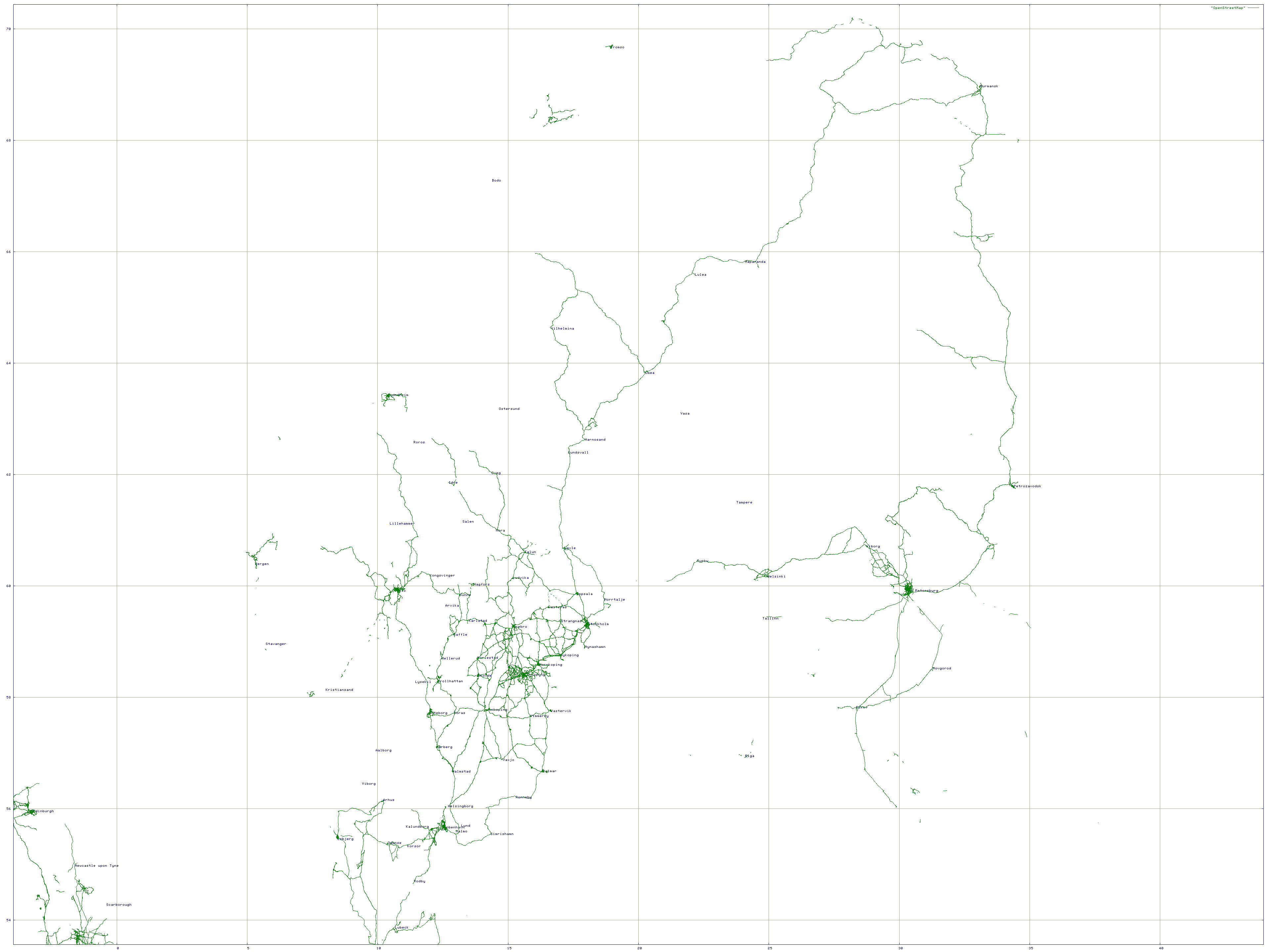
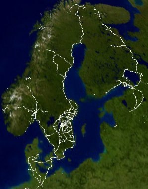
| 21:44, 3 July 2006 | Norden-200607.png (file) |  |
136 KB | Gnuplot of Scandinavia based on the July 2006 planet.osm dump of OpenStreetMap. | 2 |
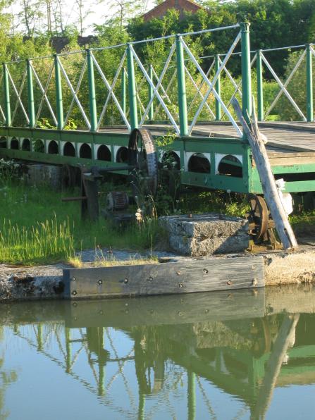
| 18:18, 15 June 2006 | LA2-canal-crank.jpg (file) |  |
60 KB | Göta Kanal (built 1815) in Östergötland, Sweden, and a rolling bridge near Ljung castle. This bridge on a private road is hand cranked and yields to the canal. Bridges on public roads are electrified. This photo (C) by Lars Aronsson, June 2006, may be | 1 |
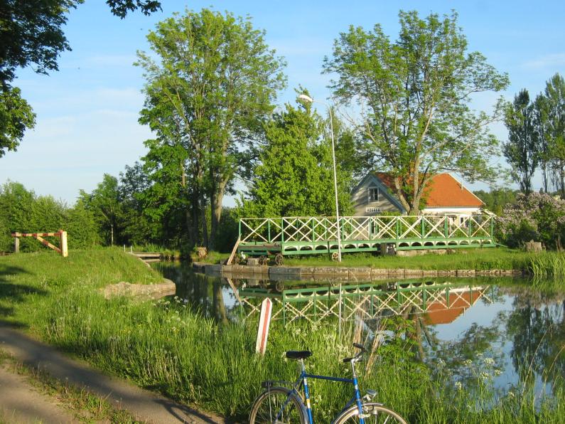
| 18:13, 15 June 2006 | LA2-canal-bridge.jpg (file) |  |
130 KB | Göta Kanal (built 1815) in Östergötland, Sweden, and a rolling bridge near Ljung castle. This photo (C) by Lars Aronsson, June 2006, may be used according to the Creative Commons Share-Alike license. | 1 |
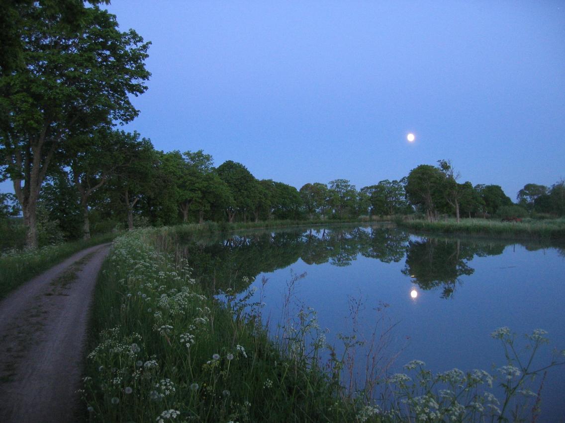
| 18:04, 15 June 2006 | LA2-canal-moon.jpg (file) |  |
119 KB | Göta Kanal (built 1815) in Östergötland, Sweden, and accompanying bikepath and line of trees. This photo (C) by Lars Aronsson, June 2006, may be used according to the Creative Commons Share-Alike license. | 1 |
| 00:50, 4 June 2006 | LA2-blagulskylt.jpg (file) |  |
45 KB | Swedish countryside: '''Blue roadsigns''' indicate destinations and kilometre distances on '''primary''' (riksväg, länsväg) and '''secondary''' (allmän väg) public roads, '''yellow roadsigns''' indicate destinations '''minor''' and private roads (pri | 1 |
| 18:30, 24 May 2006 | Gnuplot-acroread.png (file) |  |
49 KB | Screenshot of acroread, viewing the resulting PDF file from the example area in Print OpenStreetMap with Gnuplot. | 1 |
| 20:46, 12 April 2006 | Osm-planet-200604-Scandinavia.jpg (file) |  |
32 KB | Scandinavia cut out from Image:Osm-planet-1.jpg. | 1 |
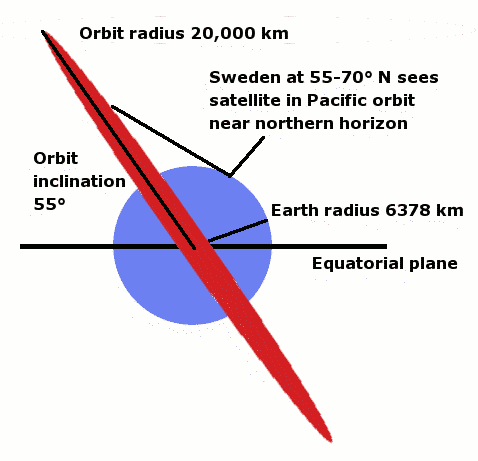
| 11:31, 27 February 2006 | Gps-orbit.png (file) |  |
8 KB | GPS orbit illustrated | 1 |
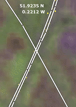
| 20:14, 25 February 2006 | Less-ugly-motorway.png (file) |  |
36 KB | Screenshot of the edit applet, showing a motorway (dual carriageway road) where nodes have been aligned in pairs, resulting in parallel line segments. | 1 |
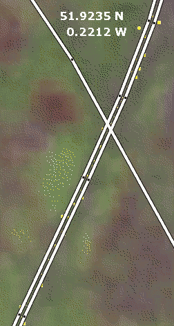
| 20:10, 25 February 2006 | Ugly-motorway.png (file) |  |
35 KB | Screenshot of the edit applet for a motorway (dual carriageway road) where nodes are not aligned, resulting in non-parallel line segments. | 1 |