Sr:WikiProjekt Srbija
| V・T・E |
| ширина: 44.241, лонгитуде: 20.907 граница: 17413111741311, ознака: 369137525369137525 |
| Browse map of Србија / Srbija |
| Edit map |
|
|
External links:
|
| Use this template for your city |
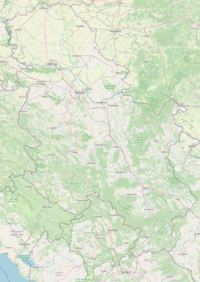
Србија / Srbija is a country in Европа at latitude 44°14′27.60″ North, longitude 20°54′25.20″ East.![]()
Need people to help on mapping Serbian cities!
Potrebni ljudi za mapiranje srpskih gradova!
Please register on this wiki page and enter your open street map wiki user name here if you are interested!
Molimo Vas registrujte se na ovoj wiki stranici i upisite Vaše korisničko ime ovde ako ste zainteresovani!
Takođe se možete prijaviti na lokalnu mailing listu: http://lists.openstreetmap.org/listinfo/talk-rs
Join the Facebook group here: https://www.facebook.com/groups/276811095803364
People involved
- (Please do not enter your email here, because of SPAM issues)
- User:Aleksblue Loznica i Banja Koviljača
- User:hakerche
- User:Zoltan_NS (Mapped most of what you can see in Vojvodina and Novi Sad at this moment)
- User:Данило (mapping Zemun)
- User:Rimtutituki (Dorćol, 25. maj, Novo groblje)
- User:Momcilo Kaludjerica
- User:homoludens Beograd
- User:LePiaf Novi Beograd, Blokovi
- User:Grecko Beograd
- User:Rade Sombor (with help of Pcmaniac mapped sombor, apatin, bezdan, backi monostor, now working on subotica)
- User:weazel Beograd
- User:Cirko Zlatibor, motorways, railways
- User:Pedja Užice, Zlatibor, Tara, Zlatiborski region, Zapadna Srbija
- User:Gorstak Zlatibor, Zlatiborski region, Zapadna Srbija
Current authors
Belgrade area (sorted by number of edits descending):
- Nikola Tasic
- J budissin
- Daryl Radivojevic
- Nils
- mapper_07 (could be bot)
- guenter
- rimtutituki (Тони Биочић)
- bonzo
- Jorg Ostertag
- Predrag
- katpatuka
- MichaelCollinson
- ivom
- Momcilo
- homoludens
ZAPADNOBACKI okrug (Sombor, Apatin, Kula, Odzaci, and rest of the vilages)
- Rade Brdar
- PCMANIAC
Novi Sad area (sorted by number of edits descending):
- Nils
- Ghogilee
- Djordje Obradovic
- mapper_07 (could be bot)
- Zdeno
I ask these users if they want to actively take part in Serbia mapping to register in the "People involved" section above.
Goals
For the first, our top priority goals are:
- upload GPS tracks so other users can map on them (if you don't want to take part in the mapping)
- map major roads and cities of Serbia
- founding the mapping guidelines for Serbia (e.g. what roads are what category, etc.)
Serbia objects to map
Please see here some examples with pictures of how we should map things (compatible with serbia):
Cities
- Beograd
- Novi Sad
- Niš
- Sombor
Roads
For help with classification, we can use this [3]. For OSM classification, see here [4]. For key usage, see here [5].
Motorways (Autoputevi)
For this we will use OSM highway=motorway class.
In Serbia, these roads are marked with A and also E (for international).
- A3 or E70
- A1 or E75
Use keys ref= for A reference, int_ref= for E reference and nat_ref= for A reference. Example, for A3 whould be:
 ref=A3
 nat_ref=A3
 int_ref=E70
Primary (Magistralni putevi)
For this we will use OSM highway=primary class.
Examples of these roads
- 21
- 22
... Use key ref= to mark these roads.
Secondary (Regionalni putevi)
For this we will use OSM highway=secondary class.
Examples of these roads
- 120
- 122
... Use key ref= to mark these roads.
Other
- Towns
- Villages
Example locations
Belgrade
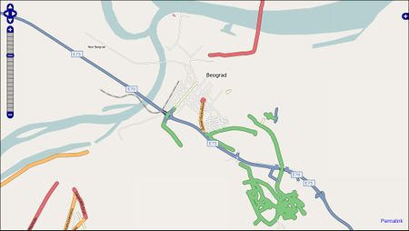
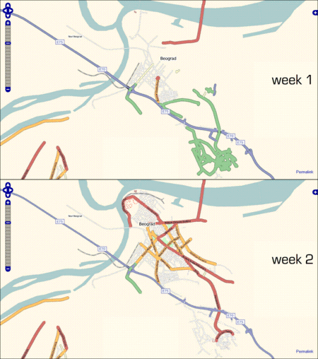
First week status from permalink http://www.openstreetmap.org/?lat=44.7977&lon=20.4669&zoom=13&layers=B0FT:
This is animated mapping of Belgrade (in weeks).
Novi Sad
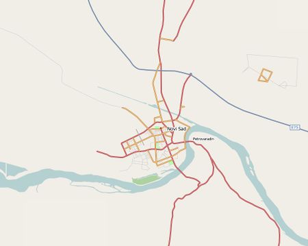
Novi Sad, after couple of months of mapping (browse map)
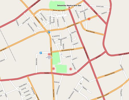
Novi Sad Down Town, after couple of months of mapping (browse map)
Pregled nepovezanih puteva u srbiji
Ovo su putevi za koje bot misli da nisu povezani. I uglavnom je upravu, ali ih moramo ručno povzati kako bi bilo koja aplikacija za traženje rute mogla da bude efikasna, pogledajte i rešavajte tamo gde znate:
http://tools.geofabrik.de/osmi/?view=routing&lon=20.94295&lat=44.14032&zoom=8&opacity=1.00
OpenStreetMap Forum
Join and discuss in our Forum! Pridružite se u forumu!
OpenStreetMap Forum Users:Serbia
Zračni snimci i tablice "offset" - Aerial Imagery and offset tables
Trenutno imamo na raspolaganje zračne snimke Orbview3 i Bing za upotrebu kao podloge za mapiranje Srbije. Molimo Vas da uvek kalibrirate "offset" zračnih snimaka poznatim GPS tačkama ili tragovima. Tablicu za već poznate ofsete možete naći dole.
Currently, Orbview3 and Bing imagery can be used for mapping Serbia. Please always remember to either GPS calibrate the maps you're using with known GPS traces or nodes in the are you are about to map. See also our offset tables.
Orbview3
- Glavna stranica o Orbview (sa pomoći oko JOSM itd.) gledaj ovde: OrbView-3
- Main Article on Orbview (with help on using with JOSM etc.) here: OrbView-3
Orbview3 pokrivenost je postala pored Binga drugi dobar izvor podloga za mapiranje. Za pokrivenost Orbview3 slikama gledaj ovde (hvala OSM-HR za urađen posao).
Orbview3 imagery is increasing on the Balcans. An overview of currently available coverage can be found here (thanks to OSM-HR for the groundwork on that)
Bing
Pokrivenost detaljnim Bing slikama možete naći ovde: Bing pokrivenost Srbije
Bing slike se direktno i standardno mogu ubaciti kao podloge u JOSM i Potlatchu. Ne zaboravite ofset!
Current Bing coverage can be found here: Bing Coverage for Serbia
Bing is directly available as a background in JOSM and Potlatch. Don't forget the offset!
Tablica poznatog ofseta zračnih snimaka / Offset table for known locations
| Mesto / Location | Ofset x,y | Izvor / source |
|---|---|---|
| Zlatibor | -6.28; -18.85 | Orbview3 po GPS traci E763 (user:cirko after user:grecko; JOSM mercator offset) |
| Crvena crkva | -2.17; 27.06 | user:SunCobalt |
| Sremska Mitrovica | 5.03; 10.73 (not sure, lacks of reliable GPS traces) | user:SunCobalt |
Permissions from local institutions for using their maps
We have additional permissions to use data of the following institutions:
- GIS of the city of Subotica
- Geodata of the city of Vršac which are on their website
- Geodata of the municipality of Senta

