Stratford-upon-Avon/Imagery
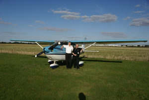
The 2009 AGI conference was held in the town in September 2009. Prior to the conference aerial photography of the town was flown using a small plane chartered with funding from ITO World and Traveline. The photographer on board, OSM contributor JR Peterson, used a normal digital camera to take the photos whilst sat in the cockpit. This was as much a demonstration of what is possible than a serious attempt to cover an area.
Workflow
- Hundreds of photos were taken
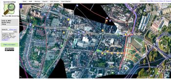
- The best ones were warped against existing OSM maps using warper.geothings.net by various people
- The geotiffs were downloaded for processing by Gravitystorm
- gdalwarp used to project into spherical mercator
- mapnik and generate_tiles.py used to read warped geotiffs, composite them, and output .png files
- the end tiles then hosted on the dev server
Using the imagery
Warning: This imagery layer is of "experimental" quality. Use GPS traces for road alignments.
In Potlatch, add the following url to your custom imagery source:
http://gravitystorm.dev.openstreetmap.org/imagery/stratford/!/!/!.png
In Josm, use the slippy map plugin. Can anyone expand the instructions to use the url above?
Things we learned
- The most important thing is how straight-down the photos are. We don't need them to professional quality (i.e. gyro-stabilised, 90°) but anything below about 70° to the vertical isn't that useful. 45° pictures make nice panoramas but aren't good for warping.
- It appears therefore you need the plane to be on a reasonable banked turn to get good shots off.
- Warping becomes chicken-and-egg when you use OSM data as a reference, and then try using the imagery as a reference for changing the data. It really helps to have GPS traces of main roads to keep things under control
- reprojecting the tiffs into spherical mercator isn't great, since it's a second warping. It would be great to use the original image + control points and go straight to the end projection.
Other Links
- Sample images on Flickr
- Warper layer (Peter Miller)
- Warper layer (Andy Allan)
- Warper layer (Matt Williams)[1]
- Raw images
Feel free to contact Gravitystorm if you have imagery of other places that you need processed.

