Tag:wetland=saltmarsh
 wetland = saltmarsh wetland = saltmarsh
|
 |
| Description |
|---|
Either a coastal or dry inland marsh, therefore characterized by herbaceous plants with special adaptations to saline environments. 
|
Rendering in OSM Carto 
|

|
| Group: natural |
| Used on these elements |
   |
| Requires |
Status: approved
|
| Tools for this tag |




Saltmarshes are found in both coastal and dryer inland settings.
Coastal  salt marsh, therefore characterized by herbaceous plants with special adaptations to saline environments. Ditches/channels in these marshes should be tagged with
 waterway=ditch. Grid-like ditches in saltmarshes were often dug to drain standing water pools in the marsh and therefore eliminate salt marsh mosquitoes and the areas can be often formed in places exposed to tidal inundation with sea water.
Inland saltmarshes are normally where water evaporates or goes underground prior to reaching the ocean and can be dry for years before water accumulates. These can be endorheic lakes or basins and can also be referred to as saltwater seeps or terminal lakes. Kati Thanda–Lake Eyre in Australia is noted part of a very large endorheic basin. Expect to see small hardy plants however larger trees may find water below the surface.
How to map
Draw the outline of the area and tag it with natural=wetland + wetland=saltmarsh.
With tidal=yes it can be shown that the area is in the tidal zone.
Rendering
-
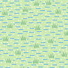 saltmarsh
 -
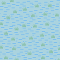 saltmarsh + water
 -
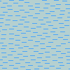 saltmarsh + water Level <=13


