Tag:seamark:shoreline_construction:category=training_wall
Jump to navigation
Jump to search
| Description |
|---|
| A wall or bank, often submerged, built to direct or confine the flow of a river or tidal current, or to promote a scour action. |
| Group: marine navigation |
| Used on these elements |
| Requires |
| Status: de facto |
| Tools for this tag |
|
A wall or bank, often submerged, built to direct or confine the flow of a river or tidal current, or to promote a scour action.
How to map
- seamark:type=shoreline_construction
- seamark:shoreline_construction:category=training_wall
- seamark:shoreline_construction:water_level=dry
Example in OpenSeaMap
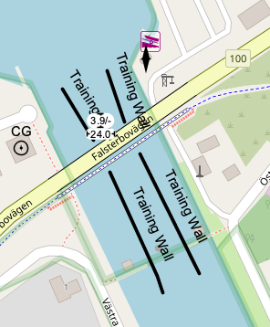
Click to open the map