Talk:Turkmenistan
Disputed: Suggested Place Tags for Administrative Subdivisions
apm-wa, the original author of the section on suggested place tags and a local mapper in Turkmenistan, recommended using the official Turkmen classifications as set out under Turkmenistan law and as provided to the OSM community in Districts in Turkmenistan.
Aka_Bob takes the position, "The use of tags to designate settlements of different significance is given to the rules that are used on OSM maps for other countries of Central Asia."
The text of this section is thus currently under dispute. Comments are welcome. Apm-wa (talk) 23:31, 1 January 2019 (UTC)
[Tagging] e-mail discussion as of midnight EST 8 January 2019
Simon Poole via openstreetmap.org Attachments Fri, Jan 4, 6:22 AM (4 days ago) to tagging
Am 02.01.2019 um 19:01 schrieb Kevin Kenny:
- On Wed, Jan 2, 2019 at 11:39 AM Simon Poole wrote:
- In any case, on your original question, I would tend towards a national consensus that doesn't deviate too much from the population guidelines in the wiki, if at all reasonable. The US-Hamlet usage is an oddity that, IMHO, should not serve as a role model.
- What's odd?
- Our administrative boundaries? I can't fix that. (Sometimes, I do
- think US mappers get treated with "the tagging model is fine, fix your
- country!" but I don't *think* that's what you're arguing here.) We
- also have administrative regions with indefinite boundaries, which
- means that there's some force-fitting in OSM - but that's what we
- have. Not all our county lines have ever been surveyed. (US government
- practice is to map them with a fainter line and the words INDEFINITE
- BOUNDARY as at https://caltopo.com/l/D1KV.)
- Our data modelling? In US practice, place=* is based on relative
- importance, not on legal designation. Any boundary=administrative, of
- course, has to follow the legal designation, and in New York at least,
- the designations of 'city', 'town', 'village' and 'hamlet' are based
- on form of government, not on size or importance. That's why we
- *don't* use them to inform place=*, but represent them with
- admin_level=*. (Otherwise, it's a total mess, because of the size
- inversions that I mentioned.
- By the way, I'd call it a 'New York State hamlet usage', because other
- states have other forms of municipal government. That's why we have
- that involved table on the Wiki for mapping the administrative regions
- of the different states to admin_level=*. Also, our admin_level's are
- not strictly hierarchical, because our municipal governments aren't
- either. But we don't have the luxury of making our politics fit our
- map.
- Making place=* depend on relative importance or population, while
- boundary=administrative depends on political organization, seems to
- follow accepted OSM practice, as far as I can tell. Where have we gone
- astray?
The weird thing is the mixing of place and administrative entities which actually leads to the inversion issues, go back read your text and you will find it difficult to determine when you are talking about one or the other.
May be we need, instead of using place values, a specific key for mapping the admin levels to "local" names of administrative entities.
Kevin Kenny via openstreetmap.org Fri, Jan 4, 10:25 AM (4 days ago) to strategy
On Fri, Jan 4, 2019 at 6:22 AM Simon Poole wrote:
- The weird thing is the mixing of place and administrative entities which
- actually leads to the inversion issues, go back read your text and you
- will find it difficult to determine when you are talking about one or
- the other.
You're right, and I should have referred to Hamlet, Village, Town, and City - capitalized - when speaking of the political entities. (I missed doing that.)
We do *not* use the political organization in place=*. There's no inversion in the place=* hierarchy. The City (capital C, the political entity) of Sherrill, for instance is (or ought to be, I haven't checked lately whether it's still right) mapped place=village. The Hamlet (capital H) of Brentwood should be place=city or place=suburb - I don't recall how far out the locals down that way decided to extend suburbia in their mapping, and they're more qualified than I am to make that decision. place=* is generally tagged on a point representing the cultural/political center of the place - often near a town square, post office, city hall, courthouse, railroad station or similar identifiable "middle", not a geographic center. We don't tag the boundary with place=*.
There are some administrative entities (some suburban Towns come to mind) that really are political divisions without identifiable 'places' - and those just get boundary=administrative without a corresponding place=*
The only tagging that follows the legal designation of Hamlet, Village, Town, City, and County or Borough is boundary=administrative. The political organization is encoded in admin_level=*. There are some corner cases in admin_level - but those mirror the messy structure of our government. For example, the five Counties/Boroughs that make up New York City have ceded their legislative powers (and most of their executive powers as well) to the City, but retain an independent judiciary. (We made up a sui generis admin_level=3 for New York City.)
We do not invert place=*. If it's inverted, it's mistagged. We do occasionally invert the topology of boundary=administrative, but that reflects reality in that the way our municipal governments are organized also inverts admin_level. Odd things happen when your form of govenrment is ad-hoc-cracy.
Joseph Eisenberg via openstreetmap.org Fri, Jan 4, 8:25 PM (4 days ago) to strategy
- “We made up a sui generis admin_level=3 for New York City.”
Ha! Not a bad idea for NY/NJ/Connecticut
But I think you mean admin_level=5? ;-)
Kevin Kenny via openstreetmap.org Fri, Jan 4, 8:28 PM (4 days ago) to OSM
On Fri, Jan 4, 2019, 20:25 Joseph Eisenberg wrote:
- “We made up a sui generis admin_level=3 for New York City.”
Ha! Not a bad idea for NY/NJ/Connecticut
But I think you mean admin_level=5? ;-)
Yes, I miscounted. Oops!
[Tagging] e-mail discussion as of midnight EST 3 January 2019
[Tagging] Dispute on tagging place=* in Turkmenistan Allan Mustard Jan 1, 2019, 6:44 PM (2 days ago) to strategy
Looking for some guidance here from the tagging experts. Please see the dispute section on the Turkmenistan wiki discussion page https://wiki.openstreetmap.org/wiki/Talk:Turkmenistan#Disputed:_Suggested_Place_Tags_for_Administrative_Subdivisions
The nub is that I advocate classifying Turkmenistan's municipalities based on their official status according to the host government (see the wiki article Districts in Turkmenistan). Another mapper, Aka_Bob, disagrees and insists that there are OSM guidelines based on population (I note that the OSM place=village article says a village can have up to 10,000 population, which in the United States is laughable--that would be a town or a city). Aka_Bob edited that section of the wiki article unilaterally without first consulting local mappers. I have no intention of entering into an edit war, but rather want to take this out to the community for discussion.
I'd like to hear what people think. Opening classification of Turkmen muncipalities to free interpretation rather than a standard official classification strikes me as a recipe for chaos, particularly since official population data have not been published for over a decade (the 2012 and 2017 censuses were made secret) but maybe that's just me. What do you think?
Best regards and Happy New Year to all!
apm-wa
Martin Koppenhoefer via openstreetmap.org Jan 1, 2019, 7:11 PM (2 days ago) to strategy
sent from a phone
- On 2. Jan 2019, at 00:44, Allan Mustard wrote:
- What do you think?
I have never understood why people wanted to add place tags to administrative territorial entities like countries, states or municipalities. Aren’t these thoroughly defined with boundary=administrative and the related admin_level?
Cheers, Martin
_______________________________________________
Tagging mailing list
https://lists.openstreetmap.org/listinfo/tagging
Kevin Kenny via openstreetmap.org
Jan 1, 2019, 7:12 PM (2 days ago)
to strategy
On Tue, Jan 1, 2019 at 6:46 PM Allan Mustard : wrote:
- Looking for some guidance here from the tagging experts. Please see the dispute section on the Turkmenistan wiki discussion page https://wiki.openstreetmap.org/wiki/Talk:Turkmenistan#Disputed:_Suggested_Place_Tags_for_Administrative_Subdivisions
- The nub is that I advocate classifying Turkmenistan's municipalities based on their official status according to the host government (see the wiki article Districts in Turkmenistan). Another mapper, Aka_Bob, disagrees and insists that there are OSM guidelines based on population (I note that the OSM place=village article says a village can have up to 10,000 population, which in the United States is laughable--that would be a town or a city). Aka_Bob edited that section of the wiki article unilaterally without first consulting local mappers. I have no intention of entering into an edit war, but rather want to take this out to the community for discussion.
I once laboured under the same misconception, and mismapped some villages in New York before more experienced mappers showed me the error of my ways. The consensus appears to be that Aka_Bob is right. With that said, there will always be some overlap among the categories, and it is possible that population may not be the only criterion in a given locality, but legal status is usually a rather poor indication.
In the US, at least, we use admin_level to track the legal status of villages, towns, et cetera, and instead follow population guidelines. Anything else for New York State, for instance, would lead to absurd results. We have some legal 'hamlets' (e.g., Brentwood, Levittown) that are actually small cities with population around 60,000 - and a chartered 'city' with a population of about 3,000. Our 'towns' range in population from 38 (Red House) to about 760,000 (Hempstead), and our 'villages' from 11 (Dering Harbor) to 54,000 (Hempstead Village). (Yes, our largest 'hamlet' is larger than our largest 'village'!)
Since in practice, what place=* is used for is to rate 'relative importance' (and so guide at what zoom level a name will appear, and how big a font will be used for it), the population guideline works better in practice than an attempt to follow the legal definition.
There's been fairly extensive discussion, here and in talk-us, that led up to https://wiki.openstreetmap.org/wiki/United_States_admin_level for the US admin levels. I'd suspect that a similar approach would work well for the administrative boundaries in Turkmenistan.
I understand that the UK is an exception, because the status of 'town', 'village', 'city' and so on relates to whether a given settlement has a church, a market, and similar facilities, and therefore does reflect somewhat the status of the settlement relative to its hinterland. (That scheme would surely not work for the US, where for instance, we have many country churches that are not part of larger settlements; it may be that the rectory is the only house within a couple of km in any direction.)
marc marc via openstreetmap.org
Jan 1, 2019, 7:17 PM (2 days ago)
Le 02.01.19 à 00:44, Allan Mustard a écrit :
- Looking for some guidance here from the tagging experts. Please see the
- dispute section on the Turkmenistan wiki discussion page
- https://wiki.openstreetmap.org/wiki/Talk:Turkmenistan#Disputed:_Suggested_Place_Tags_for_Administrative_Subdivisions
it seems useful to me that each country/local community: - keeps as much as possible the same general principle (different value to describe that there is a difference between a hamlet of a few houses and the largest city with some intermediate value between the 2) - adapts the criteria between these categories according to the local context (if no population measures exist but an official classification gives an idea, it seems to me a good idea to use it)
but for administrative subdivisions, place=* look like wrong, boundary=administrative + admin_level is the good schema
Kevin Kenny via openstreetmap.org
Jan 1, 2019, 7:18 PM (2 days ago)
to strategy
On Tue, Jan 1, 2019 at 7:11 PM Martin Koppenhoefer wrote:
- I have never understood why people wanted to add place tags to administrative territorial entities like countries, states or municipalities. Aren’t these thoroughly defined with boundary=administrative and the related admin_level?
Around here, it's because there are a fair number of places that don't have any form of self-government, but are still identifiable villages. Their boundaries are generally indefinite, but those that live in them would give the names of those places when asked for their home town. In New York State, these get mapped (admin_level=8) if their boundaries are definite (generally, fixed by defining legislation of the township of which they are a part), and as place=* nodes otherwise. They range in size from settlements with a handful of houses to small cities with populations up to about 60,000.
Joseph Eisenberg via openstreetmap.org
Jan 1, 2019, 7:32 PM (2 days ago)
to strategy
Those municipalities are relations of type=boundary and boundary=administrative with an appropriate admin_level, no?
These are different from the OSM settlements, which are mapped as a node at the center of a city, town, village, hamlet or isolated dwelling or farm.
While the pages suggest certain population ranges for each of these settled places, in the past they were defined by available services in England. A city had a cathedral or university, a town had a (full-time) marketplace, a village had a church, and a hamlet was too small for its own church but had more than one family. That’s the historic basis for the OSM system, though in modern times the standards are less certain.
I suspect this sort of classification can work even in places that do not have good population figures available, like where I map in Indonesia. For example:
a farm or isolated dwelling has only 1 or 2 households, a hamlet has a few families but no services (maybe there is a tiny kiosk or a very small place of worship)
A village has some services but only for the local community; people do not travel to a village to go shopping, except from the closest farms or hamlets. Probably there is a primary school, certainly there is some sort of place of worship.
A town is a significant local destination. People from the surrounding hamlets and villages will go to the nearest town to buy clothing, tools, specialty foods and other necessities. There may be some cultural and entertainment options, and usually some level of government services. Towns always have secondary education (high schools) in the countries that I have visited.
A city has all this as well as major healthcare and educational institutions, and is often as administrative center for businesses, organizations (NGOs, religious) and local government. People travel to cities from the whole surrounding region, including from towns, for business, entertainment, cultural facilities etc. generally a city should have just about all of the services that a middle-class person would use (though the rich may need to go to larger cities for some specialty and luxury services - OSM doesn’t have a special class for large cities or global cities however)
By population a hamlet has less than 1000 residents (often less than 100), and a city has over 50,000 (usually over 100,000), but the population cut-offs vary by region.
A very isolated settlement may still qualify as a town with a relatively small population if it has the only high school, government office, supermarket and airport on a large island, for example - in this case the whole population of the island comes to the town for services even if they do not live there, so I would be comfortable tagging a settlement of 4000 people as a town on an island with 200,000 people but no other settlements over 1000 people in size.
This is how I tag places in eastern Indonesia, where many villages and towns are very isolated. Perhaps this is similar in your country?
But in a densely populated region, like Java (where there are 120,000 million people on one island), even a settlement with 20,000 people might just be a conglomeration of farming villages that hardly qualifies as a town, and a town could grow to 200,000 residents and still lack any characteristics of a city.
Allan Mustard Jan 1, 2019, 9:18 PM (2 days ago)
to strategy
Very interesting. In the Turkmen case, the classifications are defined in law and involve both size (though population data are secret) and type of governance structure (for full details please see https://wiki.openstreetmap.org/wiki/Turkmenistan#Administrative_Structure).
Is it fair to call a settlement a "neighbourhood" when it has a governance structure (a village council with a chair who serves effectively as the municipal manager/mayor)? In my experience a "neighbourhood" lacks any sort of governance structure aside from (sometimes) Neighborhood Watch.
apm-wa
Joseph Eisenberg via openstreetmap.org
Jan 1, 2019, 10:24 PM (2 days ago)
to strategy
In OSM a neighborhood is a named part of a larger settlement, usually a town or suburb or city, though in Indonesia some “desa” (villages) consist of a dozen named “kampung” (neighborhoods).
Suburbs are also considered parts of larger towns or cities. So a city can be divided into a dozen suburbs, each of which is divided into a half-dozen neighborhoods
Allan Mustard Jan 1, 2019, 10:28 PM (2 days ago)
to strategy
By that definition, then, calling an autonomous village with its own council a "neighbourhood" would be erroneous, correct?
Graeme Fitzpatrick via openstreetmap.org
Jan 1, 2019, 10:47 PM (2 days ago)
to strategy
On Wed, 2 Jan 2019 at 10:32, Joseph Eisenberg wrote:
But in a densely populated region, like Java (where there are 120,000 million people on one island),
Wow, I knew java was crowded ... :-)
Thanks
Joseph Eisenberg via openstreetmap.org
Jan 1, 2019, 11:09 PM (2 days ago)
to strategy
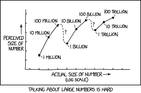
That’s the American million, you remove 3 zeros from the British version, right? Like how a trillion is a billion? Something like that. :-) https://imgs.xkcd.com/comics/million_billion_trillion.png (See hover-over text)
Allan Mustard
Jan 1, 2019, 11:12 PM (2 days ago)
to strategy
Not according to the wiki. It seems nodes are the accepted way of identifying a settlement, municipal or otherwise.
Joseph Eisenberg via openstreetmap.org
Jan 1, 2019, 11:17 PM (2 days ago)
to strategy
It depends on if it is part of a continuous urban settlement or not.
I use “suburb” and “neighborhood” for places that are considered to be part of a larger place. Usually these are mainly urban places, where most people are involved in services and industry rather than agriculture or forestry or fishing, and a significant percentage of worker travel to the larger town center for work.
Sometimes a suburb has it’s own government and town council, as is common in the USA. In other cases (Eg Shanghai), a municipality includes area of farmland and villages that are clearly separate settlements. So I don’t think that the government status can be the distinguishing characteristic.
Perhaps you have a particular example in mind?
Allan Mustard
Jan 1, 2019, 11:43 PM (2 days ago)
to strategy
I put some examples in the table located here: https://wiki.openstreetmap.org/wiki/Turkmenistan#Administrative_Structure
Dolly Andriatsiferana via openstreetmap.org
Jan 2, 2019, 2:10 AM (21 hours ago)
to strategy
I suspect this sort of classification can work even in places that do not have good population figures available, like where I map in Indonesia. For example: a farm or isolated dwelling has only 1 or 2 households, a hamlet has a few families but no services (maybe there is a tiny kiosk or a very small place of worship) A village has some services but only for the local community; people do not travel to a village to go shopping, except from the closest farms or hamlets. Probably there is a primary school, certainly there is some sort of place of worship. A town is a significant local destination. People from the surrounding hamlets and villages will go to the nearest town to buy clothing, tools, specialty foods and other necessities. There may be some cultural and entertainment options, and usually some level of government services. Towns always have secondary education (high schools) in the countries that I have visited. A city has all this as well as major healthcare and educational institutions, and is often as administrative center for businesses, organizations (NGOs, religious) and local government. People travel to cities from the whole surrounding region, including from towns, for business, entertainment, cultural facilities etc. generally a city should have just about all of the services that a middle-class person would use (though the rich may need to go to larger cities for some specialty and luxury services - OSM doesn’t have a special class for large cities or global cities however) By population a hamlet has less than 1000 residents (often less than 100), and a city has over 50,000 (usually over 100,000), but the population cut-offs vary by region. A very isolated settlement may still qualify as a town with a relatively small population if it has the only high school, government office, supermarket and airport on a large island, for example - in this case the whole population of the island comes to the town for services even if they do not live there, so I would be comfortable tagging a settlement of 4000 people as a town on an island with 200,000 people but no other settlements over 1000 people in size.
+1
I totally agree with Joseph Eisenberg on this. When classifying settlements (place=*), I think that their 'relative importance' should be valued more than administrative status or population, although there are often overlaps (administrative unit centers are often where services exist, such as hospitals, schools, markets, offices etc.). That's according to the part of the world that I know, there might be exceptions for some countries.
All the best.
Paul Allen via openstreetmap.org
Jan 2, 2019, 7:22 AM (16 hours ago)
to strategy
On Wed, 2 Jan 2019 at 02:19, Allan Mustard wrote: Very interesting. In the Turkmen case, the classifications are defined in law and involve both size (though population data are secret) and type of governance structure (for full details please see https://wiki.openstreetmap.org/wiki/Turkmenistan#Administrative_Structure).
Is it fair to call a settlement a "neighbourhood" when it has a governance structure (a village council with a chair who serves effectively as the municipal manager/mayor)? In my experience a "neighbourhood" lacks any sort of governance structure aside from (sometimes) Neighborhood Watch.
I have the feeling that hamlet/village/town/city in OSM are (now) rather arbitrary labels which don't necessarily indicate size or governmental structure or available facilities but "importance" for some vague, country-specific value of "importance." The values are essentially a way of specifying which population centres appear at which zoom levels.
As with many tags in OSM, with hindsight we'd have done it differently, but it's almost impossible to change things now. Which is a shame, because with vector tiling we might have the possibility for users to select which characteristic they wish to determine what is displayed at a particular zoom level: population size, admin level or available facilities as denoted by hamlet/village/etc. Because hamlet/village are not always used as described in the wiki, and when they are used in such a way they essentially echo population size, we'd need yet another tag for that to happen, with hamlet/village eventually becoming ignored. Good luck with that.
I have no idea how to resolve your problem. I suspect it would require a diplomat to get all sides to agree, and where are we going to find one of those? :)
Martin Koppenhoefer via openstreetmap.org
Jan 2, 2019, 8:38 AM (15 hours ago)
to strategy
sent from a phone
- On 2. Jan 2019, at 01:11, Kevin Kenny wrote:
- but legal status is usually a rather
- poor indication.
in Italy we use the status to distinguish between town and village, and I believe in Germany and other places in Europe it is also done like this.
Cheers, Martin
Martin Koppenhoefer via openstreetmap.org
Jan 2, 2019, 10:12 AM (13 hours ago)
to strategy
sent from a phone
- On 2. Jan 2019, at 01:11, Kevin Kenny wrote:
- I understand that the UK is an exception, because the status of
- 'town', 'village', 'city' and so on relates to whether a given
- settlement has a church, a market, and similar facilities, and
- therefore does reflect somewhat the status of the settlement relative
- to its hinterland. (That scheme would surely not work for the US,
- where for instance, we have many country churches that are not part of
- larger settlements; it may be that the rectory is the only house
- within a couple of km in any direction.)
this is not a contradiction, it eventually shows there simply isn’t (or wasn’t) a town/village around. “church” isn’t the only criterion, it works quite well for the christian European context.
Cheers, Martin
Martin Koppenhoefer via openstreetmap.org
Jan 2, 2019, 10:21 AM (13 hours ago)
to strategy
sent from a phone
On 2. Jan 2019, at 01:18, Kevin Kenny wrote:
- I have never understood why people wanted to add place tags to administrative territorial entities like countries, states or municipalities. Aren’t these thoroughly defined with boundary=administrative and the related admin_level?
- Around here, it's because there are a fair number of places that don't
- have any form of self-government, but are still identifiable villages.
this is a different thing, place for settlements is perfectly fine, I agree they can be orthogonal to administrative subdivisions.
Countries without an administrative border are harder, depending on our interpretation of the meaning of place=country it might not be completely impossible any more, as long as we had the on the ground rule of defacto control it wasn’t though (i.e. until very recently).
Cheers, Martin
Simon Poole via openstreetmap.org
Attachments
11:38 AM (12 hours ago)
to tagging
At the danger of throwing a spanner in the works (or better sabots :-)): there is an ongoing discussion on place mapping. Mainly taking place here https://github.com/gravitystorm/openstreetmap-carto/pull/2816
Essentially the relationship between administrative divisions and places/settlements is complicated and while we have working tagging for administrative entities (and for them I would normally suggest following whatever the "official" hierarchy and designation is), our place modelling is a bit of a mess, which among other issue has led to administrative boundaries being used for places. In any case, on your original question, I would tend towards a national consensus that doesn't deviate too much from the population guidelines in the wiki, if at all reasonable. The US-Hamlet usage is an oddity that, IMHO, should not serve as a role model.
Simon
Am 02.01.2019 um 05:12 schrieb Allan Mustard: Not according to the wiki. It seems nodes are the accepted way of identifying a settlement, municipal or otherwise.
On Tue, Jan 1, 2019 at 7:11 PM Martin Koppenhoefer wrote:
sent from a phone
- On 2. Jan 2019, at 00:44, Allan Mustard wrote:
- What do you think?
I have never understood why people wanted to add place tags to administrative territorial entities like countries, states or municipalities. Aren’t these thoroughly defined with boundary=administrative and the related admin_level?
Cheers, Martin
Kevin Kenny via openstreetmap.org 1:02 PM (10 hours ago) to strategy
On Wed, Jan 2, 2019 at 11:39 AM Simon Poole wrote:
- In any case, on your original question, I would tend towards a national consensus that doesn't deviate too much from the population guidelines in the wiki, if at all reasonable. The US-Hamlet usage is an oddity that, IMHO, should not serve as a role model.
What's odd?
Our administrative boundaries? I can't fix that. (Sometimes, I do think US mappers get treated with "the tagging model is fine, fix your country!" but I don't *think* that's what you're arguing here.) We also have administrative regions with indefinite boundaries, which means that there's some force-fitting in OSM - but that's what we have. Not all our county lines have ever been surveyed. (US government practice is to map them with a fainter line and the words INDEFINITE BOUNDARY as at https://caltopo.com/l/D1KV.)
Our data modelling? In US practice, place=* is based on relative importance, not on legal designation. Any boundary=administrative, of course, has to follow the legal designation, and in New York at least, the designations of 'city', 'town', 'village' and 'hamlet' are based on form of government, not on size or importance. That's why we
- don't* use them to inform place=*, but represent them with
admin_level=*. (Otherwise, it's a total mess, because of the size inversions that I mentioned.)
By the way, I'd call it a 'New York State hamlet usage', because other states have other forms of municipal government. That's why we have that involved table on the Wiki for mapping the administrative regions of the different states to admin_level=*. Also, our admin_level's are not strictly hierarchical, because our municipal governments aren't either. But we don't have the luxury of making our politics fit our map.
Making place=* depend on relative importance or population, while boundary=administrative depends on political organization, seems to follow accepted OSM practice, as far as I can tell. Where have we gone astray?