Template:Map Features:Tower:construction
Jump to navigation
Jump to search
Tower:construction
| Key | Value | Comment | Rendering | Photo | |
|---|---|---|---|---|---|
Masts (man_made=mast)
| |||||
| tower:construction | guyed_lattice | Mast constructed from steel in a lattice/truss structure supported by wires to the ground |  | ||
| tower:construction | guyed_tube | Mast constructed from a solid tube supported by wires to the ground |  | ||
| tower:construction | lattice | Mast constructed from steel in a lattice/truss structure |  | ||
| tower:construction | freestanding | Mast constructed as a freestanding solid structure |  | ||
Towers (man_made=tower)
| |||||
| tower:construction | lattice | Tower constructed from steel in a lattice/truss structure |  | ||
| tower:construction | freestanding | Tower constructed as a freestanding solid structure |  | ||
| tower:construction | dish | See:man_made=telescope + telescope:type=radio
|
 | ||
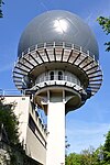
| tower:construction | dome | The 'communication tower' is a dome |  | ||
This table is a wiki template with a default description in English. Editable here.


