User:Jacurutu
I'm new to this, but having fun so far. I'm using a GlobalSat BT308 Bluetooth GPS Receiver with a Nokia N73 and the Nokia Sports Tracker software. It seems to do the job, but what I could really do with is a way of recording specific points when I'm out and about - so I probably need to look for some different software.
Much of the work I've done is with my partner, Jenny - I drive, she makes copious notes, and is fed up with me driving all the way around roundabouts and making her dizzy!
Plans
My aims at the moment are to complete the area around where I live - between York, Selby and Leeds. The Leeds Mapping Party gave me an excuse to fill in some gaps on the Leeds side, and to record the A63 out to Selby. Having had a closer look around North and East Yorkshire, and most of my favourite roads are missing. Looks like I've got lots of work to do! The next projects are:
- To completely map roads in our village (Cawood)
- Probably the same in Wistow
- Major routes into/around Selby (it's a bit scarce)
- East of the A19 (Elvington, Sutton-on-Derwent, Wheldrake, Thorganby etc)
- Much further east of the A19 - East Yorkshire
- Fulford, in York, perhaps
- York-Selby cycle route
- ...
Beyond that, I have loads of questions about how to model various junctions and road layouts, and whether the Map Features and Editing Standards and Conventions need some more work. (Current areas I'm struggling with are the singletrack roads round my way - I'd like to tag them as such, but don't think that a new highway value is the right way to do it - and motorway junctions, particularly modelling roundabouts over the motorway - the layer=1/bridge=yes convention doesn't fit well as you have to break the roundabout's own way to do it, or you fly the whole roundabout, creating seams with the adjoining roads.) If only i had more time...
My efforts on this project
- As part of the Leeds Mapping Party, I collected lots of tracks around eastern Leeds (Scholes, Thorner, Barwick-in-Elmet, Aberford, Garforth, Sherburn-in-Elmet, South Milford), and subsequently I've surveyed areas around and between York, Selby and Leeds. These are now all edited (not all by me I should add), and the end results are a big improvement. The A63 now runs all the way from Leeds to Selby, the A19 goes from York to the A63, M1 J46 is complete, M1 J47 is nearly complete, and all the roads off it are now mapped. I've also added a few of the above villages, and they all link in to the rest of the road network.
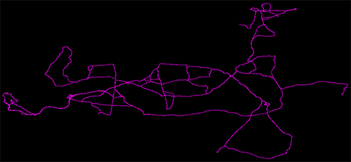
Leeds city centre is at the far left, York is the top-most trace, Bubwith is at the far right, and the bottom trace is the A645 between the A19 and Snaith.
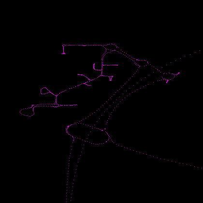
This is Thorpe Park business park at Colton, Leeds (M1 J46).
Contact Me
Try my blog http://www.jacurutu.org.uk/

