User:Nachtspazz
About Me | ||||||||||||||
---|---|---|---|---|---|---|---|---|---|---|---|---|---|---|
|
OpenStreetMap isn't a computer project, it's an outdoors activity.
Less of the bulk imports and wikifiddling please.
Go outside and map!
My OSM Account
Nachtspazz's OSM Account since 2011.
My User Name
Nacht (German) = Night (English).
Spatz (German) = Sparrow (English): Often associated with the town of Ulm ("Ulmer Spatz").
spazieren (German) = to walk / to promenade (English).
My Plans
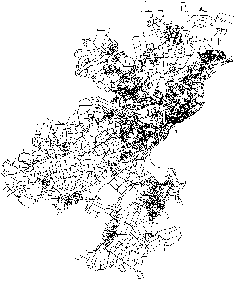
Trace all ways in Ulm (within city limits).
Map small paths in Ulm (typically for pedestrians/bikes only).
Identify Living Streets ("Spielstraße" in German) in Ulm and tag them correctly.
Tag paths with road sign 241 with bicycle=designated and foot=designated.
Tag max_speed in residential areas and access=private for privat parking lots.
Small items to map: playgrounds, bollards, benches, wayside crosses/shrines, steps, gates, post boxes, recycling containers, ...
Find and tag historic boundary stones.
My Traces of Ulm
Overview of my traces of Ulm (19th March 2011 to 22nd September 2020).
Häckselplätze
I checked and mapped all "Häckselplätze" in Ulm
(amenity=recycling
, recycling:wood=yes
, operator=Entsorgungsbetriebe Stadt Ulm (EBU)
, name=Häckselplatz XXXX
).
Name | Status |
---|---|
Ulm-Mitte | DONE |
Örlinger-Tal-Weg (Schafstall) | Mapped |
Grüner Graben | Mapped |
Eselsberg | DONE |
Trommelwiesle (Ruhetal) | Discontinued |
Ruhetal | Discontinued |
Lehrer-Tal-Weg | Mapped |
KGA Schönblick (H.-Multscher-Schule) | Discontinued |
Heilmeyersteige beim Recyclinghof | Mapped |
Weinbergweg / Ruländerweg (Sonderhäckselplatz, Anlieferung nur zu Fuß) | Mapped |
Sonnenhalde / Wilhelm-Geyer-Weg (Spielplatz) | Discontinued |
Michelsberg | DONE |
Prittwitzstrasse | Mapped |
Söflingen | DONE |
Am Roten Berg / Kleingartenanlage | Mapped |
Harthauser Strasse, Sportanlage TSG Söflingen (verlegt!) | Mapped |
Hasensteige | Mapped |
Jörg-Syrlin-Strasse / Rückhaltebecken | Discontinued |
Sterntalerweg / Köllestrasse (Parkplatz KGA) | Discontinued |
Weststadt | DONE |
Unterer Kuhberg | Mapped |
Verlängerung St.-Barbarastrasse (Parkplatz KGA) | Mapped |
Galgenbergweg | Discontinued |
Illerstrasse - Parkplatz Richtung Erbach (Bewährungsheim) | Mapped |
Illerstrasse jenseits Unterführung | Discontinued |
Böfingen | DONE |
Kleingartenanlage Braunland (Lagerhaus) | Mapped |
Obertalfinger Weg | Mapped |
Beim Recyclinghof | Recyclinghof mapped |
Böfinger Weg / Hofäcker Weg | Discontinued |
Eichenhang, westl. Geb. Nr. 164 | Mapped |
Safranberg | DONE |
Heidenheimer Str. / Albecker Steige | Mapped |
Messelsteinweg (Wendeplatte) | Discontinued |
Jungingen | DONE |
Katzental / Erddeponie | Mapped |
Lehr | DONE |
Kleingartengeb. Bühl | Mapped |
Mähringen | DONE |
Schulweg / Tobelweg (Obstwiese) | Mapped |
Harthausen | DONE |
bei K 9904 | Mapped |
Ermingen | DONE |
Wiesentalweg / Weidenweg (KGA) | Mapped |
Unterweiler | DONE |
Parkplatz Mehrzweckhalle | Mapped |