File:Flag of the United States.svg
Jump to navigation
Jump to search

Size of this PNG preview of this SVG file: 800 × 421 pixels. Other resolutions: 320 × 168 pixels | 640 × 337 pixels | 1,024 × 539 pixels | 1,280 × 674 pixels | 1,235 × 650 pixels.
Original file (SVG file, nominally 1,235 × 650 pixels, file size: 823 bytes)
This file and its description are from Wikimedia Commons.
Summary
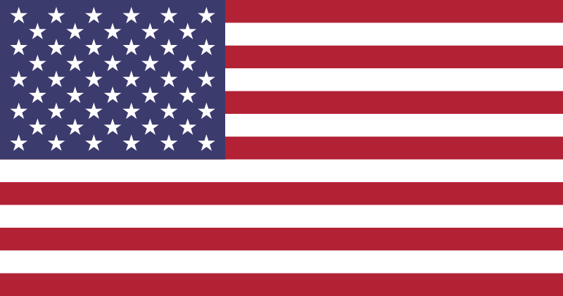
| Description | The Flag of the United States of America. Current RGB colors and geometric specifications follow the "Design Guide" published in January 2017 by State Department Bureau of Educational and Cultural Affairs.[1] | ||||||
| Date | latest version follows color clarifications published in 2017. Earlier versions of the file go back to 11 September 2005. | ||||||
| Source |
|
||||||
| Author | Many users contributed to the current and past versions of this file, including: Dbenbenn, Zscout370, Jacobolus, Indolences, Technion, TheTaraStark. | ||||||
| Other versions |
|
||||||
| SVG development | This insignia was created with a text editor. |
||||||
| SVG code | Xml code<svg xmlns="http://www.w3.org/2000/svg" xmlns:xlink="http://www.w3.org/1999/xlink" width="1235" height="650" viewBox="0 0 7410 3900">
<path d="M0,0h7410v3900H0" fill="#b31942"/>
<path d="M0,450H7410m0,600H0m0,600H7410m0,600H0m0,600H7410m0,600H0" stroke="#FFF" stroke-width="300"/>
<path d="M0,0h2964v2100H0" fill="#0a3161"/>
<g fill="#FFF">
<g id="s18">
<g id="s9">
<g id="s5">
<g id="s4">
<path id="s" d="M247,90 317.534230,307.082039 132.873218,172.917961H361.126782L176.465770,307.082039z"/>
<use xlink:href="#s" y="420"/>
<use xlink:href="#s" y="840"/>
<use xlink:href="#s" y="1260"/>
</g>
<use xlink:href="#s" y="1680"/>
</g>
<use xlink:href="#s4" x="247" y="210"/>
</g>
<use xlink:href="#s9" x="494"/>
</g>
<use xlink:href="#s18" x="988"/>
<use xlink:href="#s9" x="1976"/>
<use xlink:href="#s5" x="2470"/>
</g>
</svg>
|
||||||
| Used colors |
|
.svg)
.svg)
.svg)


Image notes
- The geometric specifications for the union jack and the sizes and positioning of the stars are given in an attachment to Executive Order 10834 of 21 August 1959, printed in 3 CFR, 1959–1963 Comp., p. 368. Also see File:US Flag spec TIOH 5-1-17 1967.jpg, the specification drawing from the Army Institute of Heraldry.
- The official colors are part of the Standard Color Reference of America, specifically Cable Nos. 75001 ("White") , 70180 ("Old Glory Red") , and 70075 ("Old Glory Blue") . Colorimetric designations for these colors were precisely specified in a 1946 paper in JOSA. When the white point is taken to have the luminous reflectance of the flag’s white, these colors can be approximated on screen as , , and , respectively. The United State Department of State uses (#FFFFFF), (#B31942) and (#0A3161) in RGB color. United States Department of State Identity and Marking Standards
- The current dimensions of the image (version of 00:43, 14 May 2008), 1235 × 650 pixels (which represents an aspect ratio of 1.9:1.0), were chosen to allow as much as possible of the final geometric manipulations to be performed using whole numbers, avoiding the need for scaling. (This also results in each stripe being 50 pixels high.)
Licensing
| This image of a flag is ineligible for copyright and therefore in the public domain, because it consists entirely of information that is common property and contains no original authorship. For more information, see Commons:Threshold of originality § Logos and flags. |  |
This work is in the public domain in the United States because it is a work prepared by an officer or employee of the United States Government as part of that person’s official duties under the terms of Title 17, Chapter 1, Section 105 of the US Code.
Note: This only applies to original works of the Federal Government and not to the work of any individual U.S. state, territory, commonwealth, county, municipality, or any other subdivision. This template also does not apply to postage stamp designs published by the United States Postal Service since 1978. (See § 313.6(C)(1) of Compendium of U.S. Copyright Office Practices). It also does not apply to certain US coins; see The US Mint Terms of Use.
|
 | |
| This file has been identified as being free of known restrictions under copyright law, including all related and neighboring rights. | ||

|
This image shows a flag, a coat of arms, a seal or some other official insignia. The use of such symbols is restricted in many countries. These restrictions are independent of the copyright status. |
- ↑ ECA Design Guidelines (PDF) (Report). Bureau of Educational and Cultural Affairs Office of Public Affairs and Strategic Communications. January 2017. Retrieved 2023-01-21.
File history
Click on a date/time to view the file as it appeared at that time.
| Date/Time | Thumbnail | Dimensions | User | Comment | |
|---|---|---|---|---|---|
| current | 03:53, 24 May 2024 | | 1,235 × 650 (823 bytes) | wikimediacommons>Jarekt | Update the colors to the RGB values from 2017 DOS ECA design guide. File provided by User:TheTaraStark |
File usage
More than 100 pages use this file. The following list shows the first 100 pages that use this file only. A full list is available.
- California
- Colorado
- Dallas, Texas
- Florida
- Illinois
- Indiana
- Kentucky
- List of OSM centric Facebook accounts
- Mississippi
- New Mexico
- New York (state)
- New York City
- North Carolina
- OpenStreetMap in the media/2009
- Oregon
- Pennsylvania
- Planet.osm
- Potlatch 1/Feedback
- Press Contacts
- South Carolina
- State of the Map
- TIGER
- TIGER 2007
- Tag:highway=motorway
- Tag:highway=primary
- Tag:highway=trunk
- Tennessee
- Texas
- United States
- United States/Road signs
- Vermont
- Washington
- Washington DC
- Talk:Current events
- Talk:Tag:highway=footway
- Talk:Tag:highway=motorway
- Talk:Tag:highway=pedestrian
- Talk:United States roads tagging
- User:Alimamo
- User:Ezekielf
- User:Grin
- User:Ivansanchez/sandbox
- User:Nickvet419
- User:Pigsonthewing
- User:Tabris
- Template:Flagicon
- Template talk:Calendar
- Category:California
- Category:Cities in Illinois
- Category:Cities in New Mexico
- Category:Colorado
- Category:Illinois
- Category:Indiana
- Category:Kentucky
- Category:Maryland
- Category:Massachusetts
- Category:Michigan
- Category:Minnesota
- Category:New Mexico
- Category:New York
- Category:North Carolina
- Category:Ohio
- Category:Oregon
- Category:Pennsylvania
- Category:South Carolina
- Category:United States
- Category:Users in Arizona
- Category:Users in California
- Category:Users in Colorado
- Category:Users in Florida
- Category:Users in Georgia (U.S. state)
- Category:Users in Illinois
- Category:Users in Indiana
- Category:Users in Maryland
- Category:Users in Massachusetts
- Category:Users in Minnesota
- Category:Users in Mississippi
- Category:Users in Nebraska
- Category:Users in New Hampshire
- Category:Users in New Jersey
- Category:Users in New York
- Category:Users in North Carolina
- Category:Users in Ohio
- Category:Users in Oklahoma
- Category:Users in Oregon
- Category:Users in Pennsylvania
- Category:Users in South Carolina
- Category:Users in Texas
- Category:Users in Vermont
- Category:Users in Virginia
- Category:Users in Washington
- Category:Users in Washington DC
- Category:Users in Wisconsin
- Category:Users in the United States
- Category:Vermont
- Category:Washington
- Category:Washington DC
- DE:OpenStreetMap in the media
- FR:Tag:boundary=administrative
- IT:Key:highway
View more links to this file.