Tag:junction=circular
| Description |
|---|
| A road junction where the traffic goes around a non-traversable island but does not always have right of way. |
| Group: highways |
| Used on these elements |
| Requires |
| Status: de facto |
| Tools for this tag |
|
This tag, junction=circular, is used for road intersections only where traffic on the junction does not have complete right of way. It includes traffic circles (also called rotaries) along with other circular (self-intersecting) road junctions. It can include intersection controls such as traffic signals, stop signs or stop markings, give way (or yield) signs or give way markings. They can vary from small to very large with several lanes.
The rotary or circular junction should not have any road network inside itself. As such, circular ring roads around a city are not valid circular junctions.
Where traffic on a circular junction itself does have complete right of way, this is a roundabout. The tag junction=roundabout should be used on roundabouts.
Naming
Tag a name=* only where the circular junction itself has a name (e.g. John's Junction). Mostly, this is not the case. Ignore are remove (older) fixme=name tags for junction=circular.
How to map
Each way intersecting (especially entries or exits) with the junction=circular should be connected via a separate node, generally. This is required to allow routing applications and software to provide correct directions, otherwise the routing software will not correctly recognise the junction.
Further, generally rotaries and circular junctions have one-way traffic and should have the tag oneway=yes; however a circular junction with bi-directional traffic can be valid and should tagged with oneway=no.
How to map
Draw the circular shape, which would represent the junction. Furthermore:
- The OSM ways of the junction must be drawn in the direction the traffic flow.
- Tag the OSM way(s) of the circular junction with junction=circular.
- Add oneway=*. Although the majority of circular junctions will be one-directional, sometimes (sections of) junctions can be bi-directional. This is especially common for cycleways.
- Connect it with the roads approaching the circular junction. If a road is split into two separated carriageways (one approaching, one departing), draw those explicitly and tag these carriageways with oneway=yes. Pay attention to their correct orientation and use separate nodes of the circular junction for the approaching and departing road.
- Also tag the junction and approaches with highway=*, the same as the connecting roads. If there are several roads of different importance connecting to the junction, you should usually use the one with the greatest importance, that does not begin or end at the junction. More details about selecting the correct tag can be found on the junction=roundabout page.
- Again, a roundabout should only be tagged with name=* if the junction itself is named independently and differently from the roads crossing it.
- Generally each road has to be connected with the circular junction in a separate node—that is, between these nodes a segment of the circular junction is required. Thus routers can safely recognise that a section of the circular junction has to be driven through.
- It is suggested to map give-way (yield) signs and road markings using highway=give_way.
Misclassification
Please pay attention to the section Possible misinterpretations to differentiate between:
- Roundabouts (junction=roundabout)—where traffic on the roundabout has right of way;
- Rotaries and traffic-circles (junction=circular)—where traffic on the rotary or circular junction does not have right of way;
- Mini roundabouts (highway=mini_roundabout)—used only on nodes, as a roundabout where the centre of the roundabout must be traversable;
- Turning circles (highway=turning_circle)—used only on nodes, including cul-de-sacs; and
- Turning loops (highway=turning_loop)—used only on nodes, where a road island or similar feature is present.
Distinguishing from roundabouts
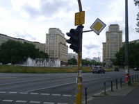
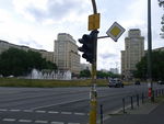
- If one of the roads entering the circle has the right-of-way and the other has to yield (Example: Berlin, Strausberger Platz)
- If the circular traffic in the junction always has to yield to incoming traffic (Example: Berlin, Großer Stern)
- If a (section of) the junction allows bi-directional traffic
This form of a junction allows the major and minor road to intersect in one node only, typically in an acute angle. An example is the Strausberger Platz in Berlin, Germany.
Purpose
The tag allows routing software to recognise circular junction structures more easily for cases that fail the OSM roundabout definition. OSRM has implemented the tag. There is no impact to expect on visual map rendering.
Implications for routing
Routing software will usually call out both the entrance to and exit from a circular junction, but it should avoid doing so when the junction is small enough. For example, OSRM treats a circular junction with a diameter less than 15 metres (49 ft) as a plain intersection[1][2].
See also
- highway=* - The highway tag is the primary tag used for any kind of street or way
- junction=roundabout - A road junction where the traffic goes around a non-traversable island and has right of way
- highway=mini_roundabout - A road junction where the traffic goes around a painted circle or traversable island and has right of way


